1970s Maps of Saint Agatha, Maine
Explore 5 historic maps of Saint Agatha from the 1970s. These maps offer a rare glimpse into what life looked like during the 1970s — showing old roads, neighborhoods, homes, and landmarks that have changed or disappeared over time.
Whether you're researching your family's past, planning a metal detecting trip, or studying how Saint Agatha's landscape evolved across the 1970s, these high-resolution maps are a powerful tool for exploring the history of this region.
- Focus on a specific era: All maps on this page are from the 1970s, giving you a focused view of this time period.
- See what’s changed: Compare century-old streets, trails, and buildings to today's modern landscape using overlays and satellite layers.
- Research with precision: Use these maps for genealogy, historical research, land use analysis, or educational projects.
- View, download, or print: Maps are fully viewable online in high resolution, and can be downloaded or printed for your own records.
Start exploring Saint Agatha's history through authentic maps from the 1970s. This is your window into the past.
Saint Agatha, ME maps
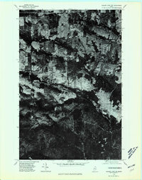
(5)- 1975 Map of Square Lake NE, 1981 Print
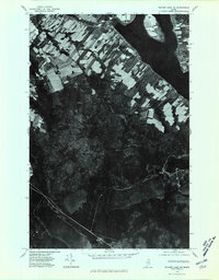 1975 Square Lake NE1981 Print · USGSAroostook County land use is frozen in time during the mid-seventies, showing the characteristic strip farms of the Acadian borderlands. Genealogy and local history researchers can trace settlement patterns in St Agatha and Sinclair along the shores of Long Lake.
 - 1975 Map of Stockholm NW, 1981 Print
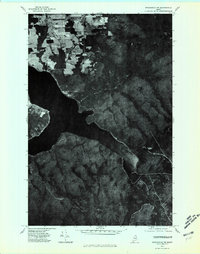 1975 Stockholm NW1981 Print · USGSNorthern Maine's lake country and timberlands are captured in high detail in the mid-1970s. Researchers can trace the wooded slopes of Gold Mountain and the expansive shoreline of Long Lake as they appeared decades ago.
 - 1975 Map of Frenchville SW, 1981 Print
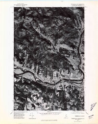 1975 Frenchville SW1981 Print · USGSNorthern Aroostook County and New Brunswick meet along the river in the mid-seventies, showing the distinct Acadian land-use patterns of the valley. Genealogists can trace family homesteads in Frenchville and Upper Frenchville or across the St John River in St-Hilaire.
 - 1975 Map of Frenchville SE, 1981 Print
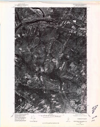 1975 Frenchville SE1981 Print · USGSThe international border along the St John River comes into sharp focus during the mid-1970s, capturing the industrial heart of the St. John Valley. Genealogists and local historians can trace the clearings and family-held land around Dionne Corner, Fournier, and the settlement at Cleveland.
 - 1975 Map of Square Lake NW, 1981 Print
 1975 Square Lake NW1981 Print · USGSNorthern Maine agricultural and timber lands come into focus during the 1970s through this aerial-based survey. Genealogists and local historians can trace the footprint of rural settlements like Daigle and Ouellette and the path of Daigle Brook.
End of results
Showing maps 1-5 of 5
Top cities near Saint Agatha
- Fort Kent historical maps
- Madawaska historical maps
- Frenchville historical maps
- New Sweden historical maps
- Square Lake historical maps
- Grand Isle historical maps
See more
Top neighborhoods of Saint Agatha
Frequently asked questions
- What are the different types of historical maps available for Saint Agatha?
- What is the oldest map of Saint Agatha?
- Where can I purchase historical maps of Saint Agatha for my home or office?
- Where can I download high-res historical maps of Saint Agatha?
- Are there historical topographic maps available for Saint Agatha?
- Is there historical aerial imagery available for Saint Agatha?
- Where are historical maps of Saint Agatha sourced from?