Old Maps of T12 R11 WELS, Maine for Metal Detecting
Plan your next treasure hunt with 33 historic maps of T12 R11 WELS. Find old homesites, ghost towns, trails, and gathering spots that may be lost to time — perfect for identifying promising metal detecting locations.
- Locate forgotten sites: Uncover places like long-lost settlements, abandoned rail lines, or gathering spots.
- Plan better hunts: Use map overlays combined with LiDAR or satellite views to narrow in on historically rich areas.
- Made for detectorists: Thousands of hobbyists use these maps to discover relics, coins, and hidden history.
Use these historic maps to boost your research and find new opportunities beneath the surface of T12 R11 WELS.
T12 R11 WELS, ME maps
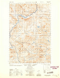
(33)- 1932 Map of Musquacook Lakes
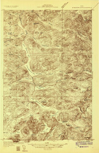 1932 Musquacook Lakes1932 Print · USGSThe North Maine Woods are captured in the early 1930s as a remote network of timber lands and glacial lakes. Trace the primitive logging routes of the California Road and Tote Road past camps like Howes Camp and the five Musquacook Lakes.4 unique versions available
 - 1932 Map of Allagash Falls
 1932 Allagash Falls1932 Print · USGSThe North Maine Woods in the early thirties reveal a landscape of timber camps and river navigation before modern infrastructure arrived. Trace the remote logging culture at Cunliffe Depot Camp and search for old riverside clearings like Michaud Farm.4 unique versions available
 - 1935 Map of Musquacook Lakes
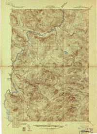
 1935 Musquacook Lakes1935 Print · USGSThe remote Aroostook County timberlands are revealed in this mid-thirties survey, showing a landscape defined by the great Musquacook chain. Researchers can trace historic logging access via the American Realty Tote Road or locate the fire tower atop Clear Lake Mtn.3 unique versions available
 - 1935 Map of Allagash Falls
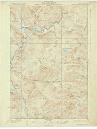 1935 Allagash Falls1935 Print · USGSThe northern Maine woods in the early 1930s were a network of logging camps and remote river outposts. Genealogists and historians can trace the early timber footprint through locations like Cunliffe Depot Camp, Michaud Farm, and the Tote Road.2 unique versions available
 - 1954 Map of Presque Isle, 1968 Print
 1954 Presque Isle1968 Print · USGSNorth Woods logging and rail history come alive in this mid-century survey of the Maine-Quebec borderlands. Genealogists and historians can trace the Bangor and Aroostook railroad through timber hubs like Ashland, Smyrna Mills, and Presque Isle.2 unique versions available
 - 1956 Map of Allagash Falls
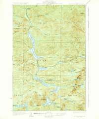
 1956 Allagash Falls1956 Print · USGSThe Maine North Woods in the mid-fifties remain a world of logging camps and remote river outposts along the Allagash. Trace the legacy of river driving and timber harvesting through sites like Cunliffe Depot Camp, Michaud Farm, and the iconic Allagash Falls.2 unique versions available
 - 1958 Map of Presque Isle
 1958 Presque Isle1958 Print · USGSThe Aroostook timber and potato country is captured here during the late fifties, showing the vital rail-to-river network of Northern Maine. Genealogists and historians can trace the Bangor & Aroostook RR through Mapleton and Ashland, or locate remote sites like Chamberlain Farm and Seven Islands.
 - 1960 Map of Presque Isle
 1960 Presque Isle1960 Print · USGSNorthern Maine during the mid-century was a land of timber, rails, and strategic airfields. Genealogists and historians can trace the growth of Presque Isle and Ashland or explore the remote northern reaches of Baxter State Park and Presque Isle AFB.3 unique versions available
 - 1986 Map of Five Finger Brook
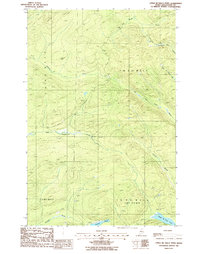
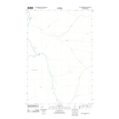
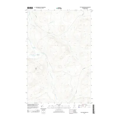
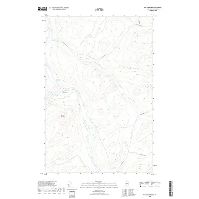
 1986 Five Finger Brook1986 Print · USGSAroostook County's deep woods are documented in the mid-eighties, focusing on the protected waters of the Allagash River corridor. Trace the remote waterways and timber tracks near Round Pond Mountain, Moose Bogan, and Five Finger Brook.
 - 1986 Map of Upper Mc Nally Pond
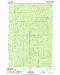
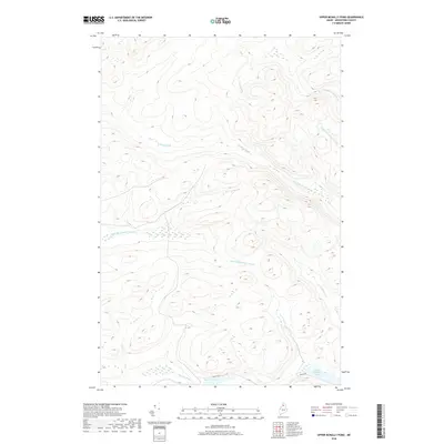
 1986 Upper Mc Nally Pond1986 Print · USGSAroostook County in the mid-1980s was a landscape of commercial timberlands and remote waterways. Researchers can trace resource extraction sites like Shale Pit or follow the paths of Little Musquacook Stream and Upper Mc Nally Pond.
 - 1986 Map of Big Brook Lake
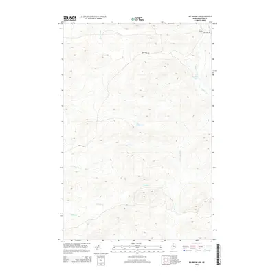
 1986 Big Brook Lake1986 Print · USGSThe northern Maine woods of the mid-eighties are shown here as a landscape of private timber roads and remote waterways. Researchers can trace the winding paths of The Corduroys and Five Finger Brook or locate the quiet Big Brook Lake campground.
 - 1986 Map of First Musquacook Lake, 1987 Print
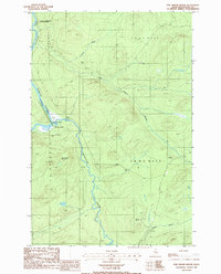
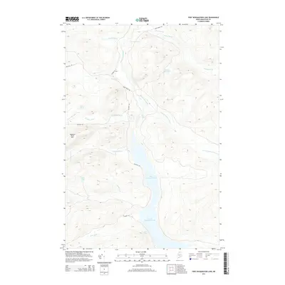
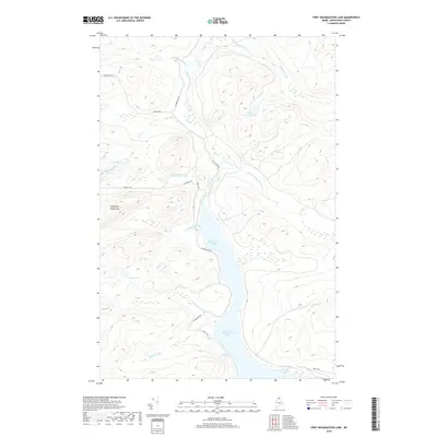
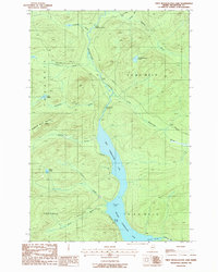 1986 First Musquacook Lake1987 Print · USGSAroostook County's deep woods are captured in the mid-1980s, centered on the interconnected waters of the Musquacook chain. Researchers can trace the logging-era road network and find remote landmarks like Porters Spring, Horse Race Rapids, and Shepherd Mountain.
 - 1993 Map of Clayton Lake, 1994 Print
 1993 Clayton Lake1994 Print · USGSThe North Woods along the Maine and Quebec border remained a vast wilderness of timber and water in the early nineties. Researchers can trace historic river crossings and remote outposts like Ninemile Bridge, Saint-Pamphile, and the Harvey Farm.
 - 2011 Map of First Musquacook Lake, 2011 Print
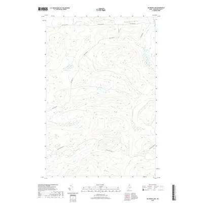
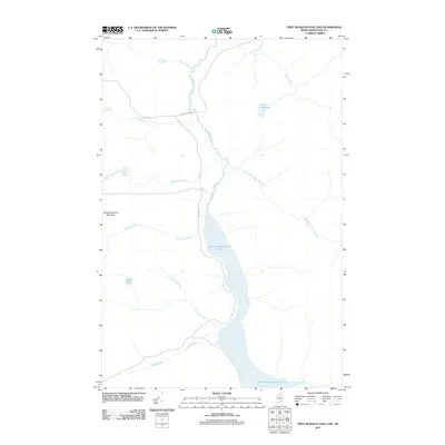 2011 First Musquacook Lake2011 Print · USGSCovers T12 R11 WELS, including T11 R12 WELS, T12 R12 WELS, and other nearby areas
 - 2011 Map of Big Brook Lake, 2011 Print
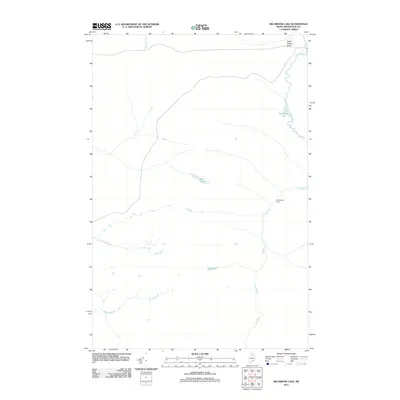 2011 Big Brook Lake2011 Print · USGSCovers T12 R11 WELS, including T14 R10 WELS, T14 R11 WELS, and other nearby areas
 - 2011 Map of Upper McNally Pond, 2011 Print
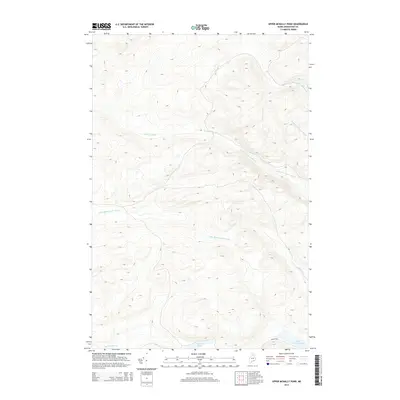
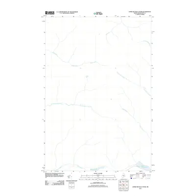 2011 Upper McNally Pond2011 Print · USGSCovers T12 R11 WELS, including T12 R10 WELS, T11 R11 WELS, and other nearby areas
 - 2011 Map of Five Finger Brook, 2011 Print
 2011 Five Finger Brook2011 Print · USGSCovers T12 R11 WELS, including T14 R12 WELS, T14 R11 WELS, and other nearby areas
 - 2014 Map of Big Brook Lake, 2014 Print
 2014 Big Brook Lake2014 Print · USGSCovers T12 R11 WELS, including T14 R10 WELS, T14 R11 WELS, and other nearby areas
 - 2014 Map of First Musquacook Lake, 2014 Print
 2014 First Musquacook Lake2014 Print · USGSCovers T12 R11 WELS, including T11 R12 WELS, T12 R12 WELS, and other nearby areas
 - 2014 Map of Five Finger Brook, 2014 Print
 2014 Five Finger Brook2014 Print · USGSCovers T12 R11 WELS, including T14 R12 WELS, T14 R11 WELS, and other nearby areas
 - 2014 Map of Upper McNally Pond, 2014 Print
 2014 Upper McNally Pond2014 Print · USGSCovers T12 R11 WELS, including T12 R10 WELS, T11 R11 WELS, and other nearby areas
 - 2018 Map of Upper McNally Pond, 2018 Print
 2018 Upper McNally Pond2018 Print · USGSCovers T12 R11 WELS, including T12 R10 WELS, T11 R11 WELS, and other nearby areas
 - 2018 Map of First Musquacook Lake, 2018 Print
 2018 First Musquacook Lake2018 Print · USGSCovers T12 R11 WELS, including T11 R12 WELS, T12 R12 WELS, and other nearby areas
 - 2018 Map of Five Finger Brook, 2018 Print
 2018 Five Finger Brook2018 Print · USGSCovers T12 R11 WELS, including T14 R12 WELS, T14 R11 WELS, and other nearby areas
 - 2018 Map of Big Brook Lake, 2018 Print
 2018 Big Brook Lake2018 Print · USGSCovers T12 R11 WELS, including T14 R10 WELS, T14 R11 WELS, and other nearby areas
Showing maps 1-25 of 33
Frequently asked questions
- What are the different types of historical maps available for T12 R11 WELS?
- What is the oldest map of T12 R11 WELS?
- Where can I purchase historical maps of T12 R11 WELS for my home or office?
- Where can I download high-res historical maps of T12 R11 WELS?
- Are there historical topographic maps available for T12 R11 WELS?
- Is there historical aerial imagery available for T12 R11 WELS?
- Where are historical maps of T12 R11 WELS sourced from?