1940s Maps of Upper Molunkus Township, Maine
Explore 8 historic maps of Upper Molunkus Township from the 1940s. These maps offer a rare glimpse into what life looked like during the 1940s — showing old roads, neighborhoods, homes, and landmarks that have changed or disappeared over time.
Whether you're researching your family's past, planning a metal detecting trip, or studying how Upper Molunkus Township's landscape evolved across the 1940s, these high-resolution maps are a powerful tool for exploring the history of this region.
- Focus on a specific era: All maps on this page are from the 1940s, giving you a focused view of this time period.
- See what’s changed: Compare century-old streets, trails, and buildings to today's modern landscape using overlays and satellite layers.
- Research with precision: Use these maps for genealogy, historical research, land use analysis, or educational projects.
- View, download, or print: Maps are fully viewable online in high resolution, and can be downloaded or printed for your own records.
Start exploring Upper Molunkus Township's history through authentic maps from the 1940s. This is your window into the past.
Upper Molunkus Township, ME maps
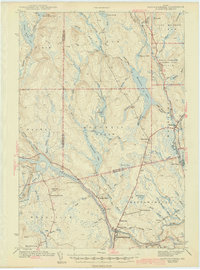
(8)- 1940 Map of Sherman, 1959 Print
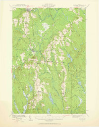 1940 Sherman1959 Print · USGSNorthern Maine's timber and rail landscape is captured here just before the mid-century, centered on the Bangor and Aroostook line. Genealogists can trace early homesteads near Sherman Mills, Golden Ridge, and the Stacyville Post Office.2 unique versions available
 - 1940 Map of Mattawamkeag, 1961 Print
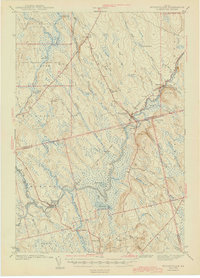
 1940 Mattawamkeag1961 Print · USGSThe rail junction at Mattawamkeag and the timber-rich Penobscot valley are captured here just before the mid-century. Genealogists and historians can trace family locations at Jordan Mills, identify the Back Settlement, and locate the North Woodville School.2 unique versions available
 - 1941 Map of Mattawamkeag Lake, 1958 Print
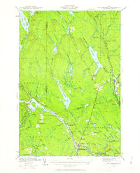
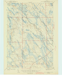
 1941 Mattawamkeag Lake1958 Print · USGSThis Maine interior was a landscape of timber and water during the 1940s, centered on the expansive Mattawamkeag Lake. Researchers can trace the rugged network of ridges and river camps, from the Otter Lake Firetower to the community at Glenwood.4 unique versions available
 - 1941 Map of Wytopitlock, 1960 Print
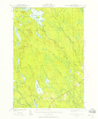
 1941 Wytopitlock1960 Print · USGSAroostook County was a landscape of remote timberlands and river-side rail hubs at the start of the 1940s. Genealogists and historians can trace old community life through landmarks like Knoxville Sch, Whitney Fire Tower, and the rail junction at Wytopitlock.2 unique versions available
 - 1942 Map of Mattawamkeag
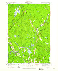
 1942 Mattawamkeag1942 Print · USGSMaine's logging and rail heartland is captured here during the early 1940s at the junction of the Penobscot and Mattawamkeag rivers. Researchers can trace the heritage of remote outposts like Jordan Mills and Back Settlement or locate the North Woodville Sch.3 unique versions available
 - 1942 Map of Sherman
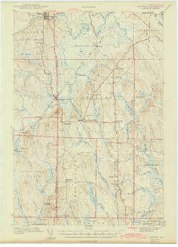 1942 Sherman1942 Print · USGSSouthern Aroostook County is captured here just before the mid-century, showcasing the railroad-dependent communities of Sherman and Patten. Genealogists can locate family sites near the Sherman Mills Cem, Doble Sch, or the now-quiet rail stops at Sherman Station.
 - 1943 Map of Wytopitlock
 1943 Wytopitlock1943 Print · USGSMaine’s timber and rail country comes to life in the early 1940s as the Mattawamkeag River valley connects isolated townships. Researchers can trace rural life through the locations of Knoxville Sch, Drew Cem, and the prominent Whitney Fire Tower.
 - 1943 Map of Mattawamkeag Lake
 1943 Mattawamkeag Lake1943 Print · USGSSouthern Aroostook County is shown during the early 1940s, a period when the timber and river economies defined these remote townships. Researchers can locate early infrastructure and family landmarks, from the Otter Lake Firetower to the small cemetery at Glenwood and the isolated City Camp Landing.
End of results
Showing maps 1-8 of 8
Top cities near Upper Molunkus Township
- Medway historical maps
- Patten historical maps
- Sherman historical maps
- Island Falls historical maps
- Mattawamkeag historical maps
- Stacyville historical maps
See more
Frequently asked questions
- What are the different types of historical maps available for Upper Molunkus Township?
- What is the oldest map of Upper Molunkus Township?
- Where can I purchase historical maps of Upper Molunkus Township for my home or office?
- Where can I download high-res historical maps of Upper Molunkus Township?
- Are there historical topographic maps available for Upper Molunkus Township?
- Is there historical aerial imagery available for Upper Molunkus Township?
- Where are historical maps of Upper Molunkus Township sourced from?