1970s Maps of Woodland, Maine
Explore 4 historic maps of Woodland from the 1970s. These maps offer a rare glimpse into what life looked like during the 1970s — showing old roads, neighborhoods, homes, and landmarks that have changed or disappeared over time.
Whether you're researching your family's past, planning a metal detecting trip, or studying how Woodland's landscape evolved across the 1970s, these high-resolution maps are a powerful tool for exploring the history of this region.
- Focus on a specific era: All maps on this page are from the 1970s, giving you a focused view of this time period.
- See what’s changed: Compare century-old streets, trails, and buildings to today's modern landscape using overlays and satellite layers.
- Research with precision: Use these maps for genealogy, historical research, land use analysis, or educational projects.
- View, download, or print: Maps are fully viewable online in high resolution, and can be downloaded or printed for your own records.
Start exploring Woodland's history through authentic maps from the 1970s. This is your window into the past.
Woodland, ME maps
(4)- 1975 Map of Caribou SE, 1981 Print
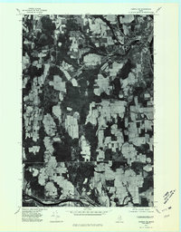 1975 Caribou SE1981 Print · USGSAroostook County agriculture is captured in high detail during the mid-seventies, showing the sprawling farm fields surrounding the city of Caribou. Researchers can trace old property lines and rural crossroads like Crouseville, Jacobs, and Adaline.
 - 1975 Map of Caribou NW, 1981 Print
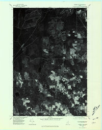 1975 Caribou NW1981 Print · USGSAroostook County's landscape in the mid-seventies is captured in this aerial survey of the rural communities and forestlands northwest of Caribou. Genealogists and local historians can trace field lines and farmsteads near Sweden, Colby, and Woodland Center.
 - 1975 Map of Caribou SW, 1981 Print
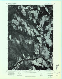 1975 Caribou SW1981 Print · USGSAroostook County agriculture and river life are captured in this mid-seventies aerial survey of the Maine countryside. Genealogists and local historians can trace the layouts of Washburn and Bugbee or follow the banks of the Aroostook River.
 - 1975 Map of New Sweden, 1981 Print
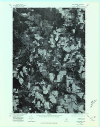 1975 New Sweden1981 Print · USGSNorthern Maine's Swedish heritage is visible in the 1970s, showcasing the rural landscapes of New Sweden and Acadia. Trace the agricultural patterns and forest boundaries near New Sweden Station and along the Little Madawaska River.
End of results
Showing maps 1-4 of 4
Top cities near Woodland
- Presque Isle historical maps
- Caribou historical maps
- Fort Fairfield historical maps
- Mapleton historical maps
- Washburn historical maps
- Limestone historical maps
See more
Top neighborhoods of Woodland
Frequently asked questions
- What are the different types of historical maps available for Woodland?
- What is the oldest map of Woodland?
- Where can I purchase historical maps of Woodland for my home or office?
- Where can I download high-res historical maps of Woodland?
- Are there historical topographic maps available for Woodland?
- Is there historical aerial imagery available for Woodland?
- Where are historical maps of Woodland sourced from?