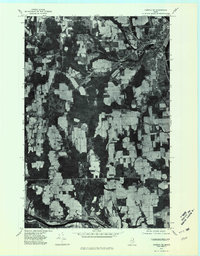
1975 Map of Caribou SE
USGS Topo · Published 1981About this map
Aroostook River curves through the southern reaches of this mid-1970s orthophoto, marking the edge of a landscape defined by intensive agricultural cultivation and small, dispersed settlements. The city of Caribou anchors the northeastern corner, where the street grid transitions into a patchwork of large farm fields and wooded stream corridors. This photographic survey reveals the distinct land-use patterns of the era, showing how smaller hamlets like Crouseville and rail-adjacent points such as Pauls and Jacobs are integrated into the rural economy. In the center of the quadrangle, Caribou Lake and the winding Caribou Stream provide a sharp contrast to the geometric lines of the surrounding cleared acreage, illustrating the natural drainage features that historically shaped local development in this northern Maine interior.
Find a feature on this map
8 named features on this map. Tap any name to fly to it.
Don’t see what you’re looking for? This feature index may not catch every label — zoom into the map to look around manually.
Map Details
Editions of this 1975 Caribou SE Map
This is the sole edition of this map. No revisions or reprints were ever made.
Other maps of this area

1929 · Caribou
USGS Topo · 1:48,000

1930 · Fort Fairfield
USGS Topo · 1:48,000

1932 · Caribou
USGS Topo · 1:62,500

1933 · Fort Fairfield
USGS Topo · 1:62,500

1935 · Presque Isle
USGS Topo · 1:62,500

1936 · Mars Hill
USGS Topo · 1:48,000

1940 · Mars Hill
USGS Topo · 1:62,500

1951 · Mars Hill
USGS Topo · 1:62,500

1951 · Fort Fairfield
USGS Topo · 1:62,500

1953 · Fort Fairfield NW
USGS Topo · 1:24,000