Old Maps of Standish, Maine for Hiking & Exploration
Hike through history with 48 historic maps of Standish. Explore old trails, ghost towns, and forgotten backroads — perfect for outdoor adventurers and local explorers.
- Rediscover forgotten places: Map out old mining camps, roads, and footpaths that no longer exist on modern maps.
- Layer with modern tools: Combine with LiDAR or satellite views to plan hikes through historical terrain.
- Made for exploration: Popular among hikers, overlanders, and local history lovers.
Use these maps to find adventure and explore the hidden past of Standish.
Standish, ME maps
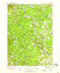
(48)- 1891 Map of Buxton
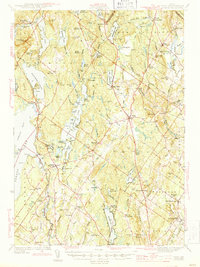
 1891 Buxton1891 Print · USGSThe Saco River valley at the end of the nineteenth century is captured here in detail, showcasing a network of mill villages and early rail lines. Researchers can trace the path of the Portland and Rochester Railroad and locate historic sites like Shaker Village, Salmon Falls, and Nasons Mills.
 - 1892 Map of Buxton, 1913 Print
 1892 Buxton1913 Print · USGSSouthern Maine's mill towns and river valleys are captured here in the late nineteenth century as the industrial economy thrived along the Saco River. Genealogists and historians can trace the early layouts of Shaker Village, Nasons Mills, and Salmon Falls before modern development changed these rural landscapes.4 unique versions available
 - 1893 Map of Buxton
 1893 Buxton1893 Print · USGSThe York County interior flourished in the late nineteenth century as a hub of river-powered industry and rail transport. Genealogists and historians can trace family-named sites and vanished mill hamlets like Shaker Village, Nasons Mills, and Salmon Falls.3 unique versions available
 - 1894 Map of Gray
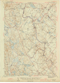
 1894 Gray1894 Print · USGSMaine's Sebago Lake region at the close of the nineteenth century shows a network of mill towns and early rail lines. Trace family roots and vanished landmarks through New Gloucester, Sabbathday Lake, and the depots along the Maine Central R. R.
 - 1896 Map of Sebago
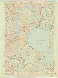
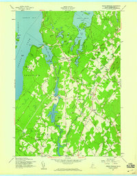
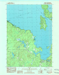
 1896 Sebago1896 Print · USGSCumberland County’s lake country thrived on a network of water and rail transport at the end of the Victorian era. Researchers can trace the Steamboat Route through Sebago Lake and locate old industrial sites like Songo Lock, Cooks Mills, and Steep Falls.8 unique versions available
 - 1898 Map of Gray
 1898 Gray1898 Print · USGSIn the 1890s, this area of southern Maine was a landscape of evolving rail connections and traditional mill towns. Genealogists can trace family roots through settlements like New Gloucester and Cumberland Center, or locate early landmarks such as Webbs Mills and Sabbathday Lake.7 unique versions available
 - 1942 Map of Gray, 1956 Print
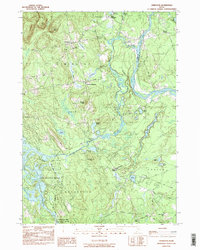
 1942 Gray1956 Print · USGSCumberland County’s interior landscape comes into focus during the early 1940s, revealing a network of rail-side stations and crossroads hamlets. Genealogists and historians can trace family locations near Suckerville, Purinton Cem, and the Friends Ch.
 - 1942 Map of Buxton, 1958 Print
 1942 Buxton1958 Print · USGSIn the early 1940s, the river valleys of southern Maine were defined by a tight-knit network of mill towns and rail corridors. Trace family roots and local industry through features like Salmon Falls, Shaw Mills, and the Chadbourne Cem.3 unique versions available
 - 1942 Map of Sebago Lake, 1959 Print
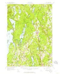
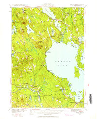 1942 Sebago Lake1959 Print · USGSCumberland County’s lakes and ridges were well-established as a summer destination in the early 1940s, centered around the expanse of Sebago Lake. Researchers can trace old rail routes at East Baldwin Mattocks Sta, find the historic Potter Academy, or locate family sites near South Naples.3 unique versions available
 - 1943 Map of Sebago Lake
 1943 Sebago Lake1943 Print · USGSMaine's lake country thrived during the early 1940s as a hub of rail commerce and early recreation. You can trace the Maine Central Railroad through Steep Falls or find local landmarks like Potter Academy and Songo Lock.3 unique versions available
 - 1944 Map of Buxton
 1944 Buxton1944 Print · USGSThe Saco River valley during the mid-forties reveals a landscape of mill towns and interconnected rural hamlets. Genealogists and local historians can trace the foundations of Bar Mills, locate the Chadbourne Cem, or follow the path of the Boston and Maine railroad.3 unique versions available
 - 1944 Map of Gray
 1944 Gray1944 Print · USGSCumberland County village life and the rail-and-water economy are captured here just after the war. You can trace the Maine Central line through several depots or locate historic family landmarks like Purinton Cem and the Opportunity Sch.3 unique versions available
 - 1949 Map of Portland
 1949 Portland1949 Print · USGSCoastal Maine and the New Hampshire interior are shown in detail during the late forties, from the bustling harbors to the lakeside villages. Researchers can trace historical rail networks like the Boston & Maine RR and locate coastal defenses such as Fort Preble.3 unique versions available
 - 1956 Map of Portland, 1963 Print
 1956 Portland1963 Print · USGSSouthern Maine and eastern New Hampshire are captured here in the mid-fifties, during a time of major highway expansion and military growth. You can trace the path of the Maine Turnpike and locate landmarks like the Portsmouth Naval Shipyard and Sebago Lake.4 unique versions available
 - 1957 Map of North Windham, 1959 Print
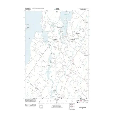
 1957 North Windham1959 Print · USGSCumberland County's lake-and-river landscape is captured here in the late fifties, during a period of steady residential and industrial growth. Researchers can trace family history through several local burial grounds like Purington Cem or explore the river economy at Eel Weir Power Sta.4 unique versions available
 - 1957 Map of Gray, 1960 Print
 1957 Gray1960 Print · USGSCumberland County during the mid-fifties shows a landscape of established rail towns and growing turnpike access. Genealogists and historians can trace family locations near crossroads like Ireland Corner, find old schools such as Gloucester Hill School, and locate rural landmarks like Windham Plains Chapel.5 unique versions available
 - 1959 Map of Portland
 1959 Portland1959 Print · USGSThe Maine and New Hampshire coastlines meet in this mid-century portrait of maritime commerce and inland rail networks. Researchers can trace the legacy of coastal defense at Fort Williams and follow the historic path of the Maine Central RR through the White Mountain National Forest.2 unique versions available
 - 1963 Map of Portland
 1963 Portland1963 Print · USGSCoastal Maine and New Hampshire thrived as maritime and industrial hubs during the mid-sixties, linked by a dense network of rail and river. Researchers can trace historic transit corridors like the Maine Central RR and locate key sites such as the Portsmouth Naval Shipyard or Pease Air Force Base.3 unique versions available
 - 1983 Map of Steep Falls, 1984 Print
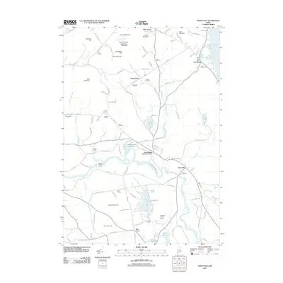
 1983 Steep Falls1984 Print · USGSMaine's riverfront settlements and family farmsteads are detailed here in the early 1980s. Genealogists can locate numerous family burial sites like Emerson-Thorne Cem and Lord Cem, or trace the winding Saco River past Steep Falls.2 unique versions available
 - 1983 Map of Standish, 1984 Print
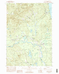
 1983 Standish1984 Print · USGSThe Saco River valley in the early 1980s reveals a network of rural hamlets and small-town Maine life before modern expansion. Genealogists and local historians can trace family locations through numerous sites like Meeting House Hill Cem, Shaw Mills, and Tylers Corner.
 - 1983 Map of Sebago Lake, 1984 Print
 1983 Sebago Lake1984 Print · USGSCumberland County’s lakefront and forest lands are documented here during the early eighties, capturing the character of Standish and Raymond. Researchers can trace the Maine Central rail line and locate community staples like Richville, the Johnson Sch, and Friendship Cem.2 unique versions available
 - 1983 Map of Limington, 1984 Print
 1983 Limington1984 Print · USGSYork County in the early eighties shows a landscape of traditional river settlements and new lakeside growth. Genealogists and local historians can locate Chadbournes Mills, the Emory Mem Sch, and family landmarks near Higgins Corner.2 unique versions available
 - 1985 Map of Portland, 1986 Print
 1985 Portland1986 Print · USGSThe Maine coast and Sebago Lake region are captured in the mid-1980s, showcasing the transition from traditional maritime centers to a modern transportation hub. Genealogists and historians can trace rail lines like the Grand Trunk RR and find local landmarks such as the U.S. Marine Hospital or Old Orchard Beach.2 unique versions available
 - 2011 Map of North Windham, 2011 Print
 2011 North Windham2011 Print · USGSCovers Standish, including Windham, Gorham, and other nearby areas
 - 2011 Map of Steep Falls, 2011 Print
 2011 Steep Falls2011 Print · USGSCovers Standish, including Limington, Sebago, and other nearby areas
Showing maps 1-25 of 48
Top cities near Standish
- Portland historical maps
- South Portland historical maps
- Scarborough historical maps
- Westbrook historical maps
- Saco historical maps
- Windham historical maps
See more
Top neighborhoods of Standish
- Steep Falls historical maps
- Richville historical maps
- Sebago Lake historical maps
- Dow Corner historical maps
- Elmwood historical maps
- Harmon Beach historical maps
See more
Frequently asked questions
- What are the different types of historical maps available for Standish?
- What is the oldest map of Standish?
- Where can I purchase historical maps of Standish for my home or office?
- Where can I download high-res historical maps of Standish?
- Are there historical topographic maps available for Standish?
- Is there historical aerial imagery available for Standish?
- Where are historical maps of Standish sourced from?