Old Maps of Gerrishville, Winter Harbor for Academic Research
Study the evolution of Gerrishville with 14 high-resolution historic maps. Whether you're teaching, researching, or modeling changes in land use, these maps provide essential visual documentation of urban, environmental, and geographic change.
- Analyze long-term change: Track patterns in development, transportation, and natural features.
- Ideal for environmental or urban studies: Support academic projects with primary historical map data.
- Use in the classroom or lab: Educators and researchers rely on these maps to bring historical context to life.
These maps are a powerful tool for teaching, research, and visualizing how Gerrishville has changed over the decades.
Gerrishville, Winter Harbor maps
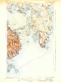
(14)- 1904 Map of Bar Harbor
 1904 Bar Harbor1904 Print · USGSThe granite coast of Maine appears at the height of its maritime era, with a dense network of steamboat routes and ferry crossings. Genealogists and historians can trace the early layout of Bar Harbor, the rail terminus at Mount Desert Ferry, and the fishing outposts of Islesford and Sorrento.6 unique versions available
 - 1942 Map of Bar Harbor
 1942 Bar Harbor1942 Print · USGSMount Desert Island and the Schoodic Peninsula are shown just before the war in this detailed coastal survey. Genealogists and historians can trace the foundations of Bar Harbor, locate the village of Islesford, and explore landmarks like Chicken Mill Pond.4 unique versions available
 - 1948 Map of Bangor
 1948 Bangor1948 Print · USGSThe Maine coast and its industrial river valleys are captured here shortly after the war, showing the vital shipping and rail hubs of the late 1940s. Genealogists and historians can trace the tracks of the Maine Central RR connecting Bangor, Augusta, and Old Town.
 - 1956 Map of Bar Harbor, 1960 Print
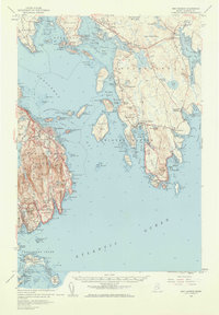 1956 Bar Harbor1960 Print · USGSThe Maine coast in the mid-1950s reveals a landscape defined by seafaring villages and the protected peaks of Acadia National Park. Genealogists and historians can trace coastal life from the streets of Bar Harbor to remote island settlements like Islesford and Gerrishville.3 unique versions available
 - 1956 Map of Bangor, 1966 Print
 1956 Bangor1966 Print · USGSMid-century Maine comes alive in this survey of the rugged coast and river valleys during the 1950s. Genealogists and historians can trace the vital rail corridors of the Maine Central RR connecting timber towns like Old Town to the coast at Bar Harbor.3 unique versions available
 - 1960 Map of Bangor
 1960 Bangor1960 Print · USGSCentral Maine in the sixties reveals a landscape of river-powered industry and sprawling coastal island chains. Researchers can trace the rail corridors of the Maine Central or locate mid-century aviation landmarks like Dow Air Force Base.
 - 1961 Map of Bangor
 1961 Bangor1961 Print · USGSMid-century Maine comes alive through its busy river ports and rocky archipelagoes during a period of steady maritime and rail commerce. Researchers can trace the path of the Maine Central railroad and locate coastal landmarks from Acadia National Park to Vinalhaven Island.
 - 1984 Map of Winter Harbor, 1985 Print
 1984 Winter Harbor1985 Print · USGSCoastal Hancock County at the mid-eighties shows a landscape of fishing villages and early conservation efforts. Researchers can locate family landmarks like Taft Cem, the historic Gouldsboro Sch, and the Prospect Harbor Point Lighthouse.2 unique versions available
 - 1985 Map of Bar Harbor
 1985 Bar Harbor1985 Print · USGSCoastal Hancock County in the mid-eighties shows an intricate landscape of island communities and protected wilderness. Trace the boundaries of Acadia National Park or locate seafaring hubs like Stonington and Bar Harbor.2 unique versions available
 - 2011 Map of Winter Harbor, 2011 Print
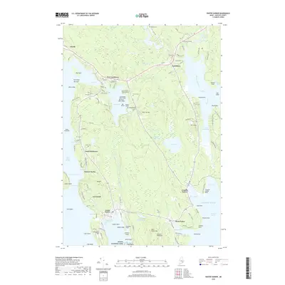
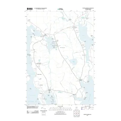 2011 Winter Harbor2011 Print · USGSCovers Gerrishville, including Gouldsboro, Sullivan, and other nearby areas
 - 2014 Map of Winter Harbor, 2014 Print
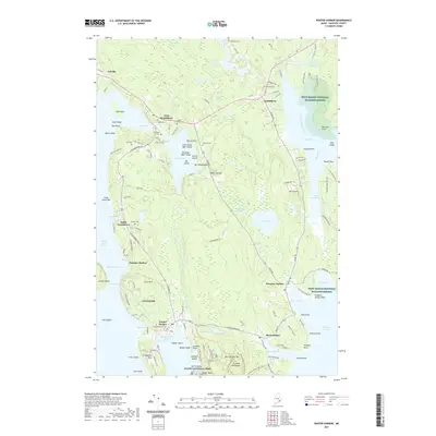
 2014 Winter Harbor2014 Print · USGSCovers Gerrishville, including Gouldsboro, Sullivan, and other nearby areas
 - 2018 Map of Winter Harbor, 2018 Print
 2018 Winter Harbor2018 Print · USGSCovers Gerrishville, including Gouldsboro, Sullivan, and other nearby areas
 - 2021 Map of Winter Harbor, 2021 Print
 2021 Winter Harbor2021 Print · USGSCovers Gerrishville, including Gouldsboro, Sullivan, and other nearby areas
 - 2024 Map of Winter Harbor, 2024 Print
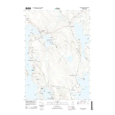
 2024 Winter Harbor2024 Print · USGSThe Maine coast near Winter Harbor and the Schoodic Peninsula comes to life in this detailed modern survey. Genealogists can trace family legacies through numerous local burial sites like Nahum Jones Cem, Greenwood Cem, and Whitaker Cem.
End of results
Showing maps 1-14 of 14
Frequently asked questions
- What are the different types of historical maps available for Gerrishville?
- What is the oldest map of Gerrishville?
- Where can I purchase historical maps of Gerrishville for my home or office?
- Where can I download high-res historical maps of Gerrishville?
- Are there historical topographic maps available for Gerrishville?
- Is there historical aerial imagery available for Gerrishville?
- Where are historical maps of Gerrishville sourced from?