Old Maps of Matinicus Isle Plantation, Maine
Explore 42 old maps of Matinicus Isle Plantation, spanning from 1904 to today. These high-resolution historic maps reveal how streets, neighborhoods, landmarks, and natural features evolved over time — perfect for genealogy, metal detecting, research, and local history exploration.
What you can do with these maps:
- See how Matinicus Isle Plantation changed over time: Compare historical maps to modern-day views to trace roads, homesites, rail lines & more.
- View detailed metadata: Each map includes creators, publishers, year, scale, and archive source.
- Overlay maps with satellite & LiDAR: Visualize the past alongside modern tools to explore terrain & human change.
- Trusted historical sources: Maps sourced from the USGS, Library of Congress, and other archives.
- Access maps your way: View online, download high-res files, or order prints for personal or research use.
Start exploring old maps of Matinicus Isle Plantation to uncover forgotten places, hidden landmarks, and the deep history beneath your feet.
Matinicus Isle Plantation, ME maps
(42)- 1904 Map of Tenants Harbor, 1960 Print
 1904 Tenants Harbor1960 Print · USGSCoastal Maine at the turn of the century reveals a seafaring landscape shaped by granite islands and protected harbors. Genealogists and historians can trace old coastal settlements like Martinsville and Elmore or navigate the intricate Muscle Ridge Channel.
 - 1906 Map of Matinicus
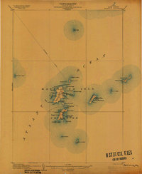 1906 Matinicus1906 Print · USGSCoastal Maine's most remote island communities are captured at the beginning of the twentieth century. Researchers can trace the early footprints of Matinicus and Criehaven, locate the Matinicus Rock LH, and follow the old Steamboat Route.4 unique versions available
 - 1906 Map of Tennant Harbor
 1906 Tennant Harbor1906 Print · USGSThe coastal waters of Knox County were a bustling corridor for maritime trade in the early 1900s. Genealogists and historians can trace the foundations of Tennant Harbor and Martinsville, while mapping the precise locations of offshore hazards like Roaring Bull and Metinic Island.4 unique versions available
 - 1948 Map of Bath
 1948 Bath1948 Print · USGSMid-coast Maine’s intricate shoreline and island outposts are captured here just after the war. Researchers can trace historic maritime settlements from Bath to Friendship and locate remote landmarks like Monhegan Island and Pemaquid Point.2 unique versions available
 - 1953 Map of Matinicus, 1959 Print
 1953 Matinicus1959 Print · USGSThe outer islands of Knox County are captured here in the early 1950s, showing the remote maritime life of the Gulf of Maine. Genealogists and historians can trace the small settlements at Matinicus and Criehaven or locate the distant U S Coast Guard Reservation on Matinicus Rock.4 unique versions available
 - 1956 Map of Bath, 1974 Print
 1956 Bath1974 Print · USGSCoastal Maine in the mid-fifties reveals a landscape of deep-water harbors and island outposts as the region transitioned from industrial roots to a summer destination. Genealogists can trace maritime families in Boothbay Harbor, Tenants Harbor, and on remote Monhegan Island.
 - 1957 Map of Bath
 1957 Bath1957 Print · USGSThe Maine coast in the mid-fifties is captured here, from the shipbuilding hubs of Bath and Brunswick to the granite reaches of Rockland. Researchers can trace the Maine Central RR line and remote island outposts like Monhegan Island and Matinicus Isle.
 - 1958 Map of Bath
 1958 Bath1958 Print · USGSCoastal Maine in the late fifties reveals a landscape of industrial river towns and remote island outposts. Genealogists and historians can trace the Maine Central RR through Bath, explore the islands of Muscongus Bay, or locate seafaring families at Pemaquid Point.
 - 1963 Map of Bath
 1963 Bath1963 Print · USGSThe Maine Midcoast in the early sixties remains a world of tidal rivers and jagged peninsulas tied to the sea. Genealogy and local history researchers can trace the rail lines of the Maine Central RR and locate offshore communities like Matinicus Island and Monhegan.2 unique versions available
 - 1965 Map of Bath
 1965 Bath1965 Print · USGSThe Midcoast Maine shoreline and its archipelago come alive in the mid-1960s, showing the region's deep reliance on river and rail. Researchers can trace historic harbor towns like Boothbay Harbor and Damariscotta, and locate coastal landmarks from Pemaquid Point to the Fort Popham Military Res.
 - 1985 Map of Matinicus
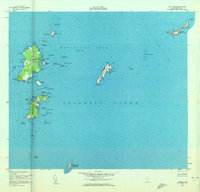
 1985 Matinicus1985 Print · USGSThe outer islands of Knox County are captured in the mid-1980s, highlighting the isolated settlements of the Gulf of Maine. Genealogists and maritime historians can locate homes and landmarks in Matinicus and Criehaven, or trace the shores of Ragged Island and Seal Island.
 - 1985 Map of Bath, 1986 Print
 1985 Bath1986 Print · USGSMidcoast Maine in the mid-eighties shows a landscape of deep-water harbors and strategic military installations. Researchers can trace the coastal rail lines of the Maine Central RR and locate landmarks from Popham Beach to the remote Monhegan Plantation.2 unique versions available
 - 1994 Map of Matinicus
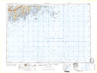
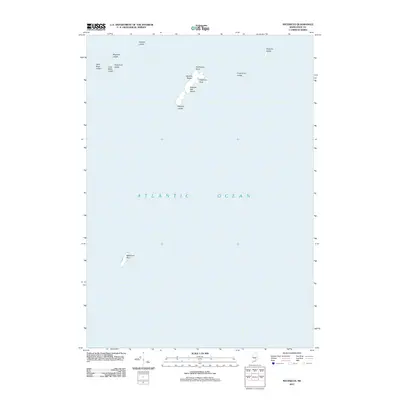
 1994 Matinicus1994 Print · USGSThe outer reaches of Penobscot Bay appear in detail during the 1990s, capturing the remote island life of Matinicus and Criehaven. Trace the geography of this maritime frontier through landmarks like Matinicus Rock, Wilson Head, and the Seal Island National Wildlife Refuge.
 - 2011 Map of Matinicus OE W, 2011 Print
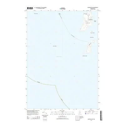
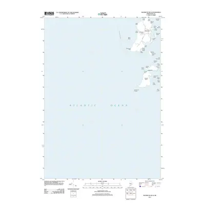 2011 Matinicus OE W2011 Print · USGSCovers Matinicus Isle Plantation, including Matinicus Isle, Criehaven Township, and other nearby areas
 - 2011 Map of Hewett Island OE S, 2011 Print
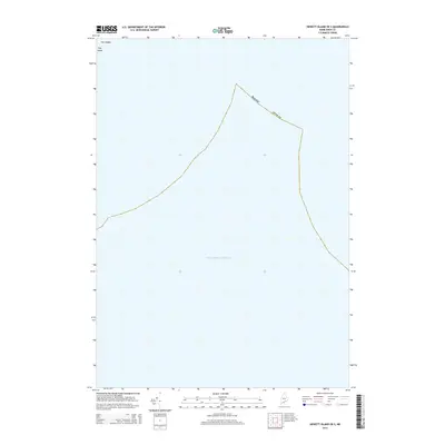
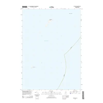
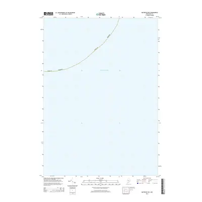
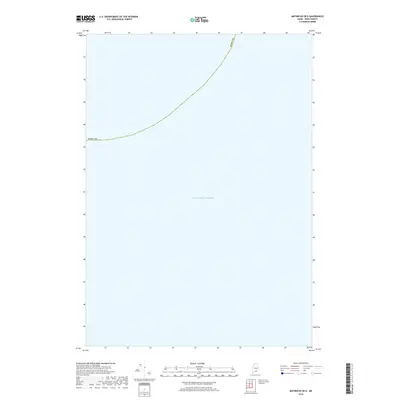
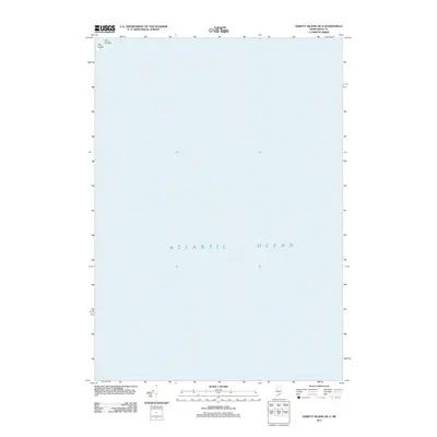 2011 Hewett Island OE S2011 Print · USGSCovers Matinicus Isle Plantation, including Knox County, United States, and other nearby areas
 - 2011 Map of Matinicus OE NW, 2011 Print
 2011 Matinicus OE NW2011 Print · USGSCovers Matinicus Isle Plantation, including Vinalhaven, Muscle Ridge Township, and other nearby areas
 - 2011 Map of Matinicus OE N, 2011 Print
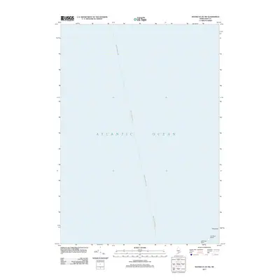
 2011 Matinicus OE N2011 Print · USGSCovers Matinicus Isle Plantation, including Vinalhaven, Knox County, and other nearby areas
 - 2011 Map of Matinicus, 2011 Print
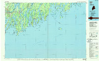
 2011 Matinicus2011 Print · USGSCovers Matinicus Isle Plantation, including Vinalhaven, Criehaven Township, and other nearby areas
 - 2014 Map of Matinicus OE W, 2014 Print
 2014 Matinicus OE W2014 Print · USGSCovers Matinicus Isle Plantation, including Matinicus Isle, Criehaven Township, and other nearby areas
 - 2014 Map of Matinicus OE NW, 2014 Print
 2014 Matinicus OE NW2014 Print · USGSCovers Matinicus Isle Plantation, including Vinalhaven, Muscle Ridge Township, and other nearby areas
 - 2014 Map of Hewett Island OE S, 2014 Print
 2014 Hewett Island OE S2014 Print · USGSCovers Matinicus Isle Plantation, including Knox County, United States, and other nearby areas
 - 2014 Map of Matinicus, 2014 Print
 2014 Matinicus2014 Print · USGSCovers Matinicus Isle Plantation, including Vinalhaven, Criehaven Township, and other nearby areas
 - 2014 Map of Matinicus OE N, 2014 Print
 2014 Matinicus OE N2014 Print · USGSCovers Matinicus Isle Plantation, including Vinalhaven, Knox County, and other nearby areas
 - 2014 Map of Matinicus OE E, 2014 Print
 2014 Matinicus OE E2014 Print · USGSCovers Matinicus Isle Plantation, including Vinalhaven, Knox County, and other nearby areas
 - 2018 Map of Matinicus OE E, 2018 Print
 2018 Matinicus OE E2018 Print · USGSCovers Matinicus Isle Plantation, including Vinalhaven, Knox County, and other nearby areas
Showing maps 1-25 of 42
Top cities near Matinicus Isle Plantation
- Saint George historical maps
- South Thomaston historical maps
- Owls Head historical maps
- Vinalhaven historical maps
- Matinicus Isle historical maps
- Isle au Haut historical maps
See more
Top neighborhoods of Matinicus Isle Plantation
Frequently asked questions
- What are the different types of historical maps available for Matinicus Isle Plantation?
- What is the oldest map of Matinicus Isle Plantation?
- Where can I purchase historical maps of Matinicus Isle Plantation for my home or office?
- Where can I download high-res historical maps of Matinicus Isle Plantation?
- Are there historical topographic maps available for Matinicus Isle Plantation?
- Is there historical aerial imagery available for Matinicus Isle Plantation?
- Where are historical maps of Matinicus Isle Plantation sourced from?