1970s Maps of Township C, Maine
Explore 4 historic maps of Township C from the 1970s. These maps offer a rare glimpse into what life looked like during the 1970s — showing old roads, neighborhoods, homes, and landmarks that have changed or disappeared over time.
Whether you're researching your family's past, planning a metal detecting trip, or studying how Township C's landscape evolved across the 1970s, these high-resolution maps are a powerful tool for exploring the history of this region.
- Focus on a specific era: All maps on this page are from the 1970s, giving you a focused view of this time period.
- See what’s changed: Compare century-old streets, trails, and buildings to today's modern landscape using overlays and satellite layers.
- Research with precision: Use these maps for genealogy, historical research, land use analysis, or educational projects.
- View, download, or print: Maps are fully viewable online in high resolution, and can be downloaded or printed for your own records.
Start exploring Township C's history through authentic maps from the 1970s. This is your window into the past.
Township C, ME maps
(4)- 1977 Map of Andover, 1983 Print
 1977 Andover1983 Print · USGSOxford County timberlands and remote water bodies appear in high detail during the late seventies. Researchers can trace the path of the West Branch Ellis River toward Andover or locate landmarks like Wyman Mountain and C Pond.
 - 1977 Map of Middle Dam, 1983 Print
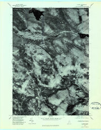
 1977 Middle Dam1983 Print · USGSThe Maine backcountry near the New Hampshire border is captured here in the late seventies, showing the vital water link between the lakes. Trace the rugged drainage from Middle Dam down the Rapid River past the slopes of Moose Mountain.
 - 1977 Map of B Pond, 1983 Print
 1977 B Pond1983 Print · USGSOxford County’s dense timberlands are captured in the late seventies through this unique aerial photo-survey. Trace the winding paths of the Dead Cambridge River and the West Branch Ellis River around B Pond.2 unique versions available
 - 1977 Map of Metallak Mountain, 1983 Print
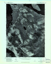 1977 Metallak Mountain1983 Print · USGSThe Maine wilderness in the late seventies is seen through aerial photography in this detailed study of the Rangeley Lakes region. Researchers can trace the timber lines and shorelines surrounding Metallak Mountain, Metallak Pond, and Richardson Lake.2 unique versions available
End of results
Showing maps 1-4 of 4
Top cities near Township C
- Rumford historical maps
- Milan historical maps
- Rangeley historical maps
- Andover historical maps
- Newry historical maps
- Roxbury historical maps
See more
Top neighborhoods of Township C
Frequently asked questions
- What are the different types of historical maps available for Township C?
- What is the oldest map of Township C?
- Where can I purchase historical maps of Township C for my home or office?
- Where can I download high-res historical maps of Township C?
- Are there historical topographic maps available for Township C?
- Is there historical aerial imagery available for Township C?
- Where are historical maps of Township C sourced from?