Old Maps of Siberia, Stacyville for Academic Research
Study the evolution of Siberia with 13 high-resolution historic maps. Whether you're teaching, researching, or modeling changes in land use, these maps provide essential visual documentation of urban, environmental, and geographic change.
- Analyze long-term change: Track patterns in development, transportation, and natural features.
- Ideal for environmental or urban studies: Support academic projects with primary historical map data.
- Use in the classroom or lab: Educators and researchers rely on these maps to bring historical context to life.
These maps are a powerful tool for teaching, research, and visualizing how Siberia has changed over the decades.
Siberia, Stacyville maps
(13)- 1940 Map of Sherman, 1959 Print
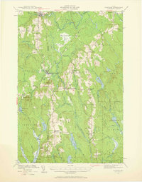 1940 Sherman1959 Print · USGSNorthern Maine's timber and rail landscape is captured here just before the mid-century, centered on the Bangor and Aroostook line. Genealogists can trace early homesteads near Sherman Mills, Golden Ridge, and the Stacyville Post Office.2 unique versions available
 - 1942 Map of Sherman
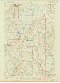 1942 Sherman1942 Print · USGSSouthern Aroostook County is captured here just before the mid-century, showcasing the railroad-dependent communities of Sherman and Patten. Genealogists can locate family sites near the Sherman Mills Cem, Doble Sch, or the now-quiet rail stops at Sherman Station.
 - 1954 Map of Millinocket, 1968 Print
 1954 Millinocket1968 Print · USGSMaine's North Woods and the Penobscot Valley are captured here during the mid-century era of logging and rail dominance. You can trace the path of the Bangor and Aroostook Railroad through timber towns like Millinocket, Mattawamkeag, and Silver Ridge.3 unique versions available
 - 1958 Map of Millinocket
 1958 Millinocket1958 Print · USGSMaine's North Woods and the Penobscot river valley are captured here in the mid-1950s, showing a landscape of timber, rail, and wild waters. Researchers can trace the legacy of the Canadian Pacific railroad and find historic settlements like Millinocket, Sherman Station, and Mattawamkeag.
 - 1960 Map of Millinocket
 1960 Millinocket1960 Print · USGSThe Maine North Woods and Penobscot River valley are captured at mid-century during the height of the paper milling era. Researchers can trace the Appalachian Trail near Mount Katardin or locate family roots in towns like Dover-Foxcroft and Milo.3 unique versions available
 - 1975 Map of Sherman NW, 1980 Print
 1975 Sherman NW1980 Print · USGSPenobscot County, Maine, is captured in this mid-1970s aerial survey, showing the agricultural heart of the region. Researchers can trace the layout of northern settlements like Patten and Sherman Station alongside the East Branch Molunkus Stream.
 - 1985 Map of Millinocket, 1986 Print
 1985 Millinocket1986 Print · USGSThe North Maine Woods were a landscape of industrial timber and wilderness recreation in the mid-eighties. Genealogists and researchers can trace local settlements and rail stops like Sherman Mills, Wytopitlock, and the Old Long A Siding near the Penobscot River.2 unique versions available
 - 1989 Map of Patten
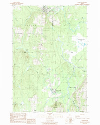 1989 Patten1989 Print · USGSUpper Penobscot County was defined by its rail junctions and vast wetlands in the late twentieth century. Genealogists and historians can trace the residents of Patten and Sherman Station or locate remote points like Siberia and Stafford Hill.
 - 2011 Map of Patten, 2011 Print
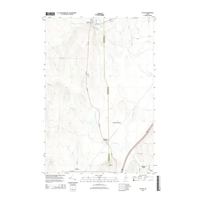
 2011 Patten2011 Print · USGSCovers Siberia, including Patten, Sherman, and other nearby areas
 - 2014 Map of Patten, 2014 Print
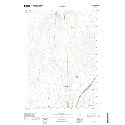
 2014 Patten2014 Print · USGSCovers Siberia, including Patten, Sherman, and other nearby areas
 - 2018 Map of Patten, 2018 Print
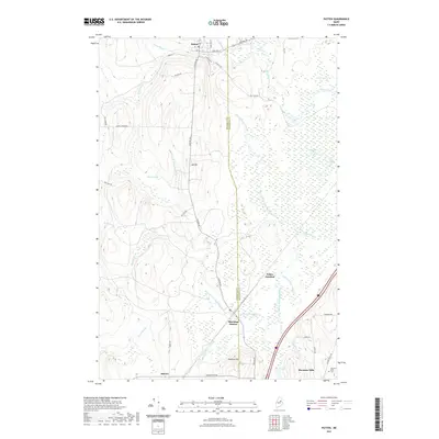
 2018 Patten2018 Print · USGSCovers Siberia, including Patten, Sherman, and other nearby areas
 - 2021 Map of Patten, 2021 Print
 2021 Patten2021 Print · USGSCovers Siberia, including Patten, Sherman, and other nearby areas
 - 2024 Map of Patten, 2024 Print
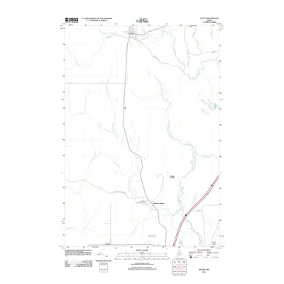
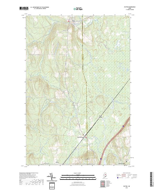 2024 Patten2024 Print · USGSThe timber and agricultural lands of northern Maine come to life in this contemporary survey of the border between Penobscot and Aroostook counties. Genealogists and historians can trace local landmarks like the Sherman Mills Cemetery and the old rail connections at Patten Junction and Sherman Station.
End of results
Showing maps 1-13 of 13
Frequently asked questions
- What are the different types of historical maps available for Siberia?
- What is the oldest map of Siberia?
- Where can I purchase historical maps of Siberia for my home or office?
- Where can I download high-res historical maps of Siberia?
- Are there historical topographic maps available for Siberia?
- Is there historical aerial imagery available for Siberia?
- Where are historical maps of Siberia sourced from?