1980s Maps of Woodville, Maine
Explore 9 historic maps of Woodville from the 1980s. These maps offer a rare glimpse into what life looked like during the 1980s — showing old roads, neighborhoods, homes, and landmarks that have changed or disappeared over time.
Whether you're researching your family's past, planning a metal detecting trip, or studying how Woodville's landscape evolved across the 1980s, these high-resolution maps are a powerful tool for exploring the history of this region.
- Focus on a specific era: All maps on this page are from the 1980s, giving you a focused view of this time period.
- See what’s changed: Compare century-old streets, trails, and buildings to today's modern landscape using overlays and satellite layers.
- Research with precision: Use these maps for genealogy, historical research, land use analysis, or educational projects.
- View, download, or print: Maps are fully viewable online in high resolution, and can be downloaded or printed for your own records.
Start exploring Woodville's history through authentic maps from the 1980s. This is your window into the past.
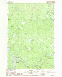
Woodville, ME maps
(9)- 1985 Map of Millinocket, 1986 Print
 1985 Millinocket1986 Print · USGSThe North Maine Woods were a landscape of industrial timber and wilderness recreation in the mid-eighties. Genealogists and researchers can trace local settlements and rail stops like Sherman Mills, Wytopitlock, and the Old Long A Siding near the Penobscot River.2 unique versions available
 - 1985 Map of Lincoln, 1994 Print
 1985 Lincoln1994 Print · USGSPenobscot County in the mid-eighties remains a landscape of river-based commerce and sprawling timberlands connected by rail. You can trace the historic paths of the Maine Central RR and Canadian Pacific RR or locate rural sites like Enfield Station and the Winn Cem.
 - 1986 Map of Lincoln
 1986 Lincoln1986 Print · USGSMid-century Maine settlement and industry converge along the Penobscot and Piscataquis rivers during the 1980s. Researchers can trace the rail networks of the Maine Central and Bangor and Aroostook through towns like Howland and Milo.
 - 1988 Map of Lincoln Center
 1988 Lincoln Center1988 Print · USGSPenobscot River life in the late eighties is centered on the townships of Lincoln and Chester, where the waterway dictates local boundaries and travel. Researchers can trace family history at the Lincoln Center Cem or locate the Mattanawcook Academy near the shores of Long Pond.
 - 1988 Map of Mattaseunk Lake
 1988 Mattaseunk Lake1988 Print · USGSPenobscot County timberlands and river valleys are captured here in the late eighties, just as the region's industrial and natural footprints intersected. Researchers can trace the water-power geography around Mattaseunk Dam, find the small outpost of Jordan Mills, and locate a Drive-In Theater on the forest edge.
 - 1988 Map of Nine Meadow Ridge
 1988 Nine Meadow Ridge1988 Print · USGSThe riverfront and timberlands of Penobscot County are documented here in the late eighties, showing the region's unique glacial topography and river settlements. Researchers can trace the Penobscot River through Lincoln Center or find remote landmarks like The Horseback and the Woodard (Site).
 - 1988 Map of East Winn
 1988 East Winn1988 Print · USGSPenobscot County in the late eighties centers on the river junctions and timberlands of the Maine interior. Researchers can trace rural settlement patterns through East Winn, the East Winn Cem, and family-named landmarks like Rollins Mtn.
 - 1988 Map of Mattawamkeag
 1988 Mattawamkeag1988 Print · USGSThe confluence of the Penobscot and Mattawamkeag rivers defines this riverine landscape in the late eighties. Genealogists and local historians can trace the footings of Meadowville, the Back Settlement, and the wilderness around Mattaseunk Lake.
 - 1988 Map of Medunkeunk Lake
 1988 Medunkeunk Lake1988 Print · USGSThe northern Penobscot woods in the late eighties show a landscape defined by the West Branch Penobscot River and its industrial towns. Genealogists and historians can locate a Cem in Medway, trace Medunkeunk Stream to the lake, and find working Gravel Pits.
End of results
Showing maps 1-9 of 9
Top cities near Woodville
- Lincoln historical maps
- Millinocket historical maps
- East Millinocket historical maps
- Enfield historical maps
- Medway historical maps
- Howland historical maps
See more
Top neighborhoods of Woodville
Frequently asked questions
- What are the different types of historical maps available for Woodville?
- What is the oldest map of Woodville?
- Where can I purchase historical maps of Woodville for my home or office?
- Where can I download high-res historical maps of Woodville?
- Are there historical topographic maps available for Woodville?
- Is there historical aerial imagery available for Woodville?
- Where are historical maps of Woodville sourced from?