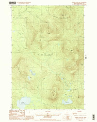
Old Maps of Frenchtown Township, Maine for Hiking & Exploration
Hike through history with 34 historic maps of Frenchtown Township. Explore old trails, ghost towns, and forgotten backroads — perfect for outdoor adventurers and local explorers.
- Rediscover forgotten places: Map out old mining camps, roads, and footpaths that no longer exist on modern maps.
- Layer with modern tools: Combine with LiDAR or satellite views to plan hikes through historical terrain.
- Made for exploration: Popular among hikers, overlanders, and local history lovers.
Use these maps to find adventure and explore the hidden past of Frenchtown Township.
Frenchtown Township, ME maps
(34)- 1952 Map of First Roach Pond, 1954 Print
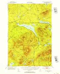 1952 First Roach Pond1954 Print · USGSThe Maine wilderness near Kokadjo is captured here in the early fifties, showing a landscape of timber grants and remote ponds. Researchers can trace the original path of the Appalachian Trail and locate local landmarks like the State Fish Hatchery and VABM Lookout Tower.6 unique versions available
 - 1954 Map of Millinocket, 1968 Print
 1954 Millinocket1968 Print · USGSMaine's North Woods and the Penobscot Valley are captured here during the mid-century era of logging and rail dominance. You can trace the path of the Bangor and Aroostook Railroad through timber towns like Millinocket, Mattawamkeag, and Silver Ridge.3 unique versions available
 - 1958 Map of Millinocket
 1958 Millinocket1958 Print · USGSMaine's North Woods and the Penobscot river valley are captured here in the mid-1950s, showing a landscape of timber, rail, and wild waters. Researchers can trace the legacy of the Canadian Pacific railroad and find historic settlements like Millinocket, Sherman Station, and Mattawamkeag.
 - 1960 Map of Millinocket
 1960 Millinocket1960 Print · USGSThe Maine North Woods and Penobscot River valley are captured at mid-century during the height of the paper milling era. Researchers can trace the Appalachian Trail near Mount Katardin or locate family roots in towns like Dover-Foxcroft and Milo.3 unique versions available
 - 1977 Map of Number Four Mountain, 1981 Print
 1977 Number Four Mountain1981 Print · USGSThe high peaks of the Moosehead Lake region appear in sharp relief during the late 1970s. Researchers can trace the drainage of South Brook or study the remote topography surrounding Number Four Mountain and Upper Wilson Pond.
 - 1977 Map of Kokadjo, 1981 Print
 1977 Kokadjo1981 Print · USGSThe Maine North Woods around Kokadjo are shown in clear aerial detail during the late seventies, documenting the timber-and-water landscape. Researchers can trace the network of old woods roads and watercourses like the Roach River and Siras Hill.
 - 1978 Map of Hay Mountain, 1981 Print
 1978 Hay Mountain1981 Print · USGSThe Maine woods near the border of the 100-Mile Wilderness are shown here during the late 1970s. Researchers can trace the path of the West Branch Pleasant River and identify the high ridges of Hay Mountain and Gulf Hagas Mountain.
 - 1978 Map of Farrar Mountain, 1981 Print
 1978 Farrar Mountain1981 Print · USGSPiscataquis County, Maine, is captured in the late seventies through detailed aerial imagery of its highland water systems. Trace the winding course of the Roach River as it connects Second Roach Pond and First Roach Pond.
 - 1985 Map of Moosehead Lake, 1986 Print
 1985 Moosehead Lake1986 Print · USGSThe Maine North Woods in the 1980s remain a landscape of vast timberlands, railroads, and the sprawling waters of the state's largest lake. Researchers can trace the Canadian Pacific line through Rockwood or locate historical townships from Seboomook to Kokadjo.
 - 1988 Map of Number Four Mtn.
 1988 Number Four Mtn.1988 Print · USGSPiscataquis County timberlands and remote highlands are captured here in the late eighties, showing the expansive Bowdoin College Grant West. Trace logging access routes and wilderness hydrology near Upper Wilson Pond, Baker Mtn, and Lily Bay Mtn.2 unique versions available
 - 1988 Map of Farrar Mountain
 1988 Farrar Mountain1988 Print · USGSThe remote timberlands of Piscataquis County are captured in the late eighties, showing the sprawling watersheds between major glacial lakes. Researchers can trace land use through the peaks of Shaw Mountain and the water networks of Second Roach Pond and Roach River.
 - 1988 Map of Hay Mountain
 1988 Hay Mountain1988 Print · USGSPiscataquis County timberlands and the deep gorge of Gulf Hagas define this late-twentieth-century landscape. Hikers and historians can trace the Appalachian National Scenic Trail past Big Lyford Pond and over White Cap Mtn.
 - 1988 Map of Kokadjo
 1988 Kokadjo1988 Print · USGSThe settlement of Kokadjo is captured in the late eighties at its historic position between First Roach Pond and the Roach River. Local historians can trace the Dam and several Sand and Gravel Pits amid the townships of Frenchtown and Spencer Bay.
 - 1994 Map of Moosehead Lake
 1994 Moosehead Lake1994 Print · USGSThe Maine North Woods at the end of the twentieth century remains a landscape of vast timberlands and remote outposts. Researchers can trace the Appalachian National Scenic Trail and locate historic water controls like Chesuncook Dam and Ripogenus Dam.
 - 2011 Map of Kokadjo, 2011 Print
 2011 Kokadjo2011 Print · USGSCovers Frenchtown Township, including East Middlesex Canal Grant Township, Lily Bay Township, and other nearby areas
 - 2011 Map of Hay Mountain, 2011 Print
 2011 Hay Mountain2011 Print · USGSCovers Frenchtown Township, including Beaver Cove, Shawtown Township, and other nearby areas
 - 2011 Map of Number Four Mountain, 2011 Print
 2011 Number Four Mountain2011 Print · USGSCovers Frenchtown Township, including Greenville, Beaver Cove, and other nearby areas
 - 2011 Map of Farrar Mountain, 2011 Print
 2011 Farrar Mountain2011 Print · USGSCovers Frenchtown Township, including T1 R12 WELS, T1 R13 WELS, and other nearby areas
 - 2014 Map of Number Four Mountain, 2014 Print
 2014 Number Four Mountain2014 Print · USGSCovers Frenchtown Township, including Greenville, Beaver Cove, and other nearby areas
 - 2014 Map of Farrar Mountain, 2014 Print
 2014 Farrar Mountain2014 Print · USGSCovers Frenchtown Township, including T1 R12 WELS, T1 R13 WELS, and other nearby areas
 - 2014 Map of Kokadjo, 2014 Print
 2014 Kokadjo2014 Print · USGSCovers Frenchtown Township, including East Middlesex Canal Grant Township, Lily Bay Township, and other nearby areas
 - 2014 Map of Hay Mountain, 2014 Print
 2014 Hay Mountain2014 Print · USGSCovers Frenchtown Township, including Beaver Cove, Shawtown Township, and other nearby areas
 - 2018 Map of Kokadjo, 2018 Print
 2018 Kokadjo2018 Print · USGSCovers Frenchtown Township, including East Middlesex Canal Grant Township, Lily Bay Township, and other nearby areas
 - 2018 Map of Farrar Mountain, 2018 Print
 2018 Farrar Mountain2018 Print · USGSCovers Frenchtown Township, including T1 R12 WELS, T1 R13 WELS, and other nearby areas
 - 2018 Map of Number Four Mountain, 2018 Print
 2018 Number Four Mountain2018 Print · USGSCovers Frenchtown Township, including Greenville, Beaver Cove, and other nearby areas
Showing maps 1-25 of 34
Top cities near Frenchtown Township
Top neighborhoods of Frenchtown Township
Frequently asked questions
- What are the different types of historical maps available for Frenchtown Township?
- What is the oldest map of Frenchtown Township?
- Where can I purchase historical maps of Frenchtown Township for my home or office?
- Where can I download high-res historical maps of Frenchtown Township?
- Are there historical topographic maps available for Frenchtown Township?
- Is there historical aerial imagery available for Frenchtown Township?
- Where are historical maps of Frenchtown Township sourced from?