2020s Maps of Trout Brook Township, Maine
Explore 4 historic maps of Trout Brook Township from the 2020s. These maps offer a rare glimpse into what life looked like during the 2020s — showing old roads, neighborhoods, homes, and landmarks that have changed or disappeared over time.
Whether you're researching your family's past, planning a metal detecting trip, or studying how Trout Brook Township's landscape evolved across the 2020s, these high-resolution maps are a powerful tool for exploring the history of this region.
- Focus on a specific era: All maps on this page are from the 2020s, giving you a focused view of this time period.
- See what’s changed: Compare century-old streets, trails, and buildings to today's modern landscape using overlays and satellite layers.
- Research with precision: Use these maps for genealogy, historical research, land use analysis, or educational projects.
- View, download, or print: Maps are fully viewable online in high resolution, and can be downloaded or printed for your own records.
Start exploring Trout Brook Township's history through authentic maps from the 2020s. This is your window into the past.
Trout Brook Township, ME maps
(4)- 2021 Map of Frost Pond, 2021 Print
 2021 Frost Pond2021 Print · USGSCovers Trout Brook Township, including T7 R9 WELS, T5 R9 WELS, and other nearby areas
 - 2021 Map of Trout Brook Mountain, 2021 Print
 2021 Trout Brook Mountain2021 Print · USGSCovers Trout Brook Township, including T6 R8 WELS, T5 R8 WELS, and other nearby areas
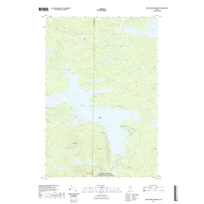
 - 2024 Map of Trout Brook Mountain, 2024 Print
 2024 Trout Brook Mountain2024 Print · USGSPenobscot and Piscataquis counties meet in this preserved Maine wilderness as it appeared in the early 2020s. Researchers can trace the rugged topography of Horse Mtn and the shoreline of Grand Lake Matagamon along old routes like the Park Tote Rd.
 - 2024 Map of Frost Pond, 2024 Print
 2024 Frost Pond2024 Print · USGSNorth Maine Woods geography comes alive in this Piscataquis County survey, detailing a landscape of isolated peaks and interconnected waterways. Researchers can trace historic access routes like Park Tote Rd and explore landmarks such as Grand Pitch and Wadleigh Mtn.
End of results
Showing maps 1-4 of 4
Frequently asked questions
- What are the different types of historical maps available for Trout Brook Township?
- What is the oldest map of Trout Brook Township?
- Where can I purchase historical maps of Trout Brook Township for my home or office?
- Where can I download high-res historical maps of Trout Brook Township?
- Are there historical topographic maps available for Trout Brook Township?
- Is there historical aerial imagery available for Trout Brook Township?
- Where are historical maps of Trout Brook Township sourced from?