Old Maps of Bowdoin, Maine for Hiking & Exploration
Hike through history with 49 historic maps of Bowdoin. Explore old trails, ghost towns, and forgotten backroads — perfect for outdoor adventurers and local explorers.
- Rediscover forgotten places: Map out old mining camps, roads, and footpaths that no longer exist on modern maps.
- Layer with modern tools: Combine with LiDAR or satellite views to plan hikes through historical terrain.
- Made for exploration: Popular among hikers, overlanders, and local history lovers.
Use these maps to find adventure and explore the hidden past of Bowdoin.
Bowdoin, ME maps
(49)- 1892 Map of Gardiner
 1892 Gardiner1892 Print · USGSThe Kennebec River valley in the 1890s was a bustling corridor of rail and river commerce. Genealogists and historians can trace old homesteads and landings from Gardiner down to Bowdoinham, including points like Ship Yard Pt and the grounds of the Richmond Campmeeting.7 unique versions available
 - 1894 Map of Bath
 1894 Bath1894 Print · USGSCoastal Maine at the height of the maritime era is captured in this survey of the river-linked communities of Bath and Brunswick. Genealogists and historians can trace the foundations of local shipping and rail at Winnegance, Parker Head, and along the M. C. R. R. lines.9 unique versions available
 - 1908 Map of Lewiston
 1908 Lewiston1908 Print · USGSAndroscoggin County at the start of the century shows a thriving industrial corridor centered on the twin cities and the river. Genealogists can trace family farms and local institutions near Sabattus Pond, Bates College, and Lisbon Falls.6 unique versions available
 - 1920 Map of Bath
 1920 Bath1920 Print · USGSCoastal Maine at the height of the rail era is captured here, showing the intricate tidal waters surrounding Bath and Brunswick. Genealogists and local historians can trace family locations near Nequasset Falls, Cundy Harbor, and the Quaker church.2 unique versions available
 - 1942 Map of Lewiston
 1942 Lewiston1942 Print · USGSLewiston and the Androscoggin River valley are shown in detail during the early 1940s, capturing the area's transition from industrial hubs to rural crossroads. Researchers can locate early schoolhouses like No Name Sch, the campus of Bates College, and vanished rail stops at Golder Siding and Leeds Junc.
 - 1943 Map of Gardiner
 1943 Gardiner1943 Print · USGSThe Kennebec River valley in the early 1940s reveals a landscape of riverside industry and inland farming communities. Researchers can trace ancestral roots through dozens of local schoolhouses like J F Stevens Sch and family crossroads such as Spears Cor or Starbird Cor.4 unique versions available
 - 1945 Map of Bath
 1945 Bath1945 Print · USGSThe mid-coast Maine shoreline and Kennebec River shipping corridor are preserved here just as the war was ending. Genealogists and historians can trace the locations of family burial grounds like Winnegance Cem, rural schoolhouses like Littlefield Sch, and the industrial footprint of the Dana Mill.2 unique versions available
 - 1948 Map of Bangor
 1948 Bangor1948 Print · USGSThe Maine coast and its industrial river valleys are captured here shortly after the war, showing the vital shipping and rail hubs of the late 1940s. Genealogists and historians can trace the tracks of the Maine Central RR connecting Bangor, Augusta, and Old Town.
 - 1948 Map of Bath
 1948 Bath1948 Print · USGSMid-coast Maine’s intricate shoreline and island outposts are captured here just after the war. Researchers can trace historic maritime settlements from Bath to Friendship and locate remote landmarks like Monhegan Island and Pemaquid Point.2 unique versions available
 - 1950 Map of Lewiston
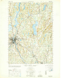 1950 Lewiston1950 Print · USGSAndroscoggin County at mid-century shows a landscape of busy industrial centers and quiet crossroad hamlets connected by the river. Genealogists can trace family names at Jordan Corners or Blake Corners and locate rural landmarks like Sprague Mill and Ridge Sch.
 - 1950 Map of Lewiston
 1950 Lewiston1950 Print · USGSThe Maine and New Hampshire borderlands come alive in this post-war survey of the White Mountains and Androscoggin valley. Genealogists and historians can trace rail lines like the Maine Central Railroad and find high-altitude landmarks from Mount Washington to Bretton Woods.2 unique versions available
 - 1956 Map of Lewiston, 1958 Print
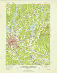 1956 Lewiston1958 Print · USGSThe industrial twin cities of Lewiston and Auburn thrive along the Androscoggin River during the mid-fifties. Genealogists and historians can trace the legacy of Bates College, the busy Maine Central Railroad corridors, and dozens of rural burying grounds like St Peters Cem.4 unique versions available
 - 1956 Map of Bangor, 1966 Print
 1956 Bangor1966 Print · USGSMid-century Maine comes alive in this survey of the rugged coast and river valleys during the 1950s. Genealogists and historians can trace the vital rail corridors of the Maine Central RR connecting timber towns like Old Town to the coast at Bar Harbor.3 unique versions available
 - 1956 Map of Bath, 1974 Print
 1956 Bath1974 Print · USGSCoastal Maine in the mid-fifties reveals a landscape of deep-water harbors and island outposts as the region transitioned from industrial roots to a summer destination. Genealogists can trace maritime families in Boothbay Harbor, Tenants Harbor, and on remote Monhegan Island.
 - 1956 Map of Lewiston, 1975 Print
 1956 Lewiston1975 Print · USGSThe Northern New England interior is documented here in the mid-fifties, from the industrial Androscoggin River to the high peaks of the White Mountains. Trace the Grand Trunk Railway through mountain passes or locate family landmarks near Sabbathday Lake and Bretton Woods.
 - 1957 Map of Bath
 1957 Bath1957 Print · USGSThe Maine coast in the mid-fifties is captured here, from the shipbuilding hubs of Bath and Brunswick to the granite reaches of Rockland. Researchers can trace the Maine Central RR line and remote island outposts like Monhegan Island and Matinicus Isle.
 - 1957 Map of Gardiner, 1959 Print
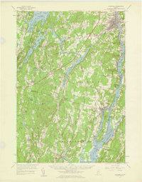 1957 Gardiner1959 Print · USGSThe Kennebec River valley in the late fifties shows a landscape of riverfront industry and rural crossroads. Genealogists and historians can trace family-named sites like Batchelders Crossing or Litchfield Academy and explore the complex waters of Swan Island.3 unique versions available
 - 1957 Map of Bath, 1960 Print
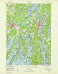 1957 Bath1960 Print · USGSThe mid-coast of Maine is captured here during a period of military and industrial growth along the Kennebec River. Genealogists and historians can trace the foundations of Bath and Brunswick, identifying family plots like Maple Grove Cem and the historic Bowdoin College campus.4 unique versions available
 - 1958 Map of Bath
 1958 Bath1958 Print · USGSCoastal Maine in the late fifties reveals a landscape of industrial river towns and remote island outposts. Genealogists and historians can trace the Maine Central RR through Bath, explore the islands of Muscongus Bay, or locate seafaring families at Pemaquid Point.
 - 1960 Map of Bangor
 1960 Bangor1960 Print · USGSCentral Maine in the sixties reveals a landscape of river-powered industry and sprawling coastal island chains. Researchers can trace the rail corridors of the Maine Central or locate mid-century aviation landmarks like Dow Air Force Base.
 - 1961 Map of Bangor
 1961 Bangor1961 Print · USGSMid-century Maine comes alive through its busy river ports and rocky archipelagoes during a period of steady maritime and rail commerce. Researchers can trace the path of the Maine Central railroad and locate coastal landmarks from Acadia National Park to Vinalhaven Island.
 - 1961 Map of Lewiston
 1961 Lewiston1961 Print · USGSWestern Maine and the White Mountains appear here during the early sixties, showing the industrial river towns and vast timberlands before the modern interstate era. Genealogists and historians can trace the Grand Trunk RR through Berlin or locate landmarks like Old Speck Mountain and Elephant Mountain.
 - 1962 Map of Lewiston
 1962 Lewiston1962 Print · USGSThe industrial river valleys and high peaks of Maine and New Hampshire define the region in the early sixties. Trace the rail-and-river network from Lewiston to the White Mountains, passing through mill towns like Berlin and Rumford.
 - 1963 Map of Bath
 1963 Bath1963 Print · USGSThe Maine Midcoast in the early sixties remains a world of tidal rivers and jagged peninsulas tied to the sea. Genealogy and local history researchers can trace the rail lines of the Maine Central RR and locate offshore communities like Matinicus Island and Monhegan.2 unique versions available
 - 1965 Map of Bath
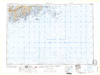 1965 Bath1965 Print · USGSThe Midcoast Maine shoreline and its archipelago come alive in the mid-1960s, showing the region's deep reliance on river and rail. Researchers can trace historic harbor towns like Boothbay Harbor and Damariscotta, and locate coastal landmarks from Pemaquid Point to the Fort Popham Military Res.
Showing maps 1-25 of 49
Top cities near Bowdoin
- Lewiston historical maps
- Auburn historical maps
- Brunswick historical maps
- Augusta historical maps
- Lisbon historical maps
- Yarmouth historical maps
See more
Top neighborhoods of Bowdoin
- Bowdoin Center historical maps
- West Bowdoin historical maps
- Starbird Corner historical maps
- Varney Corner historical maps
Frequently asked questions
- What are the different types of historical maps available for Bowdoin?
- What is the oldest map of Bowdoin?
- Where can I purchase historical maps of Bowdoin for my home or office?
- Where can I download high-res historical maps of Bowdoin?
- Are there historical topographic maps available for Bowdoin?
- Is there historical aerial imagery available for Bowdoin?
- Where are historical maps of Bowdoin sourced from?