Old Maps of Pleasant Ridge Plantation, Maine for Metal Detecting
Plan your next treasure hunt with 47 historic maps of Pleasant Ridge Plantation. Find old homesites, ghost towns, trails, and gathering spots that may be lost to time — perfect for identifying promising metal detecting locations.
- Locate forgotten sites: Uncover places like long-lost settlements, abandoned rail lines, or gathering spots.
- Plan better hunts: Use map overlays combined with LiDAR or satellite views to narrow in on historically rich areas.
- Made for detectorists: Thousands of hobbyists use these maps to discover relics, coins, and hidden history.
Use these historic maps to boost your research and find new opportunities beneath the surface of Pleasant Ridge Plantation.
Pleasant Ridge Plantation, ME maps
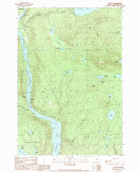
(47)- 1903 Map of Bingham, 1957 Print
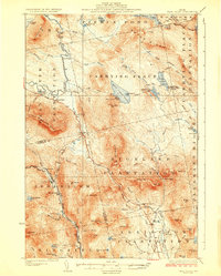
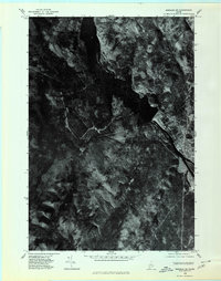
 1903 Bingham1957 Print · USGSSomerset County’s river valleys and timberlands are captured here at the turn of the century, centered on the growing village of Bingham. Genealogists and historians can trace early settlements and wilderness landmarks from Caratunk to the shores of Pleasant Pond and Austin Stream.
 - 1905 Map of Bingham
 1905 Bingham1905 Print · USGSSomerset County's river-driven economy and rugged highlands are captured here in the early 1900s. Researchers can trace the Carrying Place portage route and locate early homesteads near Bingham, Merrill Pond, and Pierce Hill.5 unique versions available
 - 1928 Map of Dead River
 1928 Dead River1928 Print · USGSThe Somerset County wilderness in the mid-twenties is captured here as a landscape of isolated plantations and mountain trails. Genealogists and historians can trace the remote Dead River School and family sites like Joe Farm or the East Carry (Carry Pond P O).6 unique versions available
 - 1931 Map of Dead River
 1931 Dead River1931 Print · USGSSomerset and Franklin counties in the mid-1920s show a landscape of remote plantations and traditional woodsman outposts. Genealogists and historians can trace localized landmarks like the Dead River School, the East Carry (Carry Pond PO) Pond, and Joe Farm.
 - 1944 Map of Dead River
 1944 Dead River1944 Print · USGSSomerset County plantations and the high timberlands are captured here in the mid-1940s before modern development altered the valley. Genealogists can locate isolated homesteads and rural schools like Joe Farm, the Dead River Sch, and the historic Arnolds Trail.
 - 1949 Map of Jackman
 1949 Jackman1949 Print · USGSThe Quebec and Maine borderlands are shown in great detail during the late 1940s, highlighting the industrial and natural geography of the region. Trace old rail lines like the Canadian Pacific and locate settlements from Sherbrooke to Scotstown.2 unique versions available
 - 1950 Map of Dead River
 1950 Dead River1950 Print · USGSSomerset and Franklin Counties are shown during a time of isolated farms and remote plantations in the mid-twentieth century. Researchers can locate early schoolhouses like Dead River Sch and trace the old postal route at Carry Pond PO.
 - 1954 Map of Millinocket, 1968 Print
 1954 Millinocket1968 Print · USGSMaine's North Woods and the Penobscot Valley are captured here during the mid-century era of logging and rail dominance. You can trace the path of the Bangor and Aroostook Railroad through timber towns like Millinocket, Mattawamkeag, and Silver Ridge.3 unique versions available
 - 1956 Map of Little Bigelow Mtn, 1959 Print
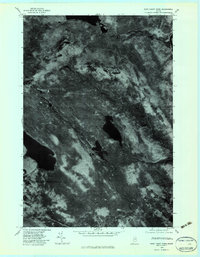
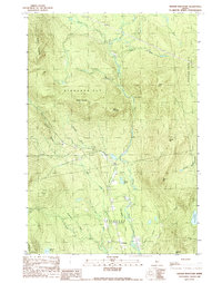
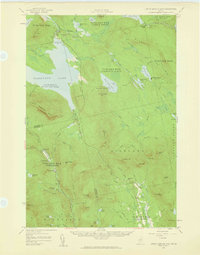 1956 Little Bigelow Mtn1959 Print · USGSSomerset and Franklin counties are shown here in the mid-fifties, just after the waters of the Dead River were impounded. Researchers can locate remote seasonal outposts like West Carry Camps, the Highland Sch, and the winding path of the Appalachian Trail.4 unique versions available
 - 1956 Map of Bingham, 1962 Print
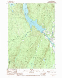
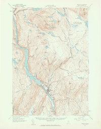 1956 Bingham1962 Print · USGSThe Kennebec River valley in the mid-1950s shows a landscape of hydropower and high-elevation ponds before significant modern development. Genealogists and historians can trace the footprint of Bingham and Moscow, locate the Longfellow Sch, and follow the Appalachian Trail past Pleasant Ridge.2 unique versions available
 - 1958 Map of Millinocket
 1958 Millinocket1958 Print · USGSMaine's North Woods and the Penobscot river valley are captured here in the mid-1950s, showing a landscape of timber, rail, and wild waters. Researchers can trace the legacy of the Canadian Pacific railroad and find historic settlements like Millinocket, Sherman Station, and Mattawamkeag.
 - 1960 Map of Millinocket
 1960 Millinocket1960 Print · USGSThe Maine North Woods and Penobscot River valley are captured at mid-century during the height of the paper milling era. Researchers can trace the Appalachian Trail near Mount Katardin or locate family roots in towns like Dover-Foxcroft and Milo.3 unique versions available
 - 1963 Map of Jackman
 1963 Jackman1963 Print · USGSThe international borderlands of Maine and Quebec come alive in the mid-twentieth century, showing a landscape of timber towns and rail connections. Genealogists and historians can trace the paths of the Canadian Pacific Railway through Jackman or locate families in Sherbrooke and Megantic.
 - 1966 Map of Sherbrooke
 1966 Sherbrooke1966 Print · USGSThe borderlands of Quebec and Maine come alive in the mid-1960s, documenting the industrial towns and deep woods of the Northeast. Genealogists can trace family lines through Sherbrooke and Coaticook, or locate remote logging outposts along the Moose River and Flagstaff Lake.
 - 1975 Map of Bingham NW, 1980 Print
 1975 Bingham NW1980 Print · USGSThe Maine woods and the upper Kennebec River are captured in high detail in the mid-1970s. Researchers can trace the terrain and water systems of Somerset County, from the depths of Pleasant Pond to the peaks of Moxie Mountain.
 - 1975 Map of Bingham SW, 1980 Print
 1975 Bingham SW1980 Print · USGSThe upper Kennebec River valley is captured here in the mid-1970s through high-resolution aerial imagery. Genealogists and researchers can trace the exact footprint of settlements in Bingham and Moscow or locate terrain features like Old Bluff Mountain.
 - 1976 Map of Sherbrooke
 1976 Sherbrooke1976 Print · USGSThe northern Maine woods and Quebec’s Eastern Townships meet in this mid-century survey of the rugged international borderlands. Genealogists and historians can trace rail-and-river connections through Thetford Mines, follow the Dead River to Flagstaff Lake, or locate small border crossings at Stanhope and Beecher Falls.2 unique versions available
 - 1979 Map of East Carry Pond, 1983 Print
 1979 East Carry Pond1983 Print · USGSThe Maine woods and the Kennebec River corridor are captured in the late seventies through this detailed orthophotoquad. Researchers can trace the historic portage route at Carrying Place or study the shorelines of East Carry Pond and West Carry Pond.
 - 1979 Map of Witham Mountain, 1983 Print
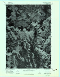 1979 Witham Mountain1983 Print · USGSThe Maine wilderness of the late seventies is captured here in sharp aerial detail, showing the timberlands around Witham Mountain. Researchers can trace the exact paths of Sandy Stream and Barker Brook through this unpopulated landscape.
 - 1986 Map of Flagstaff Lake
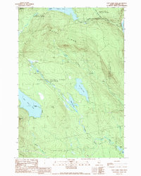
 1986 Flagstaff Lake1986 Print · USGSThe Maine North Woods and the Dead River valley are captured here in the mid-1980s, an era of established hydroelectric lakes and outdoor recreation. Genealogists and researchers can trace the vicinity of Kennebago Settlement, Langtown Mill, and the villages of Stratton and Eustis.
 - 1986 Map of Dover-Foxcroft
 1986 Dover-Foxcroft1986 Print · USGSPiscataquis County at the edge of the great Maine woods is documented here in the mid-1980s, centered on the river-and-rail hubs of the interior. Trace the industrial footprints of Dover South Mills, the rail yards at Brownville Junction, or the historic Katahdin Iron Works.
 - 1989 Map of East Carry Pond
 1989 East Carry Pond1989 Print · USGSSomerset County's interior wilderness is captured here in the late 1980s, centered on the ancient portage routes of the Carry Ponds. Hikers and historians can trace the Appalachian National Scenic Trail past Arnolds Point and the remote shores of Pierce Pond.
 - 1989 Map of Caratunk
 1989 Caratunk1989 Print · USGSThe Kennebec River valley and the village of Caratunk are seen here in the late 1980s as the river widens into Wyman Lake. Outdoorsmen and local historians can trace the Appalachian Trail, find the local Cem, and locate the Historic Site along the water.
 - 1989 Map of Bingham
 1989 Bingham1989 Print · USGSThe Kennebec River valley in the late eighties is defined by the massive Wyman Dam and the waters of Wyman Lake. Genealogists and local historians can trace the town layouts of Bingham and Moscow or locate the upland Cem near the banks of Austin Stream.
 - 1989 Map of Witham Mtn
 1989 Witham Mtn1989 Print · USGSSomerset County’s interior landscape is documented here during the late eighties, featuring the plantations and townships of the western Maine woods. Local historians can trace the foundations of Lexington, find a rural Schoolhouse, and locate isolated waters like Butler Pond.
Showing maps 1-25 of 47
Top cities near Pleasant Ridge Plantation
- Madison historical maps
- Anson historical maps
- Cornville historical maps
- Solon historical maps
- Kingfield historical maps
- Athens historical maps
See more
Frequently asked questions
- What are the different types of historical maps available for Pleasant Ridge Plantation?
- What is the oldest map of Pleasant Ridge Plantation?
- Where can I purchase historical maps of Pleasant Ridge Plantation for my home or office?
- Where can I download high-res historical maps of Pleasant Ridge Plantation?
- Are there historical topographic maps available for Pleasant Ridge Plantation?
- Is there historical aerial imagery available for Pleasant Ridge Plantation?
- Where are historical maps of Pleasant Ridge Plantation sourced from?