1940s Maps of Centerville Township, Maine
Explore 6 historic maps of Centerville Township from the 1940s. These maps offer a rare glimpse into what life looked like during the 1940s — showing old roads, neighborhoods, homes, and landmarks that have changed or disappeared over time.
Whether you're researching your family's past, planning a metal detecting trip, or studying how Centerville Township's landscape evolved across the 1940s, these high-resolution maps are a powerful tool for exploring the history of this region.
- Focus on a specific era: All maps on this page are from the 1940s, giving you a focused view of this time period.
- See what’s changed: Compare century-old streets, trails, and buildings to today's modern landscape using overlays and satellite layers.
- Research with precision: Use these maps for genealogy, historical research, land use analysis, or educational projects.
- View, download, or print: Maps are fully viewable online in high resolution, and can be downloaded or printed for your own records.
Start exploring Centerville Township's history through authentic maps from the 1940s. This is your window into the past.
Centerville Township, ME maps
(6)- 1941 Map of Columbia Falls, 1955 Print
 1941 Columbia Falls1955 Print · USGSThe Washington County coast was a bustling network of river-mouth towns and island villages during the early 1940s. Genealogists can locate family landmarks from Whitneyville to Jonesport, including local institutions like Flyingplace Sch and Cape Split Sch.3 unique versions available
 - 1941 Map of Wesley, 1956 Print
 1941 Wesley1956 Print · USGSWashington County’s interior woods and riverways appear here as they were surveyed just before the war. You can trace the path of the Air Line road and locate landmarks like the Lower Wesley Sch, Joe Hanscom Heath, and Smith Landing.3 unique versions available
 - 1942 Map of Columbia Falls
 1942 Columbia Falls1942 Print · USGSCoastal Washington County appears just before the mid-century as a network of fishing villages and rail stops. Genealogists can trace family landmarks and schools like Tibbettsown, Peasley Corners, and the Lower Eastside Sch along the Indian River.
 - 1943 Map of Wesley
 1943 Wesley1943 Print · USGSWashington County during the early 1940s was defined by its timberlands and the winding Machias River. Genealogists and local historians can trace family locations and rural landmarks like Mattimo Place, the Northfield Sch, and the hilltop Firetower.2 unique versions available
 - 1948 Map of Columbia Falls, 1968 Print
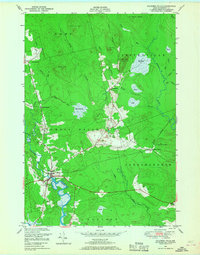 1948 Columbia Falls1968 Print · USGSCoastal Maine in the late 1940s is defined by its winding rivers and the rail economy of the Maine Central line. Genealogists and historians can trace the foundations of Columbia Falls, find the remote Jonesboro Station, or locate family landmarks like Patten Hill and Staple Ridge.2 unique versions available
 - 1948 Map of Whitneyville, 1971 Print
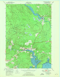 1948 Whitneyville1971 Print · USGSCoastal Washington County comes alive in the late 1940s, showing a landscape defined by tidal rivers and glacial ridges. Genealogists and local historians can locate the White School, trace the banks of the Machias River, and explore named landmarks like Kilton Mtn.3 unique versions available
End of results
Showing maps 1-6 of 6
Top cities near Centerville Township
- Machias historical maps
- Milbridge historical maps
- East Machias historical maps
- Jonesport historical maps
- Addison historical maps
- Machiasport historical maps
See more
Frequently asked questions
- What are the different types of historical maps available for Centerville Township?
- What is the oldest map of Centerville Township?
- Where can I purchase historical maps of Centerville Township for my home or office?
- Where can I download high-res historical maps of Centerville Township?
- Are there historical topographic maps available for Centerville Township?
- Is there historical aerial imagery available for Centerville Township?
- Where are historical maps of Centerville Township sourced from?