Old Maps of T26 ED BPP, Maine
Explore 24 old maps of T26 ED BPP, spanning from 1941 to today. These high-resolution historic maps reveal how streets, neighborhoods, landmarks, and natural features evolved over time — perfect for genealogy, metal detecting, research, and local history exploration.
What you can do with these maps:
- See how T26 ED BPP changed over time: Compare historical maps to modern-day views to trace roads, homesites, rail lines & more.
- View detailed metadata: Each map includes creators, publishers, year, scale, and archive source.
- Overlay maps with satellite & LiDAR: Visualize the past alongside modern tools to explore terrain & human change.
- Trusted historical sources: Maps sourced from the USGS, Library of Congress, and other archives.
- Access maps your way: View online, download high-res files, or order prints for personal or research use.
Start exploring old maps of T26 ED BPP to uncover forgotten places, hidden landmarks, and the deep history beneath your feet.
T26 ED BPP, ME maps
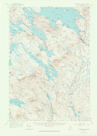
(24)- 1941 Map of Wesley, 1956 Print
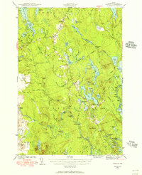 1941 Wesley1956 Print · USGSCovers T26 ED BPP, including East Machias, Marshfield, and other nearby areas3 unique versions available
 - 1941 Map of Big Lake, 1960 Print
 1941 Big Lake1960 Print · USGSCovers T26 ED BPP, including Baileyville, Princeton, and other nearby areas
 - 1941 Map of Wabassus Lake, 1962 Print
 1941 Wabassus Lake1962 Print · USGSCovers T26 ED BPP, including Grand Lake Stream, T37 MD BPP, and other nearby areas
 - 1943 Map of Big Lake
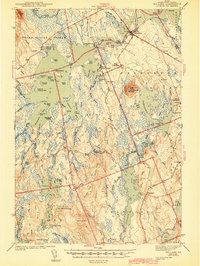 1943 Big Lake1943 Print · USGSCovers T26 ED BPP, including Baileyville, Princeton, and other nearby areas4 unique versions available
 - 1943 Map of Wesley
 1943 Wesley1943 Print · USGSCovers T26 ED BPP, including East Machias, Marshfield, and other nearby areas2 unique versions available
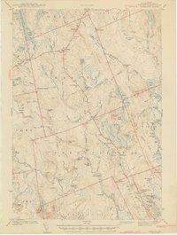
 - 1943 Map of Wabassus Lake
 1943 Wabassus Lake1943 Print · USGSCovers T26 ED BPP, including Grand Lake Stream, T37 MD BPP, and other nearby areas3 unique versions available
 - 1952 Map of Big Lake
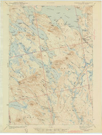
 1952 Big Lake1952 Print · USGSCovers T26 ED BPP, including Baileyville, Princeton, and other nearby areas
 - 1953 Map of Wabassus Lake, 1984 Print
 1953 Wabassus Lake1984 Print · USGSCovers T26 ED BPP, including Grand Lake Stream, T37 MD BPP, and other nearby areas
 - 1957 Map of Fredericton, 1981 Print
 1957 Fredericton1981 Print · USGSCovers T26 ED BPP, including Saint John, Fredericton, and other nearby areas
 - 1961 Map of Eastport
 1961 Eastport1961 Print · USGSCovers T26 ED BPP, including Machias, Gouldsboro, and other nearby areas
 - 1963 Map of Fredericton
 1963 Fredericton1963 Print · USGSCovers T26 ED BPP, including Saint John, Fredericton, and other nearby areas
 - 1963 Map of Big Lake, 1966 Print
 1963 Big Lake1966 Print · USGSCovers T26 ED BPP, including Baileyville, Princeton, and other nearby areas4 unique versions available
 - 1963 Map of Wabassus Lake, 1966 Print
 1963 Wabassus Lake1966 Print · USGSCovers T26 ED BPP, including Grand Lake Stream, T37 MD BPP, and other nearby areas2 unique versions available
 - 1969 Map of Eastport
 1969 Eastport1969 Print · USGSCovers T26 ED BPP, including Machias, Gouldsboro, and other nearby areas
 - 1975 Map of Wabassus Lake SE, 1980 Print
 1975 Wabassus Lake SE1980 Print · USGSCovers T26 ED BPP, including T37 MD BPP, T43 MD BPP, and other nearby areas
 - 1976 Map of Eastport
 1976 Eastport1976 Print · USGSCovers T26 ED BPP, including Machias, Gouldsboro, and other nearby areas
 - 1985 Map of Machias, 1986 Print
 1985 Machias1986 Print · USGSCovers T26 ED BPP, including Machias, Gouldsboro, and other nearby areas
 - 1986 Map of Calais
 1986 Calais1986 Print · USGSCovers T26 ED BPP, including Saint Stephen, Calais, and other nearby areas
 - 1990 Map of Round Lake
 1990 Round Lake1990 Print · USGSCovers T26 ED BPP, including Northfield, Wesley, and other nearby areas
 - 1990 Map of Clifford Lake
 1990 Clifford Lake1990 Print · USGSCovers T26 ED BPP, including Crawford, T37 MD BPP, and other nearby areas
 - 1990 Map of Wesley
 1990 Wesley1990 Print · USGSCovers T26 ED BPP, including Wesley, Crawford, and other nearby areas
 - 1990 Map of Monroe Lake
 1990 Monroe Lake1990 Print · USGSCovers T26 ED BPP, including T37 MD BPP, T43 MD BPP, and other nearby areas
 - 1994 Map of Calais
 1994 Calais1994 Print · USGSCovers T26 ED BPP, including Saint Stephen, Calais, and other nearby areas
 - 1994 Map of Machias
 1994 Machias1994 Print · USGSCovers T26 ED BPP, including Machias, Gouldsboro, and other nearby areas
End of results
Showing maps 1-24 of 24
Top cities near T26 ED BPP
- East Machias historical maps
- Baileyville historical maps
- Princeton historical maps
- Indian Township / Motahkomikuk historical maps
- Marshfield historical maps
- Alexander historical maps
See more
Frequently asked questions
- What are the different types of historical maps available for T26 ED BPP?
- What is the oldest map of T26 ED BPP?
- Where can I purchase historical maps of T26 ED BPP for my home or office?
- Where can I download high-res historical maps of T26 ED BPP?
- Are there historical topographic maps available for T26 ED BPP?
- Is there historical aerial imagery available for T26 ED BPP?
- Where are historical maps of T26 ED BPP sourced from?