Old Maps of T30 MD BPP, Maine for Metal Detecting
Plan your next treasure hunt with 25 historic maps of T30 MD BPP. Find old homesites, ghost towns, trails, and gathering spots that may be lost to time — perfect for identifying promising metal detecting locations.
- Locate forgotten sites: Uncover places like long-lost settlements, abandoned rail lines, or gathering spots.
- Plan better hunts: Use map overlays combined with LiDAR or satellite views to narrow in on historically rich areas.
- Made for detectorists: Thousands of hobbyists use these maps to discover relics, coins, and hidden history.
Use these historic maps to boost your research and find new opportunities beneath the surface of T30 MD BPP.
T30 MD BPP, ME maps
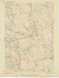
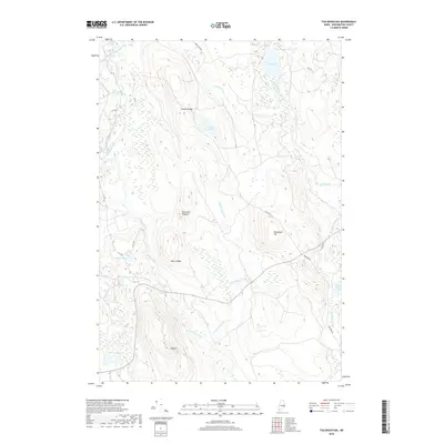
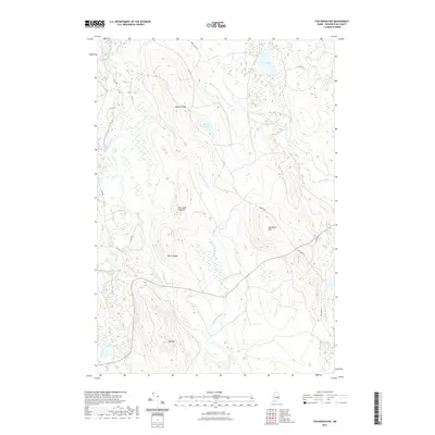
(25)- 1941 Map of Tug Mountain, 1958 Print
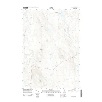
 1941 Tug Mountain1958 Print · USGSWashington County during the early 1940s was a landscape of timber and remote sporting camps. You can trace early backcountry retreats like Worcester Lodge and Hartford Camp or follow the route of the historic Air Line Road past Tug Mountain.2 unique versions available
 - 1943 Map of Tug Mountain
 1943 Tug Mountain1943 Print · USGSThe Maine woods in the early 1940s reveal a network of logging dams and remote seasonal camps. Genealogists and historians can trace family-named sites like Worcester Lodge, Hartford Camp, and Ben Tucker Mtn along the Machias River.2 unique versions available
 - 1961 Map of Eastport
 1961 Eastport1961 Print · USGSThe maritime borderlands of Maine and New Brunswick are captured here in the early sixties, showing a world defined by the Bay of Fundy. Researchers can trace the Maine Central Railroad to Machiasport or explore remote island villages like Grand Harbour and Welchpool.
 - 1969 Map of Eastport
 1969 Eastport1969 Print · USGSThe maritime borderlands of Washington County and New Brunswick appear in detail during the late sixties. Researchers can trace historic rail lines like the Maine Central Railroad and explore coastal settlements from Machias to St. Andrews.
 - 1976 Map of Eastport
 1976 Eastport1976 Print · USGSThe maritime borderlands of Maine and Nova Scotia come alive in this mid-seventies survey of the Downeast coast. Genealogists and historians can trace the shoreline settlements of Eastport, Lubec, and Machias, or cross the channel to find Acadian villages like Church Point and Meteghan Centre.
 - 1985 Map of Machias, 1986 Print
 1985 Machias1986 Print · USGSThe Downeast coast of Maine in the 1980s reveals a landscape of deep-water bays, tidal rivers, and isolated timberlands. Researchers can trace the Maine Central rail line and locate coastal landmarks from Leighton Point to the U.S. Naval Radio Station.
 - 1990 Map of Northeast Bluff
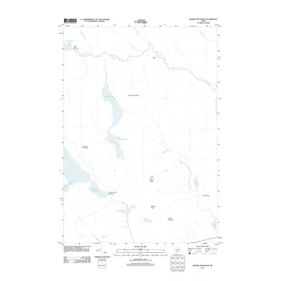
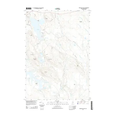
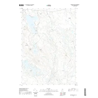
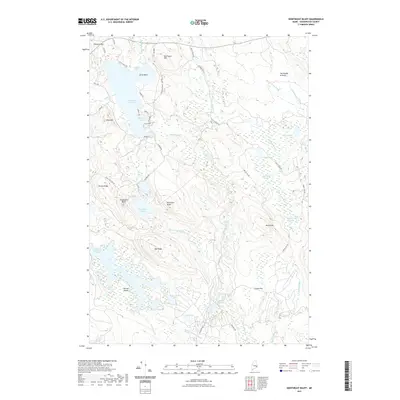
 1990 Northeast Bluff1990 Print · USGSEastern Maine's interior reaches are documented here during the late twentieth century, showing a remote landscape of the Bingham Purchase. Researchers can trace the drainages of the Pleasant River and locate landmarks like Dorman Island, Northeast Bluff, and Spruce Ridge.
 - 1990 Map of Tug Mountain
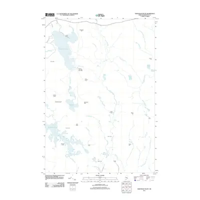
 1990 Tug Mountain1990 Print · USGSWashington County’s interior timberlands were largely unorganized territory in the late twentieth century. You can trace the hydrology of the Machias River while locating landmarks like Canaan Dam, Tug Mountain, and Kerosene Pond.
 - 1990 Map of Peaked Mountain
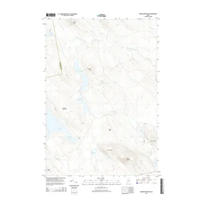
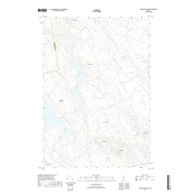
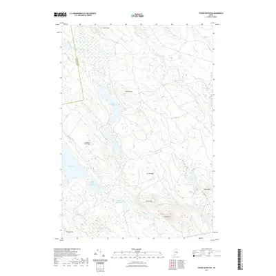
 1990 Peaked Mountain1990 Print · USGSThe Maine North Woods in the early nineties reveal a landscape of vast water networks and timber ridges across Washington and Hancock counties. Researchers can trace the drainage of Lower Cranberry Lake and locate landforms like Peaked Mountain and Tibbetts Ridge.
 - 1994 Map of Machias
 1994 Machias1994 Print · USGSThe Downeast coast of Maine in the 1990s is captured here, from the Narraguagus River to the Canadian border. Genealogists and historians can trace coastal settlements like Jonesboro and Addison or locate the U.S. Naval Radio Station and Moosehorn National Wildlife Refuge.
 - 2011 Map of Peaked Mountain, 2011 Print
 2011 Peaked Mountain2011 Print · USGSCovers T30 MD BPP, including T36 MD BPP, Devereaux Township, and other nearby areas
 - 2011 Map of Northeast Bluff, 2011 Print
 2011 Northeast Bluff2011 Print · USGSCovers T30 MD BPP, including Deblois, Beddington, and other nearby areas
 - 2011 Map of Tug Mountain, 2011 Print
 2011 Tug Mountain2011 Print · USGSCovers T30 MD BPP, including T36 MD BPP, Day Block Township, and other nearby areas
 - 2014 Map of Northeast Bluff, 2014 Print
 2014 Northeast Bluff2014 Print · USGSCovers T30 MD BPP, including Deblois, Beddington, and other nearby areas
 - 2014 Map of Tug Mountain, 2014 Print
 2014 Tug Mountain2014 Print · USGSCovers T30 MD BPP, including T36 MD BPP, Day Block Township, and other nearby areas
 - 2014 Map of Peaked Mountain, 2014 Print
 2014 Peaked Mountain2014 Print · USGSCovers T30 MD BPP, including T36 MD BPP, Devereaux Township, and other nearby areas
 - 2018 Map of Northeast Bluff, 2018 Print
 2018 Northeast Bluff2018 Print · USGSCovers T30 MD BPP, including Deblois, Beddington, and other nearby areas
 - 2018 Map of Tug Mountain, 2018 Print
 2018 Tug Mountain2018 Print · USGSCovers T30 MD BPP, including T36 MD BPP, Day Block Township, and other nearby areas
 - 2018 Map of Peaked Mountain, 2018 Print
 2018 Peaked Mountain2018 Print · USGSCovers T30 MD BPP, including T36 MD BPP, Devereaux Township, and other nearby areas
 - 2021 Map of Peaked Mountain, 2021 Print
 2021 Peaked Mountain2021 Print · USGSCovers T30 MD BPP, including T36 MD BPP, Devereaux Township, and other nearby areas
 - 2021 Map of Northeast Bluff, 2021 Print
 2021 Northeast Bluff2021 Print · USGSCovers T30 MD BPP, including Deblois, Beddington, and other nearby areas
 - 2021 Map of Tug Mountain, 2021 Print
 2021 Tug Mountain2021 Print · USGSCovers T30 MD BPP, including T36 MD BPP, Day Block Township, and other nearby areas
 - 2024 Map of Tug Mountain, 2024 Print
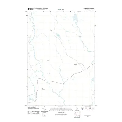
 2024 Tug Mountain2024 Print · USGSMaine's eastern woods are revealed in this modern survey of the interior Machias River watershed. Genealogists and historians can trace the naming of local landmarks like Tug Mtn, Porcupine Pinnacle, and the historic CCC RD corridor.
 - 2024 Map of Peaked Mountain, 2024 Print
 2024 Peaked Mountain2024 Print · USGSWashington County's backcountry is captured here in the early twenty-first century, showing a landscape shaped by glacial lakes and ridges. Trace the network of timber roads past Mopang Lake, Peaked Mtn, and the headwaters of the West Branch Machias River.
 - 2024 Map of Northeast Bluff, 2024 Print
 2024 Northeast Bluff2024 Print · USGSWashington County, Maine, is documented here in a modern era of forest management and intricate waterways. Trace the network of timber access roads and remote water bodies like Southwest Pond, Otter Pond, and the wide reaches of Pleasant River Lake.
End of results
Showing maps 1-25 of 25
Top cities near T30 MD BPP
- Cherryfield historical maps
- Columbia Falls historical maps
- Columbia historical maps
- Northfield historical maps
- Wesley historical maps
- Deblois historical maps
See more
Frequently asked questions
- What are the different types of historical maps available for T30 MD BPP?
- What is the oldest map of T30 MD BPP?
- Where can I purchase historical maps of T30 MD BPP for my home or office?
- Where can I download high-res historical maps of T30 MD BPP?
- Are there historical topographic maps available for T30 MD BPP?
- Is there historical aerial imagery available for T30 MD BPP?
- Where are historical maps of T30 MD BPP sourced from?