Old Maps of Saco, Maine for Genealogy
Trace your family roots with 74 historic maps of Saco. These high-res maps reveal old neighborhoods, homesites, landmarks, and streets — helping you uncover where your ancestors lived and how the area evolved over time.
- Explore historic neighborhoods: Identify where your relatives may have lived in the 1800s or 1900s.
- Compare maps over time: Trace the changes in streets, buildings, and landmarks for multi-generational research.
- Perfect for genealogy & ancestry research: Used by family historians and researchers to map out lineage and migration.
These maps are an incredible resource for exploring your personal connection to Saco's past.
Saco, ME maps
(74)- 1891 Map of Portland
 1891 Portland1891 Print · USGSCoastal Maine at the height of its rail-and-milling era shows the rapid development of the Portland suburbs and industrial waterfront. Genealogists can trace early homesteads and rail stops like Cape Elizabeth Depot, Saccarappa, and Prout's Neck.
 - 1891 Map of Biddeford
 1891 Biddeford1891 Print · USGSCoastal Maine in the 1890s is defined by the vital rail corridors and working harbors of York County. Researchers can trace the early industrial development of Biddeford, locate family landmarks near Oak Ridge, and explore the maritime layout of Kennebunkport and its lighthouses.
 - 1891 Map of Kennebunk
 1891 Kennebunk1891 Print · USGSCoastal York County comes alive in the late Victorian era as the railroad network expands through the marshes and timberlands. Researchers can trace the dual tracks of the Boston and Maine Railroad and locate vanished stops like Wells Depot or the early industry at Littlefield's Mills.
 - 1891 Map of Buxton
 1891 Buxton1891 Print · USGSThe Saco River valley at the end of the nineteenth century is captured here in detail, showcasing a network of mill villages and early rail lines. Researchers can trace the path of the Portland and Rochester Railroad and locate historic sites like Shaker Village, Salmon Falls, and Nasons Mills.
 - 1892 Map of Buxton, 1913 Print
 1892 Buxton1913 Print · USGSSouthern Maine's mill towns and river valleys are captured here in the late nineteenth century as the industrial economy thrived along the Saco River. Genealogists and historians can trace the early layouts of Shaker Village, Nasons Mills, and Salmon Falls before modern development changed these rural landscapes.4 unique versions available
 - 1893 Map of Kennebunk
 1893 Kennebunk1893 Print · USGSThe coastal and inland reaches of York County are documented here in the final decade of the nineteenth century, showing a landscape defined by river power and rail. Genealogists and historians can trace the early layouts of Littlefield's Mills, the bustling Kennebunk Landing, and the tracks of the Boston and Maine Railroad.
 - 1893 Map of Biddeford
 1893 Biddeford1893 Print · USGSCoastal Maine during the late Victorian era is captured here at the height of its rail-and-sea economy. Genealogists and local historians can trace the early footprints of Biddeford, the busy docks of Cape Porpoise, and maritime landmarks like Wood Island Light.7 unique versions available
 - 1893 Map of Portland
 1893 Portland1893 Print · USGSCumberland County at the close of the nineteenth century centers on the bustling rail hub of Portland and its surrounding mill towns. Researchers can trace the Victorian-era development of Saccarappa, the seaside sprawl of Old Orchard, and the river industry at Cumberland Mills.6 unique versions available
 - 1893 Map of Buxton
 1893 Buxton1893 Print · USGSThe York County interior flourished in the late nineteenth century as a hub of river-powered industry and rail transport. Genealogists and historians can trace family-named sites and vanished mill hamlets like Shaker Village, Nasons Mills, and Salmon Falls.3 unique versions available
 - 1898 Map of Kennebunk
 1898 Kennebunk1898 Print · USGSThe York County coastline and inland mill towns thrive in the late nineteenth century as the railroad era reaches its peak. Genealogists and historians can trace old homesteads and depots near Littlefields Mills, Kennebunk Landing, and the seaside reaches of Ogunquit.6 unique versions available
 - 1914 Map of Portland
 1914 Portland1914 Print · USGSCoastal Maine at the start of the twentieth century shows a landscape tied together by industrial rivers and an expanding network of electric railroads. Genealogists can locate family names at Hillside Cemetery or trace old rural schoolhouses like the Babb School and Beech Ridge School.
 - 1916 Map of Portland
 1916 Portland1916 Print · USGSGreater Portland and the Cumberland County coast are documented here during the height of the trolley and rail era. Researchers can trace ancestral property near the Evergreen Cemetery, early industries at Cumberland Mills, and vanished local sites like the State Reform School.7 unique versions available
 - 1916 Map of Portland And Vicinity
 1916 Portland And Vicinity1916 Print · USGSCoastal Maine at the start of the Great War reveals a landscape of heavy coastal fortifications and bustling rail terminals. Trace old neighborhood boundaries and family landmarks like Milliken Mills, Hillside Cemetery, and the Portland Head lighthouse.
 - 1918 Map of Portland And Vicinity, 1926 Print
 1918 Portland And Vicinity1926 Print · USGSCoastal Maine at the height of the Great War reveals a landscape of harbor forts, railroad junctions, and seaside settlements. Genealogists and historians can trace family roots through labels for Evergreen Cemetery, Spurwink Church, and dozens of rural schoolhouses like Babb School.
 - 1941 Map of Portland
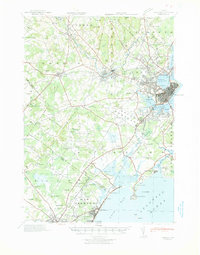 1941 Portland1941 Print · USGSCoastal Maine at the start of the 1940s reveals a bustling corridor of river mills and seaside settlements. Genealogists and historians can trace family roots through numerous local schools and landmarks like Cumberland Mills, Spurwink Ch, and Prouts Neck.
 - 1941 Map of Biddeford, 1952 Print
 1941 Biddeford1952 Print · USGSThe York County coastline during the early years of the war reveals a landscape of tidal harbors and rural school districts. Genealogists and historians can locate family plots at Laurel Hill Cem or trace old routes like Guinea Road past the Nott Sch.2 unique versions available
 - 1941 Map of Kennebunk, 1952 Print
 1941 Kennebunk1952 Print · USGSCoastal Maine in the early 1940s reveals a landscape of industrial mill sites and growing seaside resorts connected by the nascent Maine Turnpike. Genealogists can trace family roots through numerous numbered schoolhouses and landmarks like Merriland Ch and Evergreen Cem.2 unique versions available
 - 1942 Map of Buxton, 1958 Print
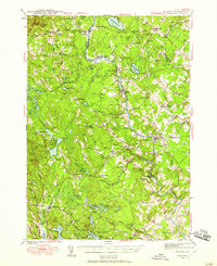 1942 Buxton1958 Print · USGSIn the early 1940s, the river valleys of southern Maine were defined by a tight-knit network of mill towns and rail corridors. Trace family roots and local industry through features like Salmon Falls, Shaw Mills, and the Chadbourne Cem.3 unique versions available
 - 1944 Map of Buxton
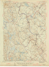 1944 Buxton1944 Print · USGSThe Saco River valley during the mid-forties reveals a landscape of mill towns and interconnected rural hamlets. Genealogists and local historians can trace the foundations of Bar Mills, locate the Chadbourne Cem, or follow the path of the Boston and Maine railroad.3 unique versions available
 - 1944 Map of Prouts Neck
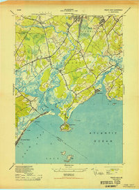 1944 Prouts Neck1944 Print · USGSCumberland County's coastline at the peak of the Second World War reveals a blend of seaside resorts and strategic military defense. Genealogists and historians can locate legacy sites like the Buggy Meetinghouse, the Observation Post at Prouts Neck, and the rail stops at West Scarboro Sta.
 - 1944 Map of Biddeford
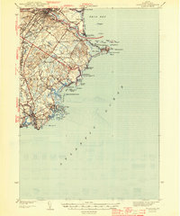 1944 Biddeford1944 Print · USGSCoastal York County at the start of the 1940s reveals a blend of textile-mill industry, storied summer resorts, and rugged maritime life. Researchers can trace the old schoolhouse network including Nell Sch, the grounds of St Francis College, and the waterfront at Cape Porpoise.2 unique versions available
 - 1944 Map of Old Orchard Beach
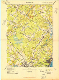 1944 Old Orchard Beach1944 Print · USGSCoastal Maine during the mid-forties reveals a landscape of summer resorts, rural schoolhouses, and working mills. Genealogists and historians can trace the foundations of Old Orchard Beach and find landmarks like Milliken Mills, the Heath Meetinghouse, and Ocean Park.
 - 1944 Map of Kennebunk
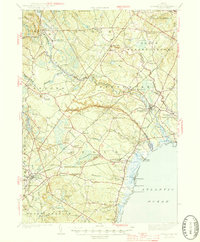 1944 Kennebunk1944 Print · USGSCoastal Maine thrives along the rivers and rails of York County in the early 1940s. Genealogists and historians can trace family roots through numerous local landmarks, from Evergreen Cem and Merriland Ch to the many numbered schoolhouses like School No 10.2 unique versions available
 - 1949 Map of Portland
 1949 Portland1949 Print · USGSCoastal Maine and the New Hampshire interior are shown in detail during the late forties, from the bustling harbors to the lakeside villages. Researchers can trace historical rail networks like the Boston & Maine RR and locate coastal defenses such as Fort Preble.3 unique versions available
 - 1949 Map of Biddeford Pool
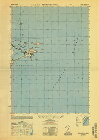 1949 Biddeford Pool1949 Print · USGSThe Maine coastline south of Saco Bay is captured here just after the war, detailing the maritime landscape of Saco and Biddeford. Researchers can trace the layout of Hill Beach and identify offshore landmarks like the Wood Island Lighthouse and Stage I.
Showing maps 1-25 of 74
Top cities near Saco
- Portland historical maps
- South Portland historical maps
- Biddeford historical maps
- Scarborough historical maps
- Westbrook historical maps
- Windham historical maps
See more
Top neighborhoods of Saco
- Pepperell Square historical maps
- Boothbay Park historical maps
- Bay View historical maps
- Camp Ellis historical maps
- Ferry Beach historical maps
- Kinney Shores historical maps
See more
Frequently asked questions
- What are the different types of historical maps available for Saco?
- What is the oldest map of Saco?
- Where can I purchase historical maps of Saco for my home or office?
- Where can I download high-res historical maps of Saco?
- Are there historical topographic maps available for Saco?
- Is there historical aerial imagery available for Saco?
- Where are historical maps of Saco sourced from?