Old Maps of Cedarwood Cove, Maryland for Metal Detecting
Plan your next treasure hunt with 21 historic maps of Cedarwood Cove. Find old homesites, ghost towns, trails, and gathering spots that may be lost to time — perfect for identifying promising metal detecting locations.
- Locate forgotten sites: Uncover places like long-lost settlements, abandoned rail lines, or gathering spots.
- Plan better hunts: Use map overlays combined with LiDAR or satellite views to narrow in on historically rich areas.
- Made for detectorists: Thousands of hobbyists use these maps to discover relics, coins, and hidden history.
Use these historic maps to boost your research and find new opportunities beneath the surface of Cedarwood Cove.
Cedarwood Cove, MD maps
(21)- 1893 Map of North Point
 1893 North Point1893 Print · USGSMaryland's maritime heart is captured here in the late nineteenth century, showing the industrial rise of Steelton and the rural reaches of Anne Arundel. Researchers can trace old landings and light stations like Wilson Wharf, Sandy Pt. Light, and the settlement at Jacob Store.3 unique versions available
 - 1898 Map of Tolchester
 1898 Tolchester1898 Print · USGSThe upper Chesapeake Bay and its tidal tributaries are shown in the late 1890s, when steamships and railroads still dominated regional commerce. Trace the landings and rail stops that fueled the bay economy, from Buck Neck Landing to Stillpond Sta. and the historic Harford Furnace.
 - 1903 Map of Tolchester
 1903 Tolchester1903 Print · USGSThe upper Chesapeake Bay at the turn of the century shows a bustling maritime landscape where steamship wharves and major rail lines met. Researchers can trace defunct stops like Baldwin Sta. and Clayton Sta. or locate historic landings such as Rockhall Landing and Quaker Wharf.
 - 1904 Map of North Point
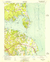
 1904 North Point1904 Print · USGSChesapeake Bay maritime life at the turn of the century is captured here, from industrial waterfronts to rural landings. Genealogists can trace family landmarks and ferry points like Love Point Landing, Sparrow Point, and Skidmore.5 unique versions available
 - 1908 Map of Tolchester
 1908 Tolchester1908 Print · USGSChesapeake Bay life at the turn of the century centered on a complex network of tidewater landings and strategic railroad lines. Researchers can trace historic family settlements and maritime landmarks like Fort Howard, Harford Furnace, and the Sevenfoot Knoll LH.4 unique versions available
 - 1943 Map of North Point
 1943 North Point1943 Print · USGSThe Chesapeake Bay's maritime approaches are captured here during the 1940s, highlighting the industrial strength of Sparrows Point and the coastal defenses at Fort Howard. Researchers can trace the rail connections at Love Point Landing or explore the mid-century waterfronts of Gibson Island and Bay Shore.
 - 1944 Map of Gibson Island
 1944 Gibson Island1944 Print · USGSThe Anne Arundel County coastline during the 1940s reveals a maritime landscape shaped by ferry travel and bay-side settlements. Genealogists and local historians can trace family locations near St Margarets, explore the grounds of Manresa, or locate the Sandy Point Ferry Terminal.
 - 1947 Map of North Point, 1955 Print
 1947 North Point1955 Print · USGSCoastal Maryland at the close of the 1940s reveals a sharp contrast between the industrial might of Sparrows Point and the quiet summer communities of the western shore. Trace maritime history through dredging records and landmarks like Fort Howard, Gibson Island, and Sevenfoot Knoll Light.
 - 1948 Map of Baltimore
 1948 Baltimore1948 Print · USGSMaryland and Pennsylvania crossroads are captured in the late 1940s, showing a landscape defined by historic rail lines and major military installations. Genealogists can trace family connections in Gettysburg, Westminster, and near the U.S. Naval Academy in Annapolis.2 unique versions available
 - 1954 Map of Baltimore
 1954 Baltimore1954 Print · USGSThe Mid-Atlantic region in the early fifties shows a landscape of growing suburban centers and heavy rail corridors. Trace mid-century transit networks and military landmarks from the Aberdeen Proving Ground to the Gettysburg National Military Park.
 - 1954 Map of Gibson Island, 1955 Print
 1954 Gibson Island1955 Print · USGSAnne Arundel County's shoreline was a hub of maritime navigation and coastal development in the mid-fifties. Genealogists and historians can trace family locations in St Margarets or Skidmore and locate landmarks like the State Prison Camp and Baltimore Lighthouse.5 unique versions available
 - 1956 Map of Baltimore
 1956 Baltimore1956 Print · USGSMid-century Maryland and Pennsylvania are captured here during a period of massive suburban and military growth across the Chesapeake region. Genealogists and historians can trace the rail corridors of the Baltimore & Ohio RR and locate landmarks like Fort McHenry or the Aberdeen Proving Ground.
 - 1957 Map of Baltimore, 1964 Print
 1957 Baltimore1964 Print · USGSMaryland and Southern Pennsylvania are shown during the mid-century expansion of the Baltimore-Washington corridor. Researchers can trace the extensive rail lines of the Baltimore & Ohio RR and locate sites like Fort Detrick and Gettysburg National Military Park.5 unique versions available
 - 1961 Map of Baltimore
 1961 Baltimore1961 Print · USGSMaryland and Pennsylvania are captured at a mid-century peak of industrial and military expansion. Genealogists and historians can trace rail corridors like the Western Maryland Ry or locate regional landmarks such as Camp Detrick and Kent Island.
 - 1984 Map of Baltimore
 1984 Baltimore1984 Print · USGSThe Baltimore and Annapolis corridor in the mid-eighties shows a landscape of rapid suburban growth and deep-seated maritime history. Researchers can trace the massive footprints of the U S Naval Academy, Fort George G Meade, and Goddard Space Flight Ctr.
 - 1989 Map of Baltimore
 1989 Baltimore1989 Print · USGSThe Mid-Atlantic corridor in the late eighties is captured here, from the Baltimore harbor to the Blue Ridge foothills. Researchers can trace the sprawling footprints of Aberdeen Proving Ground, the historic grounds of Gettysburg National Military Park, and the winding Susquehanna River.
 - 2011 Map of Gibson Island, 2011 Print
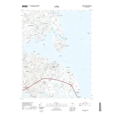
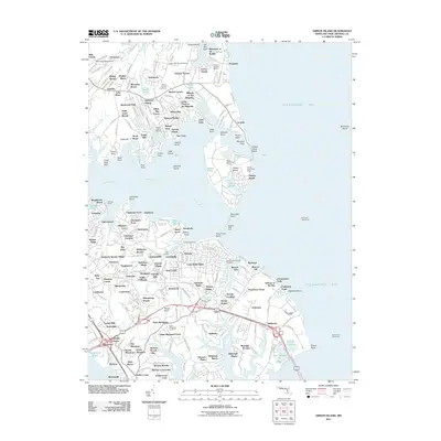 2011 Gibson Island2011 Print · USGSCovers Cedarwood Cove, including Annapolis, Cape Saint Claire, and other nearby areas
 - 2014 Map of Gibson Island, 2014 Print
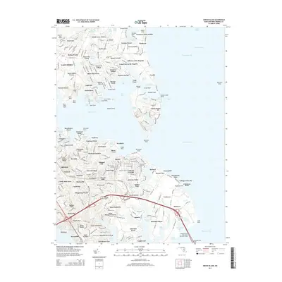 2014 Gibson Island2014 Print · USGSCovers Cedarwood Cove, including Annapolis, Cape Saint Claire, and other nearby areas
 - 2017 Map of Gibson Island, 2017 Print
 2017 Gibson Island2017 Print · USGSCovers Cedarwood Cove, including Annapolis, Cape Saint Claire, and other nearby areas
 - 2019 Map of Gibson Island, 2019 Print
 2019 Gibson Island2019 Print · USGSCovers Cedarwood Cove, including Annapolis, Cape Saint Claire, and other nearby areas
 - 2023 Map of Gibson Island, 2023 Print
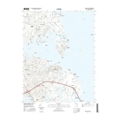
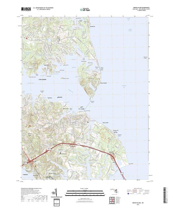 2023 Gibson Island2023 Print · USGSCoastal Anne Arundel County comes into focus in this contemporary survey of the Magothy River and Chesapeake Bay. Local historians can trace established neighborhoods and family-named sites from Gibson Island to the historic Saint Margarets Episcopal Church.
End of results
Showing maps 1-21 of 21
Top cities near Cedarwood Cove
- Glen Burnie historical maps
- Severna Park historical maps
- Annapolis historical maps
- Crofton historical maps
- Pasadena historical maps
- Arnold historical maps
See more
Frequently asked questions
- What are the different types of historical maps available for Cedarwood Cove?
- What is the oldest map of Cedarwood Cove?
- Where can I purchase historical maps of Cedarwood Cove for my home or office?
- Where can I download high-res historical maps of Cedarwood Cove?
- Are there historical topographic maps available for Cedarwood Cove?
- Is there historical aerial imagery available for Cedarwood Cove?
- Where are historical maps of Cedarwood Cove sourced from?