Old Maps of Hampstead, Maryland for Metal Detecting
Plan your next treasure hunt with 29 historic maps of Hampstead. Find old homesites, ghost towns, trails, and gathering spots that may be lost to time — perfect for identifying promising metal detecting locations.
- Locate forgotten sites: Uncover places like long-lost settlements, abandoned rail lines, or gathering spots.
- Plan better hunts: Use map overlays combined with LiDAR or satellite views to narrow in on historically rich areas.
- Made for detectorists: Thousands of hobbyists use these maps to discover relics, coins, and hidden history.
Use these historic maps to boost your research and find new opportunities beneath the surface of Hampstead.
Hampstead, MD maps
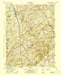
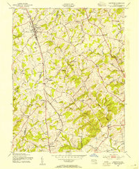
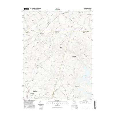
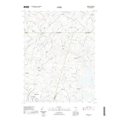
(29)- 1905 Map of Westminster
 1905 Westminster1905 Print · USGSCarroll and York Counties come alive in the first decade of the twentieth century as the rail lines connected growing Maryland villages to the Pennsylvania border. Genealogists can trace family roots through historic landmarks like Bethel Ch, Hokes PO, and early milling sites like Bachman Mills.6 unique versions available
 - 1944 Map of Hampstead
 1944 Hampstead1944 Print · USGSMaryland's rolling borderlands between Carroll and Baltimore counties are captured here during the mid-forties. Genealogists and historians can trace the rail-side growth of Hampstead, the rural post office at Arcadia Upperco P O, and industry at Trenton Mill.
 - 1944 Map of Lineboro
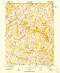
 1944 Lineboro1944 Print · USGSMaryland and Pennsylvania border life is captured here in the mid-1940s, centered on the Mason and Dixon Line. Researchers can trace rural genealogy and land use through landmarks like Baughmans Mill, Stiltz, and the Blackrock Chapel & School.
 - 1944 Map of Westminster
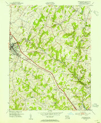
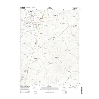
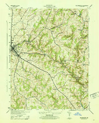 1944 Westminster1944 Print · USGSCarroll County was a landscape of rail-connected trade and small church hamlets during the mid-1940s. Genealogists can trace family roots through rural communities like Snydersburg and Houcksville or locate old landmarks such as Wesley Chapel and Cranberry Station.
 - 1948 Map of Baltimore
 1948 Baltimore1948 Print · USGSMaryland and Pennsylvania crossroads are captured in the late 1940s, showing a landscape defined by historic rail lines and major military installations. Genealogists can trace family connections in Gettysburg, Westminster, and near the U.S. Naval Academy in Annapolis.2 unique versions available
 - 1953 Map of Lineboro, 1954 Print
 1953 Lineboro1954 Print · USGSThe Maryland-Pennsylvania borderlands come alive in this mid-century survey of the rural Gunpowder Falls watershed. Researchers can trace ancestral locations near Lineboro, find several early schools like Hokes Sch, or locate the flooding of the Prettyboy Reservoir.6 unique versions available
 - 1953 Map of Hampstead, 1954 Print
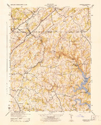
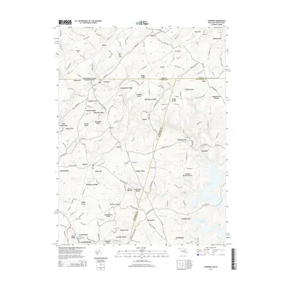
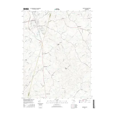
 1953 Hampstead1954 Print · USGSThe borderlands of Carroll and Baltimore counties come alive in the 1950s, showing a region shaped by the Western Maryland railroad. Trace family history through local landmarks like Arcadia (Upperco P O), St Johns Cem, and Loes Mill.4 unique versions available
 - 1953 Map of Westminster, 1954 Print
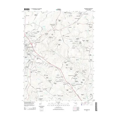
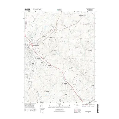
 1953 Westminster1954 Print · USGSMid-century Carroll County reveals a landscape of rural milling hamlets and growing town centers connected by the Western Maryland railroad. Genealogists can trace family footprints at Walnut Grove Mills, Snydersburg, and local landmarks like the Robert Moton Sch.5 unique versions available
 - 1954 Map of Baltimore
 1954 Baltimore1954 Print · USGSThe Mid-Atlantic region in the early fifties shows a landscape of growing suburban centers and heavy rail corridors. Trace mid-century transit networks and military landmarks from the Aberdeen Proving Ground to the Gettysburg National Military Park.
 - 1956 Map of Baltimore
 1956 Baltimore1956 Print · USGSMid-century Maryland and Pennsylvania are captured here during a period of massive suburban and military growth across the Chesapeake region. Genealogists and historians can trace the rail corridors of the Baltimore & Ohio RR and locate landmarks like Fort McHenry or the Aberdeen Proving Ground.
 - 1957 Map of Baltimore, 1964 Print
 1957 Baltimore1964 Print · USGSMaryland and Southern Pennsylvania are shown during the mid-century expansion of the Baltimore-Washington corridor. Researchers can trace the extensive rail lines of the Baltimore & Ohio RR and locate sites like Fort Detrick and Gettysburg National Military Park.5 unique versions available
 - 1961 Map of Baltimore
 1961 Baltimore1961 Print · USGSMaryland and Pennsylvania are captured at a mid-century peak of industrial and military expansion. Genealogists and historians can trace rail corridors like the Western Maryland Ry or locate regional landmarks such as Camp Detrick and Kent Island.
 - 1983 Map of York, 1984 Print
 1983 York1984 Print · USGSSouth Central Pennsylvania and Northern Maryland meet along the Susquehanna during the early eighties. Genealogists and local historians can trace the transit networks of Conrail and Amtrak through towns like Red Lion and Seven Valleys.2 unique versions available
 - 1989 Map of Baltimore
 1989 Baltimore1989 Print · USGSThe Mid-Atlantic corridor in the late eighties is captured here, from the Baltimore harbor to the Blue Ridge foothills. Researchers can trace the sprawling footprints of Aberdeen Proving Ground, the historic grounds of Gettysburg National Military Park, and the winding Susquehanna River.
 - 2011 Map of Westminster, 2011 Print
 2011 Westminster2011 Print · USGSCovers Hampstead, including Westminster, Lismarelu Farms, and other nearby areas
 - 2011 Map of Hampstead, 2011 Print
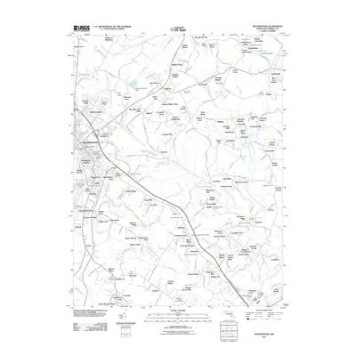
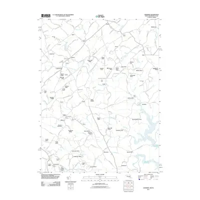
 2011 Hampstead2011 Print · USGSCovers Hampstead, including Fowblesburg, Brilhart Terrace, and other nearby areas
 - 2011 Map of Lineboro, 2011 Print
 2011 Lineboro2011 Print · USGSCovers Hampstead, including Manchester, Forest Knoll, and other nearby areas
 - 2014 Map of Lineboro, 2014 Print
 2014 Lineboro2014 Print · USGSCovers Hampstead, including Manchester, Forest Knoll, and other nearby areas
 - 2014 Map of Hampstead, 2014 Print
 2014 Hampstead2014 Print · USGSCovers Hampstead, including Fowblesburg, Brilhart Terrace, and other nearby areas
 - 2014 Map of Westminster, 2014 Print
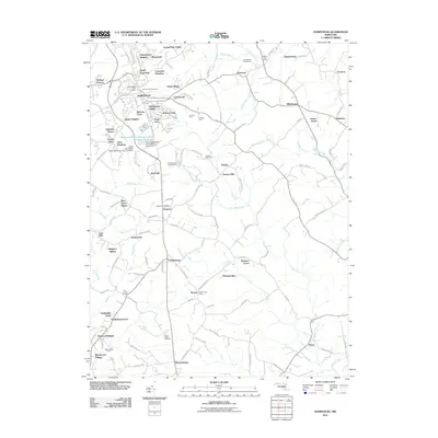
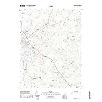
 2014 Westminster2014 Print · USGSCovers Hampstead, including Westminster, Lismarelu Farms, and other nearby areas
 - 2016 Map of Hampstead, 2016 Print
 2016 Hampstead2016 Print · USGSCovers Hampstead, including Fowblesburg, Brilhart Terrace, and other nearby areas
 - 2016 Map of Lineboro, 2016 Print
 2016 Lineboro2016 Print · USGSCovers Hampstead, including Manchester, Forest Knoll, and other nearby areas
 - 2016 Map of Westminster, 2016 Print
 2016 Westminster2016 Print · USGSCovers Hampstead, including Westminster, Lismarelu Farms, and other nearby areas
 - 2019 Map of Westminster, 2019 Print
 2019 Westminster2019 Print · USGSCovers Hampstead, including Westminster, Lismarelu Farms, and other nearby areas
 - 2019 Map of Lineboro, 2019 Print
 2019 Lineboro2019 Print · USGSCovers Hampstead, including Manchester, Forest Knoll, and other nearby areas
Showing maps 1-25 of 29
Top cities near Hampstead
- Towson historical maps
- Owings Mills historical maps
- Eldersburg historical maps
- Reisterstown historical maps
- Westminster historical maps
- Cockeysville historical maps
See more
Top neighborhoods of Hampstead
- Small Crossings historical maps
- North Carroll Farms historical maps
- Roberts Field historical maps
- Clear View historical maps
- West Wood Park HOA historical maps
Frequently asked questions
- What are the different types of historical maps available for Hampstead?
- What is the oldest map of Hampstead?
- Where can I purchase historical maps of Hampstead for my home or office?
- Where can I download high-res historical maps of Hampstead?
- Are there historical topographic maps available for Hampstead?
- Is there historical aerial imagery available for Hampstead?
- Where are historical maps of Hampstead sourced from?