Old Maps of Bellevue Heights, Union Bridge
Explore 16 old maps of Bellevue Heights, spanning from 1911 to today. These high-resolution historic maps reveal how streets, neighborhoods, landmarks, and natural features evolved over time — perfect for genealogy, metal detecting, research, and local history exploration.
What you can do with these maps:
- See how Bellevue Heights changed over time: Compare historical maps to modern-day views to trace roads, homesites, rail lines & more.
- View detailed metadata: Each map includes creators, publishers, year, scale, and archive source.
- Overlay maps with satellite & LiDAR: Visualize the past alongside modern tools to explore terrain & human change.
- Trusted historical sources: Maps sourced from the USGS, Library of Congress, and other archives.
- Access maps your way: View online, download high-res files, or order prints for personal or research use.
Start exploring old maps of Bellevue Heights to uncover forgotten places, hidden landmarks, and the deep history beneath your feet.
Bellevue Heights, Union Bridge maps
(16)- 1911 Map of Taneytown
 1911 Taneytown1911 Print · USGSCarroll County and the Maryland-Pennsylvania borderlands are captured here just after the turn of the century, showing a network of rail-linked towns and water-powered mills. Trace local history through Taneytown, Union Mills, and Pipe Creek Church, or find early school sites like Centennial Hall School.6 unique versions available
 - 1942 Map of Gettysburg, 1944 Print
 1942 Gettysburg1944 Print · USGSGettysburg and its surrounding borderlands are shown in great detail during the early 1940s, capturing the region's dense network of rural schools and mills. Genealogists can trace family-named landmarks such as Galt Kump PO, Hafers Mill, and Philips Delight Sch.
 - 1944 Map of Union Bridge
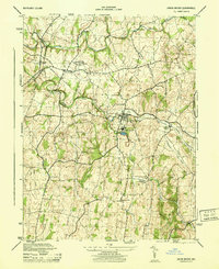 1944 Union Bridge1944 Print · USGSMaryland's agricultural and industrial borderlands thrive during the mid-forties at the junction of two major rail lines. Genealogists and historians can trace the local economy through the Lehigh Portland Cement Company and historic sites like Mc Kinstrys Mill and Keymar.
 - 1948 Map of Baltimore
 1948 Baltimore1948 Print · USGSMaryland and Pennsylvania crossroads are captured in the late 1940s, showing a landscape defined by historic rail lines and major military installations. Genealogists can trace family connections in Gettysburg, Westminster, and near the U.S. Naval Academy in Annapolis.2 unique versions available
 - 1953 Map of Union Bridge, 1955 Print
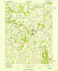 1953 Union Bridge1955 Print · USGSUnion Bridge and the Carroll-Frederick county border thrive in the early 1950s as a vital railroad junction. Researchers can trace the legacy of early industry through named sites like McKinstrys Mill, the local Copper Mine, and Bowens Chapel.3 unique versions available
 - 1954 Map of Baltimore
 1954 Baltimore1954 Print · USGSThe Mid-Atlantic region in the early fifties shows a landscape of growing suburban centers and heavy rail corridors. Trace mid-century transit networks and military landmarks from the Aberdeen Proving Ground to the Gettysburg National Military Park.
 - 1956 Map of Baltimore
 1956 Baltimore1956 Print · USGSMid-century Maryland and Pennsylvania are captured here during a period of massive suburban and military growth across the Chesapeake region. Genealogists and historians can trace the rail corridors of the Baltimore & Ohio RR and locate landmarks like Fort McHenry or the Aberdeen Proving Ground.
 - 1957 Map of Baltimore, 1964 Print
 1957 Baltimore1964 Print · USGSMaryland and Southern Pennsylvania are shown during the mid-century expansion of the Baltimore-Washington corridor. Researchers can trace the extensive rail lines of the Baltimore & Ohio RR and locate sites like Fort Detrick and Gettysburg National Military Park.5 unique versions available
 - 1961 Map of Baltimore
 1961 Baltimore1961 Print · USGSMaryland and Pennsylvania are captured at a mid-century peak of industrial and military expansion. Genealogists and historians can trace rail corridors like the Western Maryland Ry or locate regional landmarks such as Camp Detrick and Kent Island.
 - 1983 Map of Hagerstown, 1984 Print
 1983 Hagerstown1984 Print · USGSThe tri-state borderlands of Maryland, Pennsylvania, and West Virginia are shown in the early eighties as a hub of military installations and valley towns. Genealogists and historians can trace the landscape from Gettysburg National Military Park to the banks of the Potomac River.2 unique versions available
 - 1989 Map of Baltimore
 1989 Baltimore1989 Print · USGSThe Mid-Atlantic corridor in the late eighties is captured here, from the Baltimore harbor to the Blue Ridge foothills. Researchers can trace the sprawling footprints of Aberdeen Proving Ground, the historic grounds of Gettysburg National Military Park, and the winding Susquehanna River.
 - 2011 Map of Union Bridge, 2011 Print
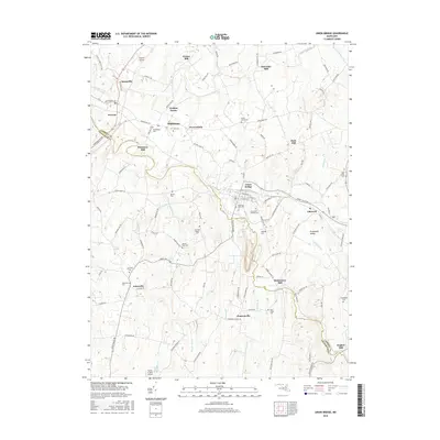
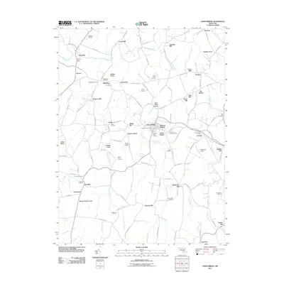 2011 Union Bridge2011 Print · USGSCovers Bellevue Heights, including Union Bridge, Rabbit Run, and other nearby areas
 - 2014 Map of Union Bridge, 2014 Print
 2014 Union Bridge2014 Print · USGSCovers Bellevue Heights, including Union Bridge, Rabbit Run, and other nearby areas
 - 2016 Map of Union Bridge, 2016 Print
 2016 Union Bridge2016 Print · USGSCovers Bellevue Heights, including Union Bridge, Rabbit Run, and other nearby areas
 - 2019 Map of Union Bridge, 2019 Print
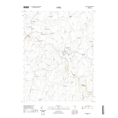 2019 Union Bridge2019 Print · USGSCovers Bellevue Heights, including Union Bridge, Rabbit Run, and other nearby areas
 - 2023 Map of Union Bridge, 2023 Print
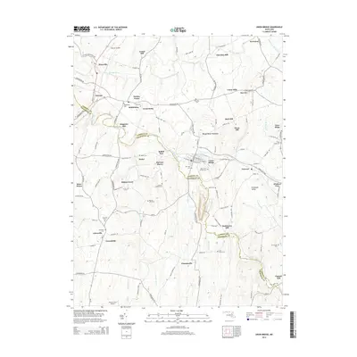
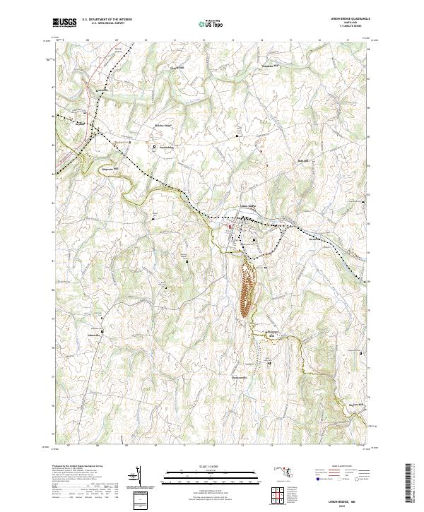 2023 Union Bridge2023 Print · USGSMaryland's Piedmont landscape is captured here in the contemporary era, showcasing a region still shaped by its historic milling and farming roots. Researchers can trace ancestral locations through numerous burial grounds like Pipe Creek Friends Cem and old industrial sites such as McKinstrys Mill.
End of results
Showing maps 1-16 of 16
Frequently asked questions
- What are the different types of historical maps available for Bellevue Heights?
- What is the oldest map of Bellevue Heights?
- Where can I purchase historical maps of Bellevue Heights for my home or office?
- Where can I download high-res historical maps of Bellevue Heights?
- Are there historical topographic maps available for Bellevue Heights?
- Is there historical aerial imagery available for Bellevue Heights?
- Where are historical maps of Bellevue Heights sourced from?