Old Maps of Carroll County, Maryland
Explore 63 old maps of Carroll County, spanning from 1892 to today. These high-resolution historic maps reveal how streets, neighborhoods, landmarks, and natural features evolved over time — perfect for genealogy, metal detecting, research, and local history exploration.
What you can do with these maps:
- See how Carroll County changed over time: Compare historical maps to modern-day views to trace roads, homesites, rail lines & more.
- View detailed metadata: Each map includes creators, publishers, year, scale, and archive source.
- Overlay maps with satellite & LiDAR: Visualize the past alongside modern tools to explore terrain & human change.
- Trusted historical sources: Maps sourced from the USGS, Library of Congress, and other archives.
- Access maps your way: View online, download high-res files, or order prints for personal or research use.
Start exploring old maps of Carroll County to uncover forgotten places, hidden landmarks, and the deep history beneath your feet.
Carroll County, MD maps
(63)- 1892 Map of Ellicott
 1892 Ellicott1892 Print · USGSCovers Carroll County, including Ellicott City, Randallstown, and other nearby areas
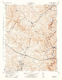
 - 1893 Map of Frederick
 1893 Frederick1893 Print · USGSCovers Carroll County, including Germantown, Frederick, and other nearby areas
 - 1894 Map of Ellicott
 1894 Ellicott1894 Print · USGSCovers Carroll County, including Ellicott City, Randallstown, and other nearby areas3 unique versions available
 - 1894 Map of Frederick
 1894 Frederick1894 Print · USGSCovers Carroll County, including Germantown, Frederick, and other nearby areas5 unique versions available
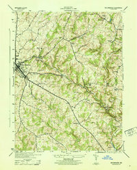
 - 1905 Map of Westminster
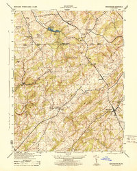
 1905 Westminster1905 Print · USGSCovers Carroll County, including Westminster, West Manheim Township, and other nearby areas6 unique versions available
 - 1906 Map of Ellicott
 1906 Ellicott1906 Print · USGSCovers Carroll County, including Ellicott City, Randallstown, and other nearby areas6 unique versions available
 - 1908 Map of Patapsco
 1908 Patapsco1908 Print · USGSCovers Carroll County, including Baltimore, Columbia, and other nearby areas4 unique versions available
 - 1909 Map of Mount Airy
 1909 Mount Airy1909 Print · USGSCovers Carroll County, including Damascus, Mount Airy, and other nearby areas7 unique versions available
 - 1911 Map of Taneytown
 1911 Taneytown1911 Print · USGSCovers Carroll County, including Westminster, Taneytown, and other nearby areas6 unique versions available
 - 1911 Map of Emmitsburg
 1911 Emmitsburg1911 Print · USGSCovers Carroll County, including Thurmont, Walkersville, and other nearby areas6 unique versions available
 - 1942 Map of Gettysburg, 1944 Print
 1942 Gettysburg1944 Print · USGSCovers Carroll County, including Westminster, Gettysburg, and other nearby areas
 - 1943 Map of Emmitsburg
 1943 Emmitsburg1943 Print · USGSCovers Carroll County, including Thurmont, Walkersville, and other nearby areas4 unique versions available
 - 1944 Map of Manchester
 1944 Manchester1944 Print · USGSCovers Carroll County, including West Manheim Township, Manchester, and other nearby areas
 - 1944 Map of Sykesville
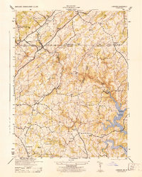
 1944 Sykesville1944 Print · USGSCovers Carroll County, including Sykesville, Amberly, and other nearby areas
 - 1944 Map of Union Bridge
 1944 Union Bridge1944 Print · USGSCovers Carroll County, including Union Bridge, Rabbit Run, and other nearby areas
 - 1944 Map of Hampstead
 1944 Hampstead1944 Print · USGSCovers Carroll County, including Hampstead, Boring, and other nearby areas
 - 1944 Map of Ellicott City
 1944 Ellicott City1944 Print · USGSCovers Carroll County, including Ellicott City, Randallstown, and other nearby areas
 - 1944 Map of New Windsor
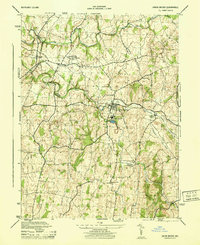
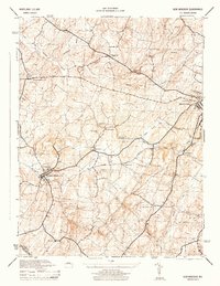 1944 New Windsor1944 Print · USGSCovers Carroll County, including Westminster, New Windsor, and other nearby areas2 unique versions available
 - 1944 Map of Littlestown
 1944 Littlestown1944 Print · USGSCovers Carroll County, including Littlestown, Germany Township, and other nearby areas2 unique versions available
 - 1944 Map of Lineboro
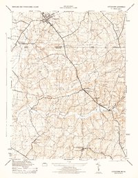
 1944 Lineboro1944 Print · USGSCovers Carroll County, including Hampstead, Manchester, and other nearby areas
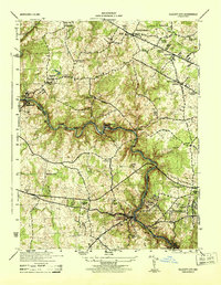
 - 1944 Map of Taneytown
 1944 Taneytown1944 Print · USGSCovers Carroll County, including Taneytown, Germany Township, and other nearby areas
 - 1944 Map of Finksburg
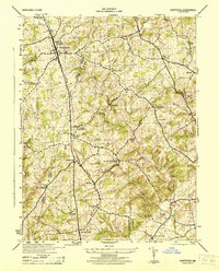
 1944 Finksburg1944 Print · USGSCovers Carroll County, including Eldersburg, Sykesville, and other nearby areas2 unique versions available
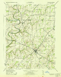
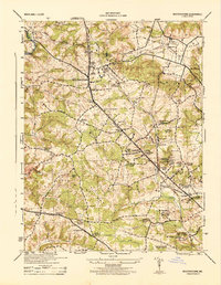
 - 1944 Map of Westminster
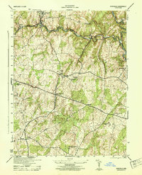
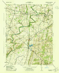
 1944 Westminster1944 Print · USGSCovers Carroll County, including Westminster, Hampstead, and other nearby areas
 - 1944 Map of Woodsboro
 1944 Woodsboro1944 Print · USGSCovers Carroll County, including Walkersville, Woodsboro, and other nearby areas2 unique versions available
 - 1944 Map of Reisterstown
 1944 Reisterstown1944 Print · USGSCovers Carroll County, including Owings Mills, Reisterstown, and other nearby areas
Showing maps 1-25 of 63
Top cities of Carroll County
- Eldersburg historical maps
- Westminster historical maps
- Taneytown historical maps
- Hampstead historical maps
- Manchester historical maps
- Sykesville historical maps
See more
Frequently asked questions
- What are the different types of historical maps available for Carroll County?
- What is the oldest map of Carroll County?
- Where can I purchase historical maps of Carroll County for my home or office?
- Where can I download high-res historical maps of Carroll County?
- Are there historical topographic maps available for Carroll County?
- Is there historical aerial imagery available for Carroll County?
- Where are historical maps of Carroll County sourced from?