1900s (20th Century) Maps of Carroll County, Maryland
Explore 59 historic maps of Carroll County from the 1900s (20th Century). These maps offer a rare glimpse into what life looked like during the 1900s — showing old roads, neighborhoods, homes, and landmarks that have changed or disappeared over time.
Whether you're researching your family's past, planning a metal detecting trip, or studying how Carroll County's landscape evolved across the 1900s, these high-resolution maps are a powerful tool for exploring the history of this region.
- Focus on a specific era: All maps on this page are from the 1900s, giving you a focused view of this time period.
- See what’s changed: Compare century-old streets, trails, and buildings to today's modern landscape using overlays and satellite layers.
- Research with precision: Use these maps for genealogy, historical research, land use analysis, or educational projects.
- View, download, or print: Maps are fully viewable online in high resolution, and can be downloaded or printed for your own records.
Start exploring Carroll County's history through authentic maps from the 1900s. This is your window into the past.
Carroll County, MD maps
(59)- 1905 Map of Westminster
 1905 Westminster1905 Print · USGSCarroll and York Counties come alive in the first decade of the twentieth century as the rail lines connected growing Maryland villages to the Pennsylvania border. Genealogists can trace family roots through historic landmarks like Bethel Ch, Hokes PO, and early milling sites like Bachman Mills.6 unique versions available
 - 1906 Map of Ellicott
 1906 Ellicott1906 Print · USGSCentral Maryland at the turn of the century shows a landscape of institutional growth and heavy rail development. Trace family roots and local history through Reisterstown, the grounds of St Charles College, and Owings Mills.6 unique versions available
 - 1908 Map of Patapsco
 1908 Patapsco1908 Print · USGSMaryland's central corridor at the opening of the twentieth century reveals a dense network of harbor defenses and rail-line economies. Genealogists and historians can trace the foundations of Baltimore alongside local landmarks like Ashland Furnace, St Charles College, and Fort McHenry.4 unique versions available
 - 1909 Map of Mount Airy
 1909 Mount Airy1909 Print · USGSCentral Maryland's Piedmont region is captured here during the height of the steam-rail era, centered on the strategic crossing at Mount Airy. Genealogists and historians can trace old property locations near Shipleys Mill, the winding Gary Turnpike, and rural settlements like Winfield and Libertytown.7 unique versions available
 - 1911 Map of Taneytown
 1911 Taneytown1911 Print · USGSCarroll County and the Maryland-Pennsylvania borderlands are captured here just after the turn of the century, showing a network of rail-linked towns and water-powered mills. Trace local history through Taneytown, Union Mills, and Pipe Creek Church, or find early school sites like Centennial Hall School.6 unique versions available
 - 1911 Map of Emmitsburg
 1911 Emmitsburg1911 Print · USGSMaryland's northern borderlands and the Catoctin mountains thrived in the early twentieth century as a hub for institutions, railroads, and milling. Genealogists and historians can locate family homes and old crossroads near St Josephs Academy, Sabillasville, and the Western Maryland RR.6 unique versions available
 - 1942 Map of Gettysburg, 1944 Print
 1942 Gettysburg1944 Print · USGSGettysburg and its surrounding borderlands are shown in great detail during the early 1940s, capturing the region's dense network of rural schools and mills. Genealogists can trace family-named landmarks such as Galt Kump PO, Hafers Mill, and Philips Delight Sch.
 - 1943 Map of Emmitsburg
 1943 Emmitsburg1943 Print · USGSMaryland's northern border and the Frederick Valley appear during the early 1940s, where the Catoctin range meets the Monocacy plain. Genealogists can trace family names at Hoovers Mill, locate historic institutions like Mount St Marys College, or follow the Western Maryland RR.4 unique versions available
 - 1944 Map of Manchester
 1944 Manchester1944 Print · USGSThe Pennsylvania-Maryland border country was a landscape of mill seats and rural schools in the 1940s. Genealogists and historians can trace the Mason And Dixon Line past Bachman Mills, Hoffackers School, and St Bartholomew Church.
 - 1944 Map of Sykesville
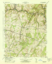 1944 Sykesville1944 Print · USGSMid-century Carroll and Howard counties are captured here just as the rural estate and railroad economies were evolving. Genealogists and historians can trace family locations near Doughoregan Manor, local burials at Mountain View Cemetery, or old rail stops at Gaither and Henryton.
 - 1944 Map of Union Bridge
 1944 Union Bridge1944 Print · USGSMaryland's agricultural and industrial borderlands thrive during the mid-forties at the junction of two major rail lines. Genealogists and historians can trace the local economy through the Lehigh Portland Cement Company and historic sites like Mc Kinstrys Mill and Keymar.
 - 1944 Map of Hampstead
 1944 Hampstead1944 Print · USGSMaryland's rolling borderlands between Carroll and Baltimore counties are captured here during the mid-forties. Genealogists and historians can trace the rail-side growth of Hampstead, the rural post office at Arcadia Upperco P O, and industry at Trenton Mill.
 - 1944 Map of Ellicott City
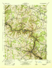 1944 Ellicott City1944 Print · USGSMaryland's Patapsco Valley comes alive in this wartime survey, showing the industrial river corridor and developing uplands between Howard and Baltimore counties. Researchers can trace the Baltimore and Ohio rail lines past Woodstock College, Alberton, and the busy streets of Ellicott City.
 - 1944 Map of New Windsor
 1944 New Windsor1944 Print · USGSMid-century Carroll County comes into focus as a landscape of academic institutions, milling operations, and rolling ridges. Genealogists and local historians can trace family-named sites like Wagners Mill, the John Hyde Quarry, and settlements from Uniontown to Warfieldsburg.2 unique versions available
 - 1944 Map of Littlestown
 1944 Littlestown1944 Print · USGSThe Pennsylvania and Maryland borderlands are captured here in the mid-1940s, revealing a landscape of rural schoolhouses and industrial milling. Genealogists and researchers can locate family sites near Menges Mill, Cherrytown, and Oak Grove School.2 unique versions available
 - 1944 Map of Lineboro
 1944 Lineboro1944 Print · USGSMaryland and Pennsylvania border life is captured here in the mid-1940s, centered on the Mason and Dixon Line. Researchers can trace rural genealogy and land use through landmarks like Baughmans Mill, Stiltz, and the Blackrock Chapel & School.
 - 1944 Map of Taneytown
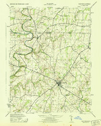 1944 Taneytown1944 Print · USGSMaryland and Pennsylvania's shared borderlands are captured here during the mid-1940s, showing a rural landscape anchored by local commerce and education. Researchers can locate vanished landmarks like Hoffmans Orphanage, Kump Station, and several rural schoolhouses such as Edgrove School.
 - 1944 Map of Finksburg
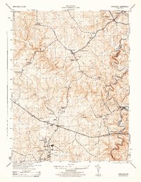 1944 Finksburg1944 Print · USGSCarroll County agriculture and industry meet along the Patapsco River during the mid-1940s. Genealogists and local historians can trace family-named landmarks and institutions like Springfield State Hospital, Sykesville, and Comet Roller Mills.2 unique versions available
 - 1944 Map of Westminster
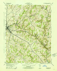 1944 Westminster1944 Print · USGSCarroll County was a landscape of rail-connected trade and small church hamlets during the mid-1940s. Genealogists can trace family roots through rural communities like Snydersburg and Houcksville or locate old landmarks such as Wesley Chapel and Cranberry Station.
 - 1944 Map of Woodsboro
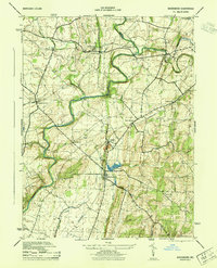 1944 Woodsboro1944 Print · USGSMaryland's agricultural heartland is documented during the war years, showing the vital rail and river networks of Frederick County. Genealogists can trace family heritage at the Terra Rubra Key Farm or locate old crossings like Stulls Ford and Wiley Mill.2 unique versions available
 - 1944 Map of Reisterstown
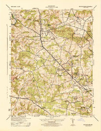 1944 Reisterstown1944 Print · USGSBaltimore County's rural and institutional landscapes come into sharp focus during the mid-1940s. Genealogists and historians can trace the footprint of early schools and estates like Hannah More Academy, Garrison, and the Gwynnbrook State Game Farm.
 - 1944 Map of Damascus, 1962 Print
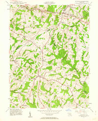 1944 Damascus1962 Print · USGSMid-century Montgomery County and its neighbors retain their rural character in this detailed survey of the Piedmont. Genealogists and local historians can trace the early road network connecting Damascus to outlying hamlets like Claggettsville, Kemptown, and Etchison.5 unique versions available
 - 1944 Map of Libertytown, 1970 Print
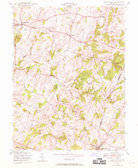 1944 Libertytown1970 Print · USGSMaryland's rolling countryside during the mid-forties is captured here, showing the rural crossroads and farming communities of Frederick and Carroll Counties. Researchers can locate family landmarks such as Ridge Sch No 4, the Lime Mill, and the rail stops of the Baltimore and Ohio.4 unique versions available
 - 1945 Map of Emmitsburg
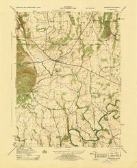 1945 Emmitsburg1945 Print · USGSMaryland's northern border country is captured in the mid-1940s, showing a landscape of storied academies and quiet river crossings. Genealogists and local historians can trace family roots through the many rural schools and small settlements like St. Anthony, Motters, and Keysville.
 - 1945 Map of Mount Airy, 1955 Print
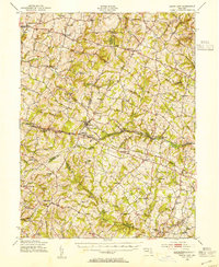 1945 Mount Airy1955 Print · USGSMid-century central Maryland is captured here as a landscape of rural villages and crossroads just before post-war expansion. Genealogists and historians can trace family locations through Mount Airy, Libertytown, and Damascus, or follow the Baltimore and Ohio rail line.2 unique versions available
Showing maps 1-25 of 59
Top cities of Carroll County
- Eldersburg historical maps
- Westminster historical maps
- Taneytown historical maps
- Hampstead historical maps
- Manchester historical maps
- Sykesville historical maps
See more
Frequently asked questions
- What are the different types of historical maps available for Carroll County?
- What is the oldest map of Carroll County?
- Where can I purchase historical maps of Carroll County for my home or office?
- Where can I download high-res historical maps of Carroll County?
- Are there historical topographic maps available for Carroll County?
- Is there historical aerial imagery available for Carroll County?
- Where are historical maps of Carroll County sourced from?