1950s Maps of Carroll County, Maryland
Explore 21 historic maps of Carroll County from the 1950s. These maps offer a rare glimpse into what life looked like during the 1950s — showing old roads, neighborhoods, homes, and landmarks that have changed or disappeared over time.
Whether you're researching your family's past, planning a metal detecting trip, or studying how Carroll County's landscape evolved across the 1950s, these high-resolution maps are a powerful tool for exploring the history of this region.
- Focus on a specific era: All maps on this page are from the 1950s, giving you a focused view of this time period.
- See what’s changed: Compare century-old streets, trails, and buildings to today's modern landscape using overlays and satellite layers.
- Research with precision: Use these maps for genealogy, historical research, land use analysis, or educational projects.
- View, download, or print: Maps are fully viewable online in high resolution, and can be downloaded or printed for your own records.
Start exploring Carroll County's history through authentic maps from the 1950s. This is your window into the past.
Carroll County, MD maps
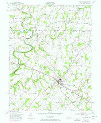
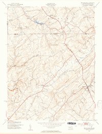
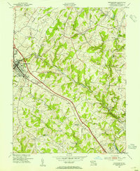
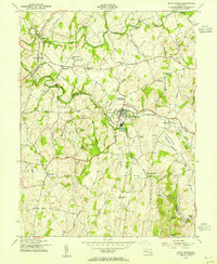
(21)- 1950 Map of Libertytown
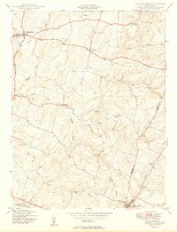 1950 Libertytown1950 Print · USGSMaryland's Piedmont region is captured here at mid-century, showing the rural landscapes of Frederick and Carroll Counties. Genealogists can locate family-named landmarks and institutions like Ridge Sch No 4, the Lime Mill, and settlements including Dorceytown and Woodville.2 unique versions available
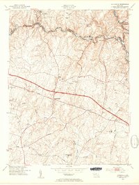
 - 1950 Map of Winfield
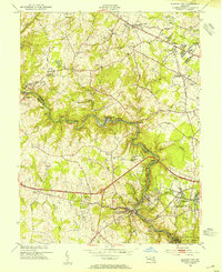
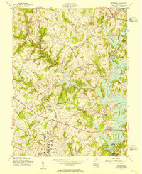
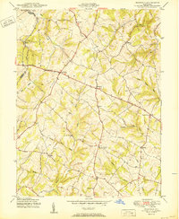 1950 Winfield1950 Print · USGSMid-century Carroll County life is centered here on the prominence of Parrs Ridge and a network of rural crossroads. Genealogists and local historians can trace family locations near Taylorsville, Winfield, and the Woodbine Sch.5 unique versions available
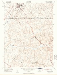
 - 1950 Map of Damascus
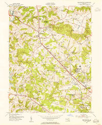
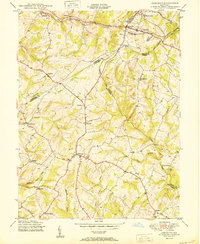 1950 Damascus1950 Print · USGSMid-century Maryland rural life is captured here at the intersection of four counties as agricultural communities thrived. Genealogists can trace family lands near Damascus or locate early settlements like Bartholows and Browningsville along the Baltimore and Ohio RR.2 unique versions available
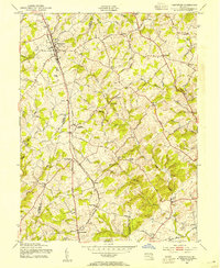
 - 1950 Map of Woodbine
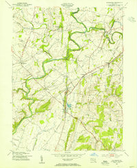
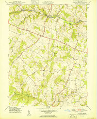 1950 Woodbine1950 Print · USGSMid-century Howard County remains a landscape of independent milling hubs and quiet crossroads hamlets. Trace the heritage of family operations like Hipsleys Mill and Roxbury Mills, or locate early rural school sites such as Mt Gregory Sch.2 unique versions available
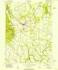
 - 1953 Map of Taneytown
 1953 Taneytown1953 Print · USGSThe Maryland-Pennsylvania borderlands are captured here in the mid-1950s, centered on the growing crossroads of Taneytown. Researchers can trace old property lines and rural life through landmarks like the Hoffman Orphanage, Mairs Mill, and the Penn Central rail corridor.5 unique versions available
 - 1953 Map of Emmitsburg, 1954 Print
 1953 Emmitsburg1954 Print · USGSThe Pennsylvania-Maryland border country comes into focus in the early 1950s, showing the historic Mason and Dixon Line and the academic institutions of Emmitsburg. Genealogists and historians can trace local landmarks like St Josephs College, St Josephs Cemetery, and the river junction at Motters.5 unique versions available
 - 1953 Map of Lineboro, 1954 Print
 1953 Lineboro1954 Print · USGSThe Maryland-Pennsylvania borderlands come alive in this mid-century survey of the rural Gunpowder Falls watershed. Researchers can trace ancestral locations near Lineboro, find several early schools like Hokes Sch, or locate the flooding of the Prettyboy Reservoir.6 unique versions available
 - 1953 Map of New Windsor, 1954 Print
 1953 New Windsor1954 Print · USGSCarroll County was a thriving network of mill towns and educational hubs in the mid-fifties, centered on the Western Maryland railroad. Researchers can trace family-named landmarks like Bailes Mill, Wakefield Mill, and the historic Western Maryland College.6 unique versions available
 - 1953 Map of Manchester, 1954 Print
 1953 Manchester1954 Print · USGSThe Maryland-Pennsylvania borderlands are captured here in the early fifties, where the historic Mason and Dixon Line bisects a landscape of small farming hamlets. Researchers can trace the layout of old rural crossroads such as Bachman Mills, Bixler, and Melrose.6 unique versions available
 - 1953 Map of Sykesville, 1954 Print
 1953 Sykesville1954 Print · USGSIn the mid-fifties, the Patapsco River valley served as a busy corridor for the Baltimore and Ohio railroad and the Henryton State Hospital. Researchers can trace old homesteads and landmarks like Doughoregan Manor and Mountain View Cemetery along the National Pike.5 unique versions available
 - 1953 Map of Littlestown, 1954 Print
 1953 Littlestown1954 Print · USGSThe Mason and Dixon Line bisects this borderland region in the 1950s, where Pennsylvania's Adams County meets Maryland's Carroll County. Genealogists and historians can trace the early industrial footprint of the creeks via Menges Mill, Pipe Creek Mill, and the settlement at Union Mills.6 unique versions available
 - 1953 Map of Hampstead, 1954 Print
 1953 Hampstead1954 Print · USGSThe borderlands of Carroll and Baltimore counties come alive in the 1950s, showing a region shaped by the Western Maryland railroad. Trace family history through local landmarks like Arcadia (Upperco P O), St Johns Cem, and Loes Mill.4 unique versions available
 - 1953 Map of Westminster, 1954 Print
 1953 Westminster1954 Print · USGSMid-century Carroll County reveals a landscape of rural milling hamlets and growing town centers connected by the Western Maryland railroad. Genealogists can trace family footprints at Walnut Grove Mills, Snydersburg, and local landmarks like the Robert Moton Sch.5 unique versions available
 - 1953 Map of Ellicott City, 1954 Print
 1953 Ellicott City1954 Print · USGSEllicott City and the Patapsco River valley are captured in the early 1950s as traditional milling towns meet the expanding Baltimore suburbs. Genealogists and local historians can trace family-named sites like Billy Cem, institutional landmarks such as Woodstock College, and the industrial pulse of the Baltimore and Ohio railroad.5 unique versions available
 - 1953 Map of Reisterstown, 1955 Print
 1953 Reisterstown1955 Print · USGSMid-century Baltimore County comes alive in this survey of Reisterstown and its surrounding institutional and rail landscape. Genealogists and historians can trace the foundations of Owings Mills, the Western Maryland Railway, and historic schools like the Hannah More Academy For Girls.6 unique versions available
 - 1953 Map of Woodsboro, 1955 Print
 1953 Woodsboro1955 Print · USGSMid-century Frederick County, Maryland, is captured here during a time of active rail transport and river-valley farming. Genealogists and researchers can locate family landmarks like Rocky Hill Ch, the Fish Hatchery, and the old rail stop at Rocky Ridge.6 unique versions available
 - 1953 Map of Union Bridge, 1955 Print
 1953 Union Bridge1955 Print · USGSUnion Bridge and the Carroll-Frederick county border thrive in the early 1950s as a vital railroad junction. Researchers can trace the legacy of early industry through named sites like McKinstrys Mill, the local Copper Mine, and Bowens Chapel.3 unique versions available
 - 1953 Map of Finksburg, 1955 Print
 1953 Finksburg1955 Print · USGSSoutheastern Carroll County is captured here in the early fifties as the rising waters of Liberty Lake reshaped the Patapsco valley. Researchers can trace the legacy of local institutions like the Springfield State Hospital and Strawbridge Home for Boys.5 unique versions available
 - 1954 Map of Baltimore
 1954 Baltimore1954 Print · USGSThe Mid-Atlantic region in the early fifties shows a landscape of growing suburban centers and heavy rail corridors. Trace mid-century transit networks and military landmarks from the Aberdeen Proving Ground to the Gettysburg National Military Park.
 - 1956 Map of Baltimore
 1956 Baltimore1956 Print · USGSMid-century Maryland and Pennsylvania are captured here during a period of massive suburban and military growth across the Chesapeake region. Genealogists and historians can trace the rail corridors of the Baltimore & Ohio RR and locate landmarks like Fort McHenry or the Aberdeen Proving Ground.
 - 1957 Map of Baltimore, 1964 Print
 1957 Baltimore1964 Print · USGSMaryland and Southern Pennsylvania are shown during the mid-century expansion of the Baltimore-Washington corridor. Researchers can trace the extensive rail lines of the Baltimore & Ohio RR and locate sites like Fort Detrick and Gettysburg National Military Park.5 unique versions available
End of results
Showing maps 1-21 of 21
Top cities of Carroll County
- Eldersburg historical maps
- Westminster historical maps
- Taneytown historical maps
- Hampstead historical maps
- Manchester historical maps
- Sykesville historical maps
See more
Frequently asked questions
- What are the different types of historical maps available for Carroll County?
- What is the oldest map of Carroll County?
- Where can I purchase historical maps of Carroll County for my home or office?
- Where can I download high-res historical maps of Carroll County?
- Are there historical topographic maps available for Carroll County?
- Is there historical aerial imagery available for Carroll County?
- Where are historical maps of Carroll County sourced from?