Old Maps of Sunrise Estates, Rising Sun
Explore 17 old maps of Sunrise Estates, spanning from 1900 to today. These high-resolution historic maps reveal how streets, neighborhoods, landmarks, and natural features evolved over time — perfect for genealogy, metal detecting, research, and local history exploration.
What you can do with these maps:
- See how Sunrise Estates changed over time: Compare historical maps to modern-day views to trace roads, homesites, rail lines & more.
- View detailed metadata: Each map includes creators, publishers, year, scale, and archive source.
- Overlay maps with satellite & LiDAR: Visualize the past alongside modern tools to explore terrain & human change.
- Trusted historical sources: Maps sourced from the USGS, Library of Congress, and other archives.
- Access maps your way: View online, download high-res files, or order prints for personal or research use.
Start exploring old maps of Sunrise Estates to uncover forgotten places, hidden landmarks, and the deep history beneath your feet.
Sunrise Estates, Rising Sun maps
(17)- 1900 Map of Havre De Grace
 1900 Havre De Grace1900 Print · USGSThe Susquehanna River valley at the turn of the century shows a landscape transitioning from the canal era to the railroad age. Genealogists and historians can trace defunct transport routes like the Tidewater Canal alongside active hubs like Rising Sun and Port Deposit.7 unique versions available
 - 1942 Map of Havre De Grace
 1942 Havre De Grace1942 Print · USGSThe Susquehanna riverfront and Mason-Dixon borderlands are captured here in the early 1940s, just as modern infrastructure began to reshape the region. Genealogists can trace family roots through landmarks like Smith Chapel, Lees Mill, and the Brookview Cem near Rising Sun.4 unique versions available
 - 1948 Map of Baltimore
 1948 Baltimore1948 Print · USGSMaryland and Pennsylvania crossroads are captured in the late 1940s, showing a landscape defined by historic rail lines and major military installations. Genealogists can trace family connections in Gettysburg, Westminster, and near the U.S. Naval Academy in Annapolis.2 unique versions available
 - 1953 Map of Rising Sun, 1954 Print
 1953 Rising Sun1954 Print · USGSNorthern Cecil County comes to life in the early fifties, following the historic Mason and Dixon Line into Pennsylvania. Genealogists can trace family names at West Nottingham Cem, Richards Oak, and the Brookview Chapel.6 unique versions available
 - 1954 Map of Baltimore
 1954 Baltimore1954 Print · USGSThe Mid-Atlantic region in the early fifties shows a landscape of growing suburban centers and heavy rail corridors. Trace mid-century transit networks and military landmarks from the Aberdeen Proving Ground to the Gettysburg National Military Park.
 - 1956 Map of Baltimore
 1956 Baltimore1956 Print · USGSMid-century Maryland and Pennsylvania are captured here during a period of massive suburban and military growth across the Chesapeake region. Genealogists and historians can trace the rail corridors of the Baltimore & Ohio RR and locate landmarks like Fort McHenry or the Aberdeen Proving Ground.
 - 1957 Map of Baltimore, 1964 Print
 1957 Baltimore1964 Print · USGSMaryland and Southern Pennsylvania are shown during the mid-century expansion of the Baltimore-Washington corridor. Researchers can trace the extensive rail lines of the Baltimore & Ohio RR and locate sites like Fort Detrick and Gettysburg National Military Park.5 unique versions available
 - 1961 Map of Baltimore
 1961 Baltimore1961 Print · USGSMaryland and Pennsylvania are captured at a mid-century peak of industrial and military expansion. Genealogists and historians can trace rail corridors like the Western Maryland Ry or locate regional landmarks such as Camp Detrick and Kent Island.
 - 1983 Map of York, 1984 Print
 1983 York1984 Print · USGSSouth Central Pennsylvania and Northern Maryland meet along the Susquehanna during the early eighties. Genealogists and local historians can trace the transit networks of Conrail and Amtrak through towns like Red Lion and Seven Valleys.2 unique versions available
 - 1989 Map of Baltimore
 1989 Baltimore1989 Print · USGSThe Mid-Atlantic corridor in the late eighties is captured here, from the Baltimore harbor to the Blue Ridge foothills. Researchers can trace the sprawling footprints of Aberdeen Proving Ground, the historic grounds of Gettysburg National Military Park, and the winding Susquehanna River.
 - 1992 Map of Rising Sun, 1993 Print
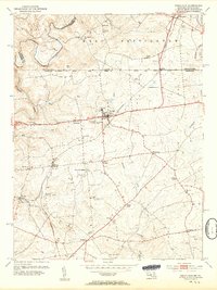
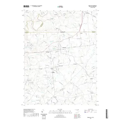
 1992 Rising Sun1993 Print · USGSMaryland's northern border country is captured here in the early 1990s, centering on the historic crossroads of Rising Sun. Genealogists and historians can trace the Mason and Dixon Line, the West Nottingham Academy, and local industry at the Wood Chromite Mine.
 - 1998 Map of Rising Sun, 2000 Print
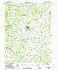
 1998 Rising Sun2000 Print · USGSIn the late 1990s, the Maryland-Pennsylvania borderlands remained a mix of historic institutional sites and industrial remnants. Researchers can trace the Mason and Dixon Line through Rising Sun or locate the Wood Chromite Mine and the historic West Nottingham Academy.
 - 2011 Map of Rising Sun, 2011 Print
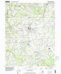
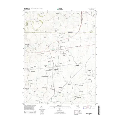
 2011 Rising Sun2011 Print · USGSCovers Sunrise Estates, including Little Britain Township, Rising Sun, and other nearby areas
 - 2014 Map of Rising Sun, 2014 Print
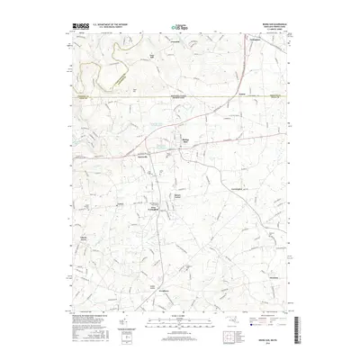
 2014 Rising Sun2014 Print · USGSCovers Sunrise Estates, including Little Britain Township, Rising Sun, and other nearby areas
 - 2016 Map of Rising Sun, 2016 Print
 2016 Rising Sun2016 Print · USGSCovers Sunrise Estates, including Little Britain Township, Rising Sun, and other nearby areas
 - 2019 Map of Rising Sun, 2019 Print
 2019 Rising Sun2019 Print · USGSCovers Sunrise Estates, including Little Britain Township, Rising Sun, and other nearby areas
 - 2023 Map of Rising Sun, 2023 Print
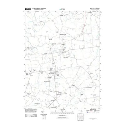
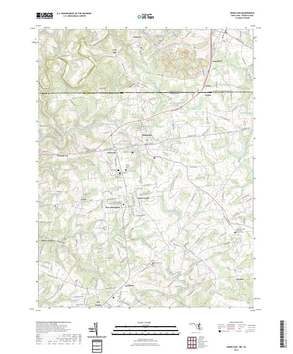 2023 Rising Sun2023 Print · USGSThe Maryland and Pennsylvania border comes alive in this survey of the Rising Sun area, where historic hamlets and family farmsteads dot the landscape. Genealogists can trace family roots at New Bridge Baptist Church Cem, Lees Mill, and the Krauss Family Cem.
End of results
Showing maps 1-17 of 17
Top cities near Sunrise Estates
- Elkton historical maps
- Aberdeen historical maps
- Havre de Grace historical maps
- New London Township historical maps
- Franklin Township historical maps
- Perryville historical maps
See more
Frequently asked questions
- What are the different types of historical maps available for Sunrise Estates?
- What is the oldest map of Sunrise Estates?
- Where can I purchase historical maps of Sunrise Estates for my home or office?
- Where can I download high-res historical maps of Sunrise Estates?
- Are there historical topographic maps available for Sunrise Estates?
- Is there historical aerial imagery available for Sunrise Estates?
- Where are historical maps of Sunrise Estates sourced from?