Old Maps of Church Creek, Maryland
Explore 28 old maps of Church Creek, spanning from 1898 to today. These high-resolution historic maps reveal how streets, neighborhoods, landmarks, and natural features evolved over time — perfect for genealogy, metal detecting, research, and local history exploration.
What you can do with these maps:
- See how Church Creek changed over time: Compare historical maps to modern-day views to trace roads, homesites, rail lines & more.
- View detailed metadata: Each map includes creators, publishers, year, scale, and archive source.
- Overlay maps with satellite & LiDAR: Visualize the past alongside modern tools to explore terrain & human change.
- Trusted historical sources: Maps sourced from the USGS, Library of Congress, and other archives.
- Access maps your way: View online, download high-res files, or order prints for personal or research use.
Start exploring old maps of Church Creek to uncover forgotten places, hidden landmarks, and the deep history beneath your feet.
Church Creek, MD maps
(28)- 1898 Map of Choptank
 1898 Choptank1898 Print · USGSThe Maryland Eastern Shore and its intricate Chesapeake coastline are documented here in the late 1890s. Genealogists can trace family roots in Annapolis or Easton, while maritime historians can locate historic landings such as Corners Wharf and Wye Landing.2 unique versions available
 - 1898 Map of St. Marys
 1898 St. Marys1898 Print · USGSMaryland's tidewater region is captured here in the late nineteenth century, showing the intricate geography of the lower Chesapeake. Genealogists can trace family roots through old landings and villages like Great Mills, Toddville, and Solomons.2 unique versions available
 - 1904 Map of Oxford
 1904 Oxford1904 Print · USGSCoastal Maryland at the start of the twentieth century was a world of steamships, rail landings, and tide-driven commerce. Genealogists can trace early homesteads and watermen's hubs near Cambridge, Oxford, and the landing at Trappe Ldg.3 unique versions available
 - 1905 Map of Crapo
 1905 Crapo1905 Print · USGSDorchester County at the turn of the century is a landscape of tide-water landings and island villages. Genealogists can trace family roots in Lakesville, Bucktown, and Hoopersville, or locate early maritime sites like Shorters Landing and the Steamboat Route.3 unique versions available
 - 1906 Map of St. Marys
 1906 St. Marys1906 Print · USGSChesapeake Bay and the Potomac River converge in this 1906 survey of the Maryland and Virginia tidewater. Historians can trace the region's maritime heritage through dozens of named landings and islands, from Solomons Id. to the remote reaches of Smith Island.4 unique versions available
 - 1908 Map of Choptank
 1908 Choptank1908 Print · USGSMaryland's Eastern Shore and the Chesapeake Bay are captured here at the start of the twentieth century, showing a world of steamships and rail. Genealogists can trace family names at St Michaels, Oxford, and waterfront landings like Claiborne or Arundel on the Bay.5 unique versions available
 - 1942 Map of Church Creek, 1958 Print
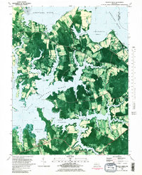
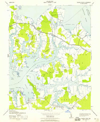 1942 Church Creek1958 Print · USGSThe Dorchester County tidewater region during the early 1940s is shown here through its intricate shoreline and rural peninsula settlements. Genealogists and historians can trace family roots through landmarks like Mace Cemetery, Gethsemane Church, and the village of Madison.2 unique versions available
 - 1942 Map of Golden Hill, 1961 Print
 1942 Golden Hill1961 Print · USGSDorchester County's tidal wetlands and coastal settlements are captured here in the early 1940s. Genealogists and historians can trace the specific boundaries of Woolford Plantation Pt and locate rural hubs like Golden Hill and Riggins Corner.2 unique versions available
 - 1943 Map of Church Creek
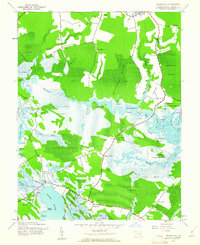
 1943 Church Creek1943 Print · USGSDorchester County's intricate tidal landscape is captured here during the early 1940s, showing a world of peninsulas and creek-side settlements. Genealogists can locate family names at Trinity Cemetery and trace historical footprints in Madison, Woolford, and Dailsville.
 - 1943 Map of Golden Hill
 1943 Golden Hill1943 Print · USGSDorchester County's tidal wetlands and scattered hamlets are captured in this mid-century survey as they appeared during the war years. Genealogists can trace family locations and old landings near Golden Hill, Riggins Corner, and the historic Woolford Plantation Pt.
 - 1948 Map of Washington
 1948 Washington1948 Print · USGSThe Potomac and Chesapeake regions in the late 1940s reveal a landscape of expanding military reach and deep-rooted Tidewater settlements. Trace old rail corridors like the Richmond Fredericksburg & Potomac RR or locate landmarks like the Wakefield Washington Monument and St. Marys College.2 unique versions available
 - 1957 Map of Washington, 1966 Print
 1957 Washington1966 Print · USGSThe mid-Atlantic region during the mid-fifties and early sixties reveals a landscape of growing suburbs and vital military outposts. Researchers can trace historic river towns and shorelines from Alexandria to the Hooper Islands and St Clements Island.5 unique versions available
 - 1961 Map of Washington
 1961 Washington1961 Print · USGSThe mid-Atlantic region in the late fifties is presented in remarkable detail, from the Blue Ridge foothills to the Chesapeake Eastern Shore. Researchers can trace historic river landings and military sites like Mount Vernon, Fort Belvoir, and Point Lookout.2 unique versions available
 - 1981 Map of Golden Hill, 1982 Print
 1981 Golden Hill1982 Print · USGSDorchester County's marshlands and coastal hamlets are captured here during the early eighties, showcasing the interface of land and water. Researchers can locate family landmarks like St Marys Star of the Sea Ch or trace the roads through Golden Hill and Woolford.2 unique versions available
 - 1982 Map of Church Creek
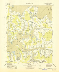
 1982 Church Creek1982 Print · USGSThe Dorchester County shoreline is revealed in this early 1980s survey, showing the intricate tidal necks and agricultural plots of the Eastern Shore. Trace local history at the St Johns Cem Chapel, or locate old crossroads in Cornersville and Dailsville.2 unique versions available
 - 1983 Map of Washington East, 1984 Print
 1983 Washington East1984 Print · USGSThe Chesapeake Bay region in the early eighties shows the Maryland capital and its suburbs meeting the maritime traditions of the Eastern Shore. Researchers can trace land patterns from Andrews Air Force Base to waterfront settlements like Oxford and Chesapeake Beach.2 unique versions available
 - 1983 Map of Leonardtown, 1984 Print
 1983 Leonardtown1984 Print · USGSSouthern Maryland and the Northern Neck of Virginia are shown in the early eighties as a mosaic of historic tidewater settlements and modern installations. Trace family roots and shoreline changes near St Marys City, Leonardtown, and Colonial Beach.2 unique versions available
 - 1989 Map of Washington
 1989 Washington1989 Print · USGSThe Potomac River valley and Chesapeake Bay are shown in comprehensive detail during the late 1980s. Genealogists and historians can trace the transition from urban Alexandria to the rural Northern Neck, locating landmarks like Mount Vernon and Stratford Hall.
 - 2011 Map of Church Creek, 2011 Print
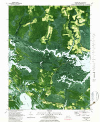
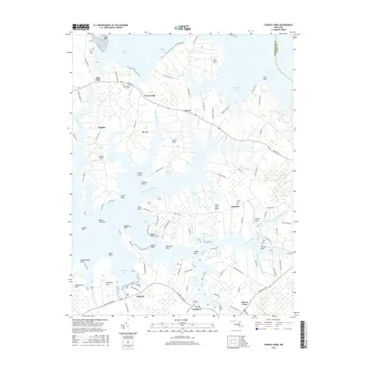
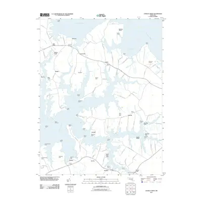 2011 Church Creek2011 Print · USGSCovers Church Creek, including Paw Paw Acres, Paw Paw Point, and other nearby areas
 - 2011 Map of Golden Hill, 2011 Print
 2011 Golden Hill2011 Print · USGSCovers Church Creek, including Gum Swamp, Walnut Landing, and other nearby areas
 - 2014 Map of Golden Hill, 2014 Print
 2014 Golden Hill2014 Print · USGSCovers Church Creek, including Gum Swamp, Walnut Landing, and other nearby areas
 - 2014 Map of Church Creek, 2014 Print
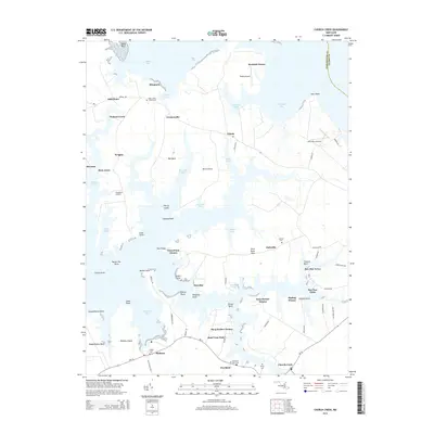 2014 Church Creek2014 Print · USGSCovers Church Creek, including Paw Paw Acres, Paw Paw Point, and other nearby areas
 - 2016 Map of Church Creek, 2016 Print
 2016 Church Creek2016 Print · USGSCovers Church Creek, including Paw Paw Acres, Paw Paw Point, and other nearby areas
 - 2016 Map of Golden Hill, 2016 Print
 2016 Golden Hill2016 Print · USGSCovers Church Creek, including Gum Swamp, Walnut Landing, and other nearby areas
 - 2019 Map of Golden Hill, 2019 Print
 2019 Golden Hill2019 Print · USGSCovers Church Creek, including Gum Swamp, Walnut Landing, and other nearby areas
Showing maps 1-25 of 28
Top cities near Church Creek
- Cambridge historical maps
- Trappe historical maps
- Oxford historical maps
- Secretary historical maps
- East New Market historical maps
- Choptank historical maps
See more
Frequently asked questions
- What are the different types of historical maps available for Church Creek?
- What is the oldest map of Church Creek?
- Where can I purchase historical maps of Church Creek for my home or office?
- Where can I download high-res historical maps of Church Creek?
- Are there historical topographic maps available for Church Creek?
- Is there historical aerial imagery available for Church Creek?
- Where are historical maps of Church Creek sourced from?