
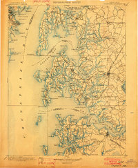
1898 Map of Choptank
USGS Topo · Published 1898About this map
Annapolis and its harbor anchor the northwestern corner of this maritime landscape, where the Severn River meets the expansive Chesapeake Bay. The late-nineteenth-century survey captures a complex network of coastal settlements and trade routes, from the agricultural heart of Easton to the seafaring communities on Kent Island. Transportation is defined by a reliance on both rail and water, with the Annapolis & Elkridge RR and Philadelphia Wilmington and Baltimore RR providing critical land links. Inland, small village centers such as Royal Oak and St. Michaels are interconnected by early roads and secondary trails. This era's topography reflects an economy tied to the tides, evidenced by numerous landings like Wye Landing and Foreman Landing, alongside essential maritime aids such as the Bloody Pt Bar Light.
Find a feature on this map
211 named features on this map. Tap any name to fly to it.
Don’t see what you’re looking for? This feature index may not catch every label — zoom into the map to look around manually.
Map Details
Editions of this 1898 Choptank Map
2 editions found
Other maps of this area

1892 · Leonardtown
USGS Topo · 1:62,500

1892 · Drum Point
USGS Topo · 1:62,500

1892 · Prince Frederick
USGS Topo · 1:62,500

1892 · Owensville
USGS Topo · 1:62,500

1892 · Annapolis
USGS Topo · 1:62,500

1893 · Sharps Island
USGS Topo · 1:62,500

1893 · North Point
USGS Topo · 1:62,500

1894 · Relay
USGS Topo · 1:62,500

1895 · Prince Frederick
USGS Topo · 1:62,500

1895 · Leonardtown
USGS Topo · 1:62,500