Old Maps of Hurlock, Maryland for Academic Research
Study the evolution of Hurlock with 36 high-resolution historic maps. Whether you're teaching, researching, or modeling changes in land use, these maps provide essential visual documentation of urban, environmental, and geographic change.
- Analyze long-term change: Track patterns in development, transportation, and natural features.
- Ideal for environmental or urban studies: Support academic projects with primary historical map data.
- Use in the classroom or lab: Educators and researchers rely on these maps to bring historical context to life.
These maps are a powerful tool for teaching, research, and visualizing how Hurlock has changed over the decades.
Hurlock, MD maps
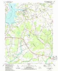
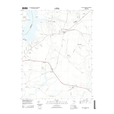
(36)- 1905 Map of Hurlock
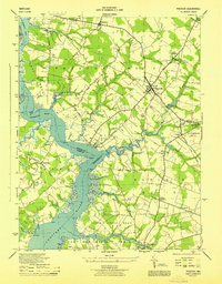
 1905 Hurlock1905 Print · USGSDorchester and Caroline Counties thrive on a river-and-rail economy at the turn of the century. Genealogists can trace family roots through landings and crossings like Tennalls Wharf, Harrison Ferry, and the junction at Hurlock.3 unique versions available
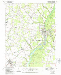
 - 1944 Map of Preston
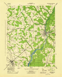
 1944 Preston1944 Print · USGSMaryland's Eastern Shore transitions from river commerce to rail-driven agriculture during the mid-forties. Genealogists can trace family roots through numerous local landmarks, from Wright Wharf to country churches like Coppins Chapel and Bethesda Ch.3 unique versions available
 - 1944 Map of Federalsburg
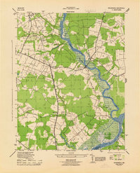
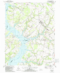
 1944 Federalsburg1944 Print · USGSThe Eastern Shore of Maryland in the mid-1940s centered on the rail and river trade through Federalsburg and Hurlock. Family historians can trace rural roots through landmarks like Solomons Temple Church, the ferry crossing at Harrison Ferry Bridge, and early railroad corridors.3 unique versions available
 - 1944 Map of East New Market
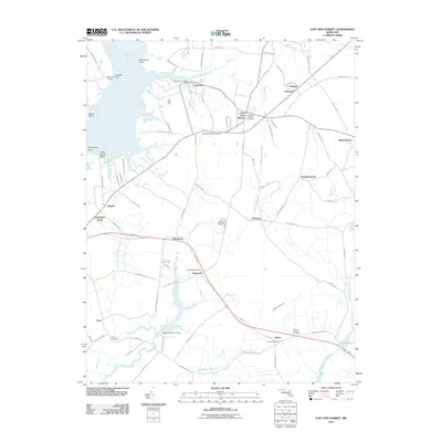
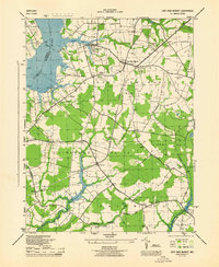 1944 East New Market1944 Print · USGSDorchester County during the mid-1940s is defined by its intricate waterways and the Pennsylvania Railroad. Genealogists and local historians can trace family roots through markers like St Stephens Church, the Hicksburg School, and the East New Market Cemetery.3 unique versions available
 - 1944 Map of Rhodesdale
 1944 Rhodesdale1944 Print · USGSThe rural landscape of the Eastern Shore is captured here at the height of the Second World War. Researchers can trace historical river landings like Walnut Landing and the route of the Baltimore and Eastern railroad through Rhodesdale.3 unique versions available
 - 1946 Map of Salisbury, 1948 Print
 1946 Salisbury1948 Print · USGSThe Delmarva Peninsula in the late nineteen-forties shows a landscape defined by its deep river arteries and emerging coastal defenses. Genealogists and historians can trace rail-connected towns like Federalsburg or locate maritime landmarks such as the Ocean City Seaplane Base and Fort Miles Military Reservation.4 unique versions available
 - 1947 Map of Salisbury, 1948 Print
 1947 Salisbury1948 Print · USGSThe Delmarva Peninsula in the late forties reveals a coastal landscape of maritime defense and growing seaside towns. Trace the post-war footprint of Salisbury, the strategic Fort Miles Military Reservation, and the Ocean City Seaplane Base.
 - 1948 Map of Salisbury, 1951 Print
 1948 Salisbury1951 Print · USGSThe Delmarva Peninsula in the late 1940s is shown here as a busy network of rail-towns and coastal outposts. Researchers can trace the legacy of the Pennsylvania Railroad through inland hubs like Georgetown or the maritime reaches of Crisfield and Cape May.
 - 1957 Map of Salisbury
 1957 Salisbury1957 Print · USGSThe Delmarva Peninsula in the mid-1950s reveals a landscape of coastal defenses and rail-driven commerce. Researchers can trace the Pennsylvania railroad lines or locate historic landmarks like the Fenwick Island Lighthouse and St Martin church.
 - 1961 Map of Salisbury
 1961 Salisbury1961 Print · USGSThe Delmarva Peninsula comes into focus in the early sixties, showing the vital road and rail networks connecting the Chesapeake to the Atlantic. Genealogists and historians can trace family-named landings and coastal landmarks from Crisfield to the Brandywine Shoal Lighthouse.
 - 1965 Map of Salisbury
 1965 Salisbury1965 Print · USGSThe Delmarva Peninsula in the mid-1960s is depicted here as a landscape of coastal defenses and maritime hubs. Genealogists and local historians can trace the foundations of bayside towns like Crisfield and the tactical positioning of the Fort Miles Military Reservation and Cape May Naval Air Station.
 - 1984 Map of Seaford, 1986 Print
 1984 Seaford1986 Print · USGSCoastal Delaware and the Maryland borderlands are captured here in the mid-eighties as modern tourism and traditional agriculture coexist. Researchers can trace the rail-and-river routes through Seaford, explore inland millponds like Chipman Pond, or study the shoreline at Cape Henlopen.2 unique versions available
 - 1988 Map of East New Market
 1988 East New Market1988 Print · USGSDorchester County's Eastern Shore interior is captured in the late eighties, showing the traditional crossroads and river landings of the Chesapeake. Genealogists can trace family footprints at East New Market Cemetery, Friendship Church, and the settlement of Secretary.
 - 1988 Map of Preston
 1988 Preston1988 Print · USGSThe Maryland Eastern Shore in the 1980s is defined by its deep river bends and rural crossroads. Researchers can trace family history through the Maryland Veterans Cem (Eastern Shore) and local settlements like Linchester, Bruceville, and Preston.
 - 1988 Map of Federalsburg
 1988 Federalsburg1988 Print · USGSMaryland's Eastern Shore comes to life in the late eighties as the towns of Federalsburg and Hurlock anchor a landscape of creeks and crossroads. Trace family roots and local history through rural landmarks like Friendship Ch, Harrison Ferry Bridge, and Browns Landing.
 - 1988 Map of Rhodesdale
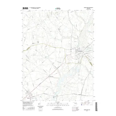
 1988 Rhodesdale1988 Print · USGSDorchester County's rural landscape is captured in the late eighties as it straddles the river-fed borders of the Eastern Shore. Genealogists and historians can trace family locations through McKendree Cem, the landing at Riverton, and agricultural settlements like Reids Grove.
 - 2011 Map of Rhodesdale, 2011 Print
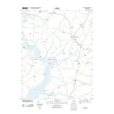
 2011 Rhodesdale2011 Print · USGSCovers Hurlock, including Brookview, Eldorado, and other nearby areas
 - 2011 Map of East New Market, 2011 Print
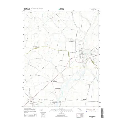
 2011 East New Market2011 Print · USGSCovers Hurlock, including Secretary, East New Market, and other nearby areas
 - 2011 Map of Preston, 2011 Print
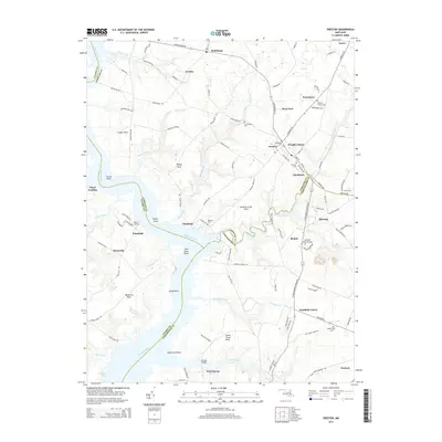
 2011 Preston2011 Print · USGSCovers Hurlock, including Preston, Choptank, and other nearby areas
 - 2011 Map of Federalsburg, 2011 Print
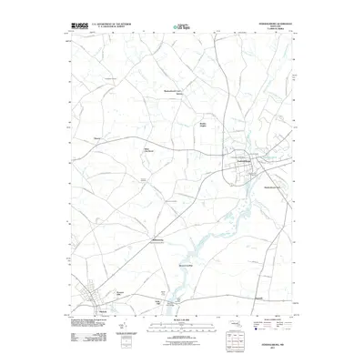 2011 Federalsburg2011 Print · USGSCovers Hurlock, including Federalsburg, Hynson, and other nearby areas
 - 2014 Map of Preston, 2014 Print
 2014 Preston2014 Print · USGSCovers Hurlock, including Preston, Choptank, and other nearby areas
 - 2014 Map of Federalsburg, 2014 Print
 2014 Federalsburg2014 Print · USGSCovers Hurlock, including Federalsburg, Hynson, and other nearby areas
 - 2014 Map of East New Market, 2014 Print
 2014 East New Market2014 Print · USGSCovers Hurlock, including Secretary, East New Market, and other nearby areas
 - 2014 Map of Rhodesdale, 2014 Print
 2014 Rhodesdale2014 Print · USGSCovers Hurlock, including Brookview, Eldorado, and other nearby areas
 - 2016 Map of Federalsburg, 2016 Print
 2016 Federalsburg2016 Print · USGSCovers Hurlock, including Federalsburg, Hynson, and other nearby areas
Showing maps 1-25 of 36
Top cities near Hurlock
- Salisbury historical maps
- Easton historical maps
- Cambridge historical maps
- Seaford historical maps
- Federalsburg historical maps
- Trappe historical maps
See more
Top neighborhoods of Hurlock
Frequently asked questions
- What are the different types of historical maps available for Hurlock?
- What is the oldest map of Hurlock?
- Where can I purchase historical maps of Hurlock for my home or office?
- Where can I download high-res historical maps of Hurlock?
- Are there historical topographic maps available for Hurlock?
- Is there historical aerial imagery available for Hurlock?
- Where are historical maps of Hurlock sourced from?