Old Maps of Churchville, Maryland for Metal Detecting
Plan your next treasure hunt with 18 historic maps of Churchville. Find old homesites, ghost towns, trails, and gathering spots that may be lost to time — perfect for identifying promising metal detecting locations.
- Locate forgotten sites: Uncover places like long-lost settlements, abandoned rail lines, or gathering spots.
- Plan better hunts: Use map overlays combined with LiDAR or satellite views to narrow in on historically rich areas.
- Made for detectorists: Thousands of hobbyists use these maps to discover relics, coins, and hidden history.
Use these historic maps to boost your research and find new opportunities beneath the surface of Churchville.
Churchville, MD maps
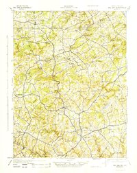
(18)- 1901 Map of Belair
 1901 Belair1901 Print · USGSThe Harford County borderlands at the start of the twentieth century show a landscape defined by rail corridors and early mining. Genealogists can trace family names and small settlements along the Maryland and Pennsylvania RR, such as Fawn Grove, McIntyre Minefield, and Delta.7 unique versions available
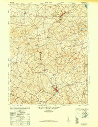
 - 1942 Map of Bel Air
 1942 Bel Air1942 Print · USGSHarford and York counties at the start of the 1940s show a landscape shaped by the Maryland and Pennsylvania R.R. and deep-cut creek valleys. Trace the local rail-and-mill economy through Clermont Mills, Whiteford, and the village of Delta near the state line.
 - 1945 Map of Bel Air
 1945 Bel Air1945 Print · USGSThe Maryland-Pennsylvania borderlands are captured here at the end of the war, centered on the winding Maryland and Pennsylvania R. R. corridor. Genealogists and historians can trace the early layout of Whiteford, Delta, and Clermont Mills as they appeared in the mid-1940s.
 - 1948 Map of Baltimore
 1948 Baltimore1948 Print · USGSMaryland and Pennsylvania crossroads are captured in the late 1940s, showing a landscape defined by historic rail lines and major military installations. Genealogists can trace family connections in Gettysburg, Westminster, and near the U.S. Naval Academy in Annapolis.2 unique versions available
 - 1948 Map of Belair
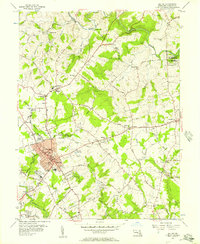
 1948 Belair1948 Print · USGSHarford County and southern York County appear at a mid-century crossroads as the post-war era begins. Researchers can trace the winding Maryland and Pennsylvania railroad, find several dozen country churches, and locate industrial relics like the Talc (Abandoned) mine.2 unique versions available
 - 1954 Map of Baltimore
 1954 Baltimore1954 Print · USGSThe Mid-Atlantic region in the early fifties shows a landscape of growing suburban centers and heavy rail corridors. Trace mid-century transit networks and military landmarks from the Aberdeen Proving Ground to the Gettysburg National Military Park.
 - 1956 Map of Baltimore
 1956 Baltimore1956 Print · USGSMid-century Maryland and Pennsylvania are captured here during a period of massive suburban and military growth across the Chesapeake region. Genealogists and historians can trace the rail corridors of the Baltimore & Ohio RR and locate landmarks like Fort McHenry or the Aberdeen Proving Ground.
 - 1956 Map of Bel Air, 1957 Print
 1956 Bel Air1957 Print · USGSHarford County's heart is captured here in the mid-fifties, showing the growth of Bel Air and its surrounding countryside. Researchers can trace family sites from Moores Mill to Churchville, locating numerous landmarks like St Ignatius Ch and Asbury Cem.4 unique versions available
 - 1957 Map of Baltimore, 1964 Print
 1957 Baltimore1964 Print · USGSMaryland and Southern Pennsylvania are shown during the mid-century expansion of the Baltimore-Washington corridor. Researchers can trace the extensive rail lines of the Baltimore & Ohio RR and locate sites like Fort Detrick and Gettysburg National Military Park.5 unique versions available
 - 1961 Map of Baltimore
 1961 Baltimore1961 Print · USGSMaryland and Pennsylvania are captured at a mid-century peak of industrial and military expansion. Genealogists and historians can trace rail corridors like the Western Maryland Ry or locate regional landmarks such as Camp Detrick and Kent Island.
 - 1963 Map of Belair
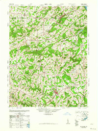 1963 Belair1963 Print · USGSHarford County and the Pennsylvania border are shown just after the war, when the Maryland and Pennsylvania RR still served these communities. Genealogists can locate family-named landmarks like the Broad Creek Meeting House, the Wheeler School, and St Ignatius Church.
 - 1983 Map of York, 1984 Print
 1983 York1984 Print · USGSSouth Central Pennsylvania and Northern Maryland meet along the Susquehanna during the early eighties. Genealogists and local historians can trace the transit networks of Conrail and Amtrak through towns like Red Lion and Seven Valleys.2 unique versions available
 - 1989 Map of Baltimore
 1989 Baltimore1989 Print · USGSThe Mid-Atlantic corridor in the late eighties is captured here, from the Baltimore harbor to the Blue Ridge foothills. Researchers can trace the sprawling footprints of Aberdeen Proving Ground, the historic grounds of Gettysburg National Military Park, and the winding Susquehanna River.
 - 2011 Map of Bel Air, 2011 Print
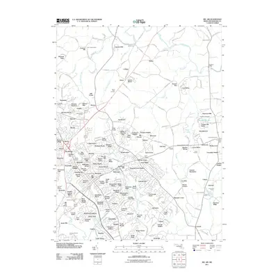 2011 Bel Air2011 Print · USGSCovers Churchville, including Bel Air, Thomas Run, and other nearby areas
 - 2014 Map of Bel Air, 2014 Print
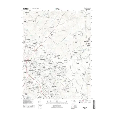 2014 Bel Air2014 Print · USGSCovers Churchville, including Bel Air, Thomas Run, and other nearby areas
 - 2016 Map of Bel Air, 2016 Print
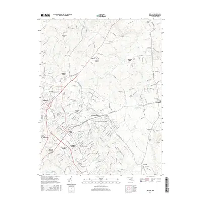 2016 Bel Air2016 Print · USGSCovers Churchville, including Bel Air, Thomas Run, and other nearby areas
 - 2019 Map of Bel Air, 2019 Print
 2019 Bel Air2019 Print · USGSCovers Churchville, including Bel Air, Thomas Run, and other nearby areas
 - 2023 Map of Bel Air, 2023 Print
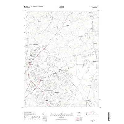
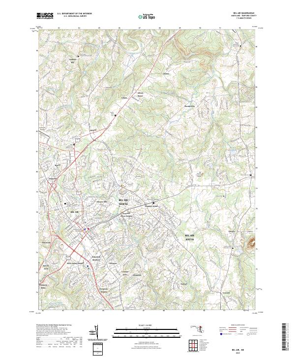 2023 Bel Air2023 Print · USGSHarford County is shown in its contemporary layout, balancing its role as a county seat with expansive suburban growth. Researchers can locate dozens of family-named sites and historic burial grounds, including Churchville Cem, the Harford County Courthouse, and Michaels Mill (Dam).
End of results
Showing maps 1-18 of 18
Top cities near Churchville
- Edgewood historical maps
- Forest Hill historical maps
- Aberdeen historical maps
- Havre de Grace historical maps
- Bel Air historical maps
- Fallston historical maps
See more
Frequently asked questions
- What are the different types of historical maps available for Churchville?
- What is the oldest map of Churchville?
- Where can I purchase historical maps of Churchville for my home or office?
- Where can I download high-res historical maps of Churchville?
- Are there historical topographic maps available for Churchville?
- Is there historical aerial imagery available for Churchville?
- Where are historical maps of Churchville sourced from?