Old Maps of Capitol Heights, Maryland
Explore 30 old maps of Capitol Heights, spanning from 1899 to today. These high-resolution historic maps reveal how streets, neighborhoods, landmarks, and natural features evolved over time — perfect for genealogy, metal detecting, research, and local history exploration.
What you can do with these maps:
- See how Capitol Heights changed over time: Compare historical maps to modern-day views to trace roads, homesites, rail lines & more.
- View detailed metadata: Each map includes creators, publishers, year, scale, and archive source.
- Overlay maps with satellite & LiDAR: Visualize the past alongside modern tools to explore terrain & human change.
- Trusted historical sources: Maps sourced from the USGS, Library of Congress, and other archives.
- Access maps your way: View online, download high-res files, or order prints for personal or research use.
Start exploring old maps of Capitol Heights to uncover forgotten places, hidden landmarks, and the deep history beneath your feet.
Capitol Heights, MD maps
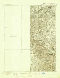
(30)- 1899 Map of Patuxent
 1899 Patuxent1899 Print · USGSSouthern Maryland in the late nineteenth century was a world of river wharves and emerging rail lines. Genealogists can trace family names across landings and settlements like Bladensburg, Upper Marlboro, and Piscataway Reform School before the landscape was modernised.3 unique versions available
 - 1900 Map of Washington
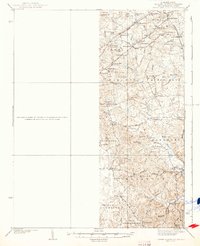
 1900 Washington1900 Print · USGSThe capital region at the turn of the century shows a landscape of river-borne commerce and expanding rail lines. Genealogists and historians can trace defunct transport links like the Shepherd Ferry and early suburbs like North Takoma and Jackson City.2 unique versions available
 - 1906 Map of Patuxent
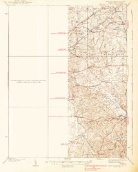
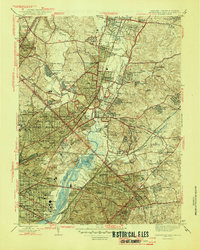
 1906 Patuxent1906 Print · USGSThe Tidewater region of Maryland and the outskirts of the District of Columbia are shown here at the turn of the century. Researchers can trace the early footprints of Maryland Agril. College, find riverfront infrastructure at Milltown Landing, and follow long-established routes like the Marlboro Turnpike.4 unique versions available
 - 1934 Map of Upper Marlboro (east half)
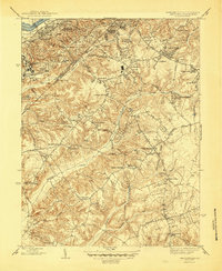
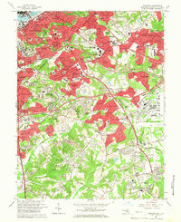
 1934 Upper Marlboro (east half)1934 Print · USGSPrince George's County is captured here in the mid-1930s as a rural landscape of crossroads communities and evolving rail lines. Genealogists and historians can trace family roots through landmarks like St Luke Ch, Glenarden Sch, and the route of the Chesapeake Beach RR.2 unique versions available
 - 1937 Map of Upper Marlboro
 1937 Upper Marlboro1937 Print · USGSMid-century Prince George’s County is captured here just as modern highways began to intersect its rural rail and school districts. Researchers can find old landmarks like St Barnabas Ch, the Collington Sch, and the busy Pennsylvania railroad line.
 - 1938 Map of Upper Marlboro
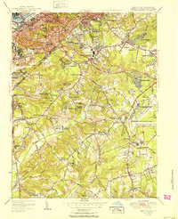
 1938 Upper Marlboro1938 Print · USGSPrince George's County at the dawn of the modern era is captured here, showing the rural landscape before the post-war expansion. Researchers can trace family sites near Holy Trinity Ch, follow the Pennsylvania RR line, and locate centers like Rosaryville and Glenn Dale.3 unique versions available
 - 1945 Map of Anacostia
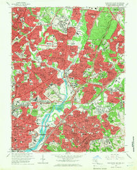
 1945 Anacostia1945 Print · USGSSoutheast D.C. and Prince George's County are captured here just before the massive post-war suburban boom. Genealogists and local historians can trace the foundations of communities like Silver Hill and Suitland, or locate family landmarks such as Gordons Corner and St Barnabas Ch.3 unique versions available
 - 1945 Map of Washington East
 1945 Washington East1945 Print · USGSThe eastern suburbs and District neighborhoods show a landscape of rapid mid-century growth along the Anacostia River and rail lines. Researchers can trace historic sites like Riggs Mill, the early aviation grounds of College Park Airport, and dozens of local schools including Taft Jr High Sch.
 - 1948 Map of Washington
 1948 Washington1948 Print · USGSThe Potomac and Chesapeake regions in the late 1940s reveal a landscape of expanding military reach and deep-rooted Tidewater settlements. Trace old rail corridors like the Richmond Fredericksburg & Potomac RR or locate landmarks like the Wakefield Washington Monument and St. Marys College.2 unique versions available
 - 1951 Map of Washington East
 1951 Washington East1951 Print · USGSThe Maryland and District of Columbia borderlands are caught in a period of intense post-war development. Local historians can trace the foundations of the University of Maryland, find the Franciscan Monastery, and locate vanished landmarks like Riggs Mill.
 - 1951 Map of Anacostia
 1951 Anacostia1951 Print · USGSPrince George's County and Southeast D.C. are seen here during their mid-century expansion, blending federal nerve centers with emerging suburban neighborhoods. Genealogists and local historians can trace family roots through the numerous legacy Hebrew Cems, St Johns Ch, and the grounds of St Elizabeths Hospital.
 - 1956 Map of Anacostia
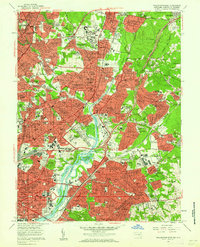
 1956 Anacostia1956 Print · USGSSoutheast Washington and Prince George's County are captured during a period of massive mid-century suburban and federal expansion. Genealogists and historians can trace the development of Fairfax Village, locate the Rosecroft Raceway, and find family sites at Cedar Hill Cem.2 unique versions available
 - 1956 Map of Washington East, 1959 Print
 1956 Washington East1959 Print · USGSThe northern reaches of the capital and its Maryland suburbs come into focus during the mid-fifties, showing a landscape defined by institutional campuses and rail lines. Genealogists and historians can trace significant burial grounds like Mt Olivet Cemetery or locate historic landmarks such as Bird Stadium and the National Training School for Boys.
 - 1957 Map of Washington East, 1962 Print
 1957 Washington East1962 Print · USGSThe eastern edges of the District and Maryland's inner suburbs are captured here at the height of post-war growth. Researchers can trace the mid-century layout of local landmarks like the National Arboretum, the College Park Airport, and Mt Olivet Cemetery.
 - 1957 Map of Washington, 1966 Print
 1957 Washington1966 Print · USGSThe mid-Atlantic region during the mid-fifties and early sixties reveals a landscape of growing suburbs and vital military outposts. Researchers can trace historic river towns and shorelines from Alexandria to the Hooper Islands and St Clements Island.5 unique versions available
 - 1961 Map of Washington
 1961 Washington1961 Print · USGSThe mid-Atlantic region in the late fifties is presented in remarkable detail, from the Blue Ridge foothills to the Chesapeake Eastern Shore. Researchers can trace historic river landings and military sites like Mount Vernon, Fort Belvoir, and Point Lookout.2 unique versions available
 - 1965 Map of Anacostia, 1966 Print
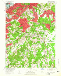
 1965 Anacostia1966 Print · USGSSoutheast Washington and Prince George's County are seen here in the mid-sixties as post-war suburban growth meets major federal installations. Trace the development of Hillcrest Heights and Forest Heights alongside institutions like Andrews Air Force Base and the Rosecroft Raceway.6 unique versions available
 - 1965 Map of Washington East, 1966 Print
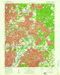
 1965 Washington East1966 Print · USGSThe Maryland-District of Columbia borderlands in the mid-sixties show a region of rapid suburban growth and established academic institutions. Researchers can trace the development of Hyattsville and College Park near the University of Maryland or locate family plots in Fort Lincoln Cemetery and Mt Olivet Cemetery.5 unique versions available
 - 1983 Map of Washington East, 1984 Print
 1983 Washington East1984 Print · USGSThe Chesapeake Bay region in the early eighties shows the Maryland capital and its suburbs meeting the maritime traditions of the Eastern Shore. Researchers can trace land patterns from Andrews Air Force Base to waterfront settlements like Oxford and Chesapeake Beach.2 unique versions available
 - 1989 Map of Washington
 1989 Washington1989 Print · USGSThe Potomac River valley and Chesapeake Bay are shown in comprehensive detail during the late 1980s. Genealogists and historians can trace the transition from urban Alexandria to the rural Northern Neck, locating landmarks like Mount Vernon and Stratford Hall.
 - 2011 Map of Anacostia, 2011 Print
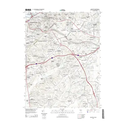
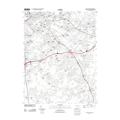 2011 Anacostia2011 Print · USGSCovers Capitol Heights, including Washington, Clinton, and other nearby areas
 - 2011 Map of Washington East, 2011 Print
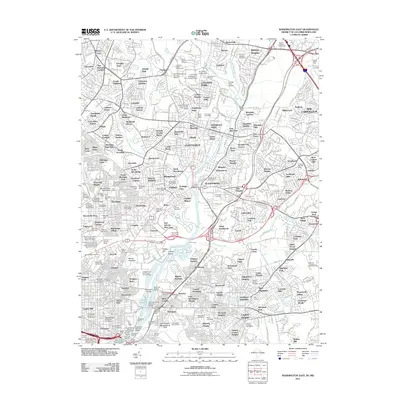 2011 Washington East2011 Print · USGSCovers Capitol Heights, including Washington, Silver Spring, and other nearby areas
 - 2014 Map of Washington East, 2014 Print
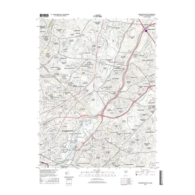
 2014 Washington East2014 Print · USGSCovers Capitol Heights, including Washington, Silver Spring, and other nearby areas
 - 2014 Map of Anacostia, 2014 Print
 2014 Anacostia2014 Print · USGSCovers Capitol Heights, including Washington, Clinton, and other nearby areas
 - 2016 Map of Washington East, 2016 Print
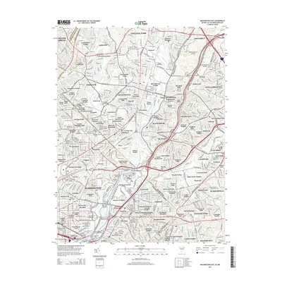
 2016 Washington East2016 Print · USGSCovers Capitol Heights, including Washington, Silver Spring, and other nearby areas
Showing maps 1-25 of 30
Top cities near Capitol Heights
- Washington historical maps
- Arlington historical maps
- Alexandria historical maps
- Silver Spring historical maps
- Bethesda historical maps
- Rockville historical maps
See more
Frequently asked questions
- What are the different types of historical maps available for Capitol Heights?
- What is the oldest map of Capitol Heights?
- Where can I purchase historical maps of Capitol Heights for my home or office?
- Where can I download high-res historical maps of Capitol Heights?
- Are there historical topographic maps available for Capitol Heights?
- Is there historical aerial imagery available for Capitol Heights?
- Where are historical maps of Capitol Heights sourced from?