Old Maps of Montpelier, Prince George's County for Genealogy
Trace your family roots with 25 historic maps of Montpelier. These high-res maps reveal old neighborhoods, homesites, landmarks, and streets — helping you uncover where your ancestors lived and how the area evolved over time.
- Explore historic neighborhoods: Identify where your relatives may have lived in the 1800s or 1900s.
- Compare maps over time: Trace the changes in streets, buildings, and landmarks for multi-generational research.
- Perfect for genealogy & ancestry research: Used by family historians and researchers to map out lineage and migration.
These maps are an incredible resource for exploring your personal connection to Montpelier's past.
Montpelier, Prince George's County maps
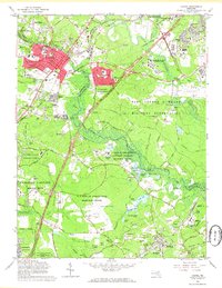
(25)- 1892 Map of Laurel
 1892 Laurel1892 Print · USGSCentral Maryland at the end of the nineteenth century centers on the busy corridor between Baltimore and Washington. Genealogists and historians can trace rail-side industrial sites like Muirkirk, family-named crossings at Snell Bridge, and numerous Iron Ore deposits.
 - 1894 Map of Laurel
 1894 Laurel1894 Print · USGSMaryland's central corridor in the 1890s reveals a landscape of growing rail towns and early industrial activity between major cities. Genealogists and historians can trace family-named crossroads and rail stops from Savage Sta. and Annapolis Junc. to the iron deposits near Muirkirk.4 unique versions available
 - 1897 Map of Laurel
 1897 Laurel1897 Print · USGSMaryland's central corridor comes to life in the 1890s, capturing the rail-and-river economy where Howard and Prince George's counties meet. Researchers can trace historic stops along the Baltimore and Ohio RR, locate local Iron Ore pits, and find old community hubs like Savage Sta. and Oakland Mills.
 - 1907 Map of Laurel
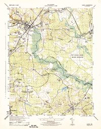
 1907 Laurel1907 Print · USGSMaryland's transit corridor between Washington and Baltimore comes alive in the early 1900s as railroads and old turnpikes cross the Patuxent valley. Trace historical landmarks from the House of Reformation to old crossings like Old Forge Bridge and Brock Bridge.3 unique versions available
 - 1908 Map of Patapsco
 1908 Patapsco1908 Print · USGSMaryland's central corridor at the opening of the twentieth century reveals a dense network of harbor defenses and rail-line economies. Genealogists and historians can trace the foundations of Baltimore alongside local landmarks like Ashland Furnace, St Charles College, and Fort McHenry.4 unique versions available
 - 1926 Map of Laurel
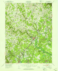
 1926 Laurel1926 Print · USGSThe corridor between Baltimore and Washington is captured here in the mid-twenties, showcasing a landscape of river-powered industry and early rail networks. Genealogists can locate family landmarks like Hicks Mill, the Willis School, and the Montgomery Chapel Cem.4 unique versions available
 - 1942 Map of Laurel
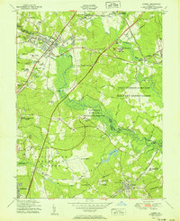
 1942 Laurel1942 Print · USGSMaryland's corridor between Baltimore and Washington is seen here in the early 1940s as a land of rural schoolhouses and riverside mills. Researchers can trace family sites near Muirkirk, find the original Christian Brothers College, or locate historic river crossings like Brock Bridge and Duvall Bridge.
 - 1944 Map of Laurel
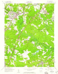
 1944 Laurel1944 Print · USGSMaryland's interior between Baltimore and Washington shows a landscape of federal research and military activity during the war years. Genealogists and historians can trace the foundations of Greenbelt, the historic Laurel Race Track, and the specialized facilities of the Beltsville Research Center.
 - 1948 Map of Baltimore
 1948 Baltimore1948 Print · USGSMaryland and Pennsylvania crossroads are captured in the late 1940s, showing a landscape defined by historic rail lines and major military installations. Genealogists can trace family connections in Gettysburg, Westminster, and near the U.S. Naval Academy in Annapolis.2 unique versions available
 - 1949 Map of Laurel, 1954 Print
 1949 Laurel1954 Print · USGSMaryland's corridor between Baltimore and Washington was a hub of federal research and military activity during the late 1940s. Researchers can trace the layout of the Fort George G Meade Military Reservation and historic sites like Savage Station or the Maryland State Teachers College.2 unique versions available
 - 1951 Map of Laurel
 1951 Laurel1951 Print · USGSThe mid-century Maryland corridor between D.C. and Baltimore shows a region in transition as major parkways and research centers emerge. Researchers can trace the development of Fort Meade or find family history at Perkins Chapel and the Laurel Race Track.
 - 1954 Map of Baltimore
 1954 Baltimore1954 Print · USGSThe Mid-Atlantic region in the early fifties shows a landscape of growing suburban centers and heavy rail corridors. Trace mid-century transit networks and military landmarks from the Aberdeen Proving Ground to the Gettysburg National Military Park.
 - 1956 Map of Baltimore
 1956 Baltimore1956 Print · USGSMid-century Maryland and Pennsylvania are captured here during a period of massive suburban and military growth across the Chesapeake region. Genealogists and historians can trace the rail corridors of the Baltimore & Ohio RR and locate landmarks like Fort McHenry or the Aberdeen Proving Ground.
 - 1957 Map of Laurel, 1960 Print
 1957 Laurel1960 Print · USGSMaryland's corridor between D.C. and Baltimore shows a mix of institutional growth and rural landscapes in the 1950s. Trace the grounds of the Laurel Race Track, the Fort George G Meade Military Reservation, and historic schools like Phair Sch.2 unique versions available
 - 1957 Map of Baltimore, 1964 Print
 1957 Baltimore1964 Print · USGSMaryland and Southern Pennsylvania are shown during the mid-century expansion of the Baltimore-Washington corridor. Researchers can trace the extensive rail lines of the Baltimore & Ohio RR and locate sites like Fort Detrick and Gettysburg National Military Park.5 unique versions available
 - 1961 Map of Baltimore
 1961 Baltimore1961 Print · USGSMaryland and Pennsylvania are captured at a mid-century peak of industrial and military expansion. Genealogists and historians can trace rail corridors like the Western Maryland Ry or locate regional landmarks such as Camp Detrick and Kent Island.
 - 1965 Map of Laurel, 1966 Print
 1965 Laurel1966 Print · USGSMaryland during the mid-sixties transition shows a landscape of federal expansion and established local identity. Trace the development of Laurel and Bowie alongside major institutions like the National Security Agency and Bowie State College.4 unique versions available
 - 1981 Map of Laurel, 1986 Print
 1981 Laurel1986 Print · USGSThe Patuxent River valley in the early 1980s reveals a Maryland landscape in the midst of significant suburban transformation. Researchers can trace the development of Laurel and Maryland City alongside water landmarks like Cash Lake and the Baltimore Washington Parkway.
 - 1984 Map of Baltimore
 1984 Baltimore1984 Print · USGSThe Baltimore and Annapolis corridor in the mid-eighties shows a landscape of rapid suburban growth and deep-seated maritime history. Researchers can trace the massive footprints of the U S Naval Academy, Fort George G Meade, and Goddard Space Flight Ctr.
 - 1989 Map of Baltimore
 1989 Baltimore1989 Print · USGSThe Mid-Atlantic corridor in the late eighties is captured here, from the Baltimore harbor to the Blue Ridge foothills. Researchers can trace the sprawling footprints of Aberdeen Proving Ground, the historic grounds of Gettysburg National Military Park, and the winding Susquehanna River.
 - 2011 Map of Laurel, 2011 Print
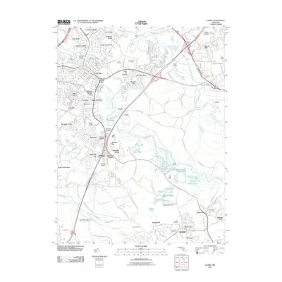 2011 Laurel2011 Print · USGSCovers Montpelier, including Bowie, South Laurel, and other nearby areas
 - 2014 Map of Laurel, 2014 Print
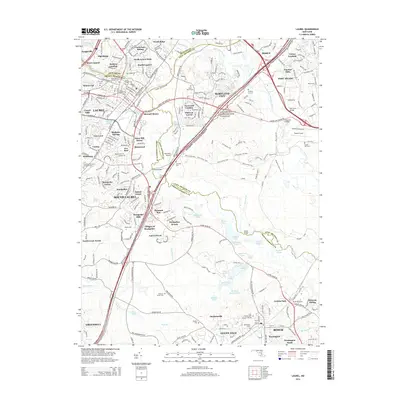 2014 Laurel2014 Print · USGSCovers Montpelier, including Bowie, South Laurel, and other nearby areas
 - 2016 Map of Laurel, 2016 Print
 2016 Laurel2016 Print · USGSCovers Montpelier, including Bowie, South Laurel, and other nearby areas
 - 2019 Map of Laurel, 2019 Print
 2019 Laurel2019 Print · USGSCovers Montpelier, including Bowie, South Laurel, and other nearby areas
 - 2023 Map of Laurel, 2023 Print
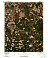
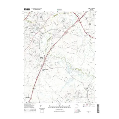
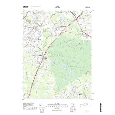
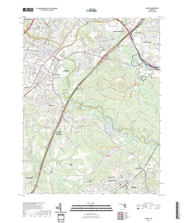 2023 Laurel2023 Print · USGSThe corridor between Baltimore and Washington comes into focus in this recent survey of the Prince George's and Anne Arundel county lines. Researchers can pinpoint historic family sites like the Snowden Family Cem and the grounds of Capitol Technology University.
End of results
Showing maps 1-25 of 25
Frequently asked questions
- What are the different types of historical maps available for Montpelier?
- What is the oldest map of Montpelier?
- Where can I purchase historical maps of Montpelier for my home or office?
- Where can I download high-res historical maps of Montpelier?
- Are there historical topographic maps available for Montpelier?
- Is there historical aerial imagery available for Montpelier?
- Where are historical maps of Montpelier sourced from?