Old Maps of Breton Beach, Maryland for Metal Detecting
Plan your next treasure hunt with 19 historic maps of Breton Beach. Find old homesites, ghost towns, trails, and gathering spots that may be lost to time — perfect for identifying promising metal detecting locations.
- Locate forgotten sites: Uncover places like long-lost settlements, abandoned rail lines, or gathering spots.
- Plan better hunts: Use map overlays combined with LiDAR or satellite views to narrow in on historically rich areas.
- Made for detectorists: Thousands of hobbyists use these maps to discover relics, coins, and hidden history.
Use these historic maps to boost your research and find new opportunities beneath the surface of Breton Beach.
Breton Beach, MD maps
(19)- 1892 Map of Piney Point
 1892 Piney Point1892 Print · USGSThe Potomac River tidewater is captured in the early 1890s, bridging the maritime communities of Maryland and Virginia. Genealogists can trace family lands near Kinsale, Nomini Grove, and the historic crossing at Mount Holly (Nomini Ferry).
 - 1894 Map of Piney Point
 1894 Piney Point1894 Print · USGSThe Lower Potomac during the late nineteenth century was a world of landings, ferries, and river-dependent villages. Genealogists and historians can trace old homesteads and crossings near Mount Holly (Nomini Ferry), Kinsale, and Valley Lee.
 - 1895 Map of Nomini
 1895 Nomini1895 Print · USGSSouthern Maryland and the Virginia tidewater shores meet along the Potomac in this late nineteenth-century survey. Genealogists can trace family holdings and river landings from Charlotte Hall down to Sotterly and the Nomini Ferry.
 - 1895 Map of Piney Point
 1895 Piney Point1895 Print · USGSThe Potomac River and its intricate Virginia and Maryland shorelines are revealed here in the late nineteenth century. Genealogists can trace family roots through landings and settlements like Kinsale, Hague, and Mount Holly (Nomini Ferry).
 - 1898 Map of Nomini
 1898 Nomini1898 Print · USGSMaryland and Virginia's Tidewater region comes alive in the late nineteenth century as a world of river landings, rail terminals, and rural crossroads. Researchers can trace the maritime economy through Nomini Ferry and Stone Wharf, or locate ancestral homesteads near Charlotte Hall and Potomac Mills.5 unique versions available
 - 1901 Map of Piney Point
 1901 Piney Point1901 Print · USGSThe Potomac River tidewater at the opening of the twentieth century was a landscape of remote landings and river-bound commerce. Researchers can trace historic ferry crossings at Mount Holly, find the L.H. at Piney Point, or locate old mill sites like Clifton Mills.5 unique versions available
 - 1943 Map of Blakiston Island
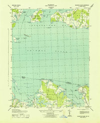 1943 Blakiston Island1943 Print · USGSThe Potomac River and its sprawling bays are captured here in the mid-1940s, showing a strategic landscape of military activity and coastal life. Researchers can trace landforms and local points like the Proving Ground on Newtown Neck and the Blakiston I Lighthouse.
 - 1948 Map of Washington
 1948 Washington1948 Print · USGSThe Potomac and Chesapeake regions in the late 1940s reveal a landscape of expanding military reach and deep-rooted Tidewater settlements. Trace old rail corridors like the Richmond Fredericksburg & Potomac RR or locate landmarks like the Wakefield Washington Monument and St. Marys College.2 unique versions available
 - 1953 Map of Blakiston Island
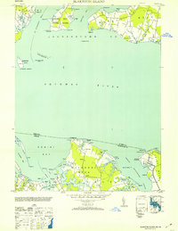 1953 Blakiston Island1953 Print · USGSThe Potomac River shoreline near St. Mary's and Westmoreland County is captured here in the early fifties, showing a landscape defined by tidewater inlets and maritime activity. Researchers can trace land tracts on Machodoc Neck or locate the Blakiston I Lighthouse and the Proving Ground near Newtown.2 unique versions available
 - 1957 Map of Washington, 1966 Print
 1957 Washington1966 Print · USGSThe mid-Atlantic region during the mid-fifties and early sixties reveals a landscape of growing suburbs and vital military outposts. Researchers can trace historic river towns and shorelines from Alexandria to the Hooper Islands and St Clements Island.5 unique versions available
 - 1961 Map of Washington
 1961 Washington1961 Print · USGSThe mid-Atlantic region in the late fifties is presented in remarkable detail, from the Blue Ridge foothills to the Chesapeake Eastern Shore. Researchers can trace historic river landings and military sites like Mount Vernon, Fort Belvoir, and Point Lookout.2 unique versions available
 - 1968 Map of St Clements Island, 1972 Print
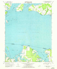 1968 St Clements Island1972 Print · USGSThe Potomac River shoreline at the Maryland and Virginia border is captured here during the late sixties, showing the transition from rural landings to coastal communities. Local researchers can trace family-named points and coves like Blue Sow, Coles Point, and the landmark Stone Cross on St Clements Island.5 unique versions available
 - 1983 Map of Leonardtown, 1984 Print
 1983 Leonardtown1984 Print · USGSSouthern Maryland and the Northern Neck of Virginia are shown in the early eighties as a mosaic of historic tidewater settlements and modern installations. Trace family roots and shoreline changes near St Marys City, Leonardtown, and Colonial Beach.2 unique versions available
 - 1989 Map of Washington
 1989 Washington1989 Print · USGSThe Potomac River valley and Chesapeake Bay are shown in comprehensive detail during the late 1980s. Genealogists and historians can trace the transition from urban Alexandria to the rural Northern Neck, locating landmarks like Mount Vernon and Stratford Hall.
 - 2011 Map of Saint Clements Island, 2011 Print
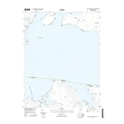
 2011 Saint Clements Island2011 Print · USGSCovers Breton Beach, including Coles Point, Meter, and other nearby areas
 - 2014 Map of Saint Clements Island, 2014 Print
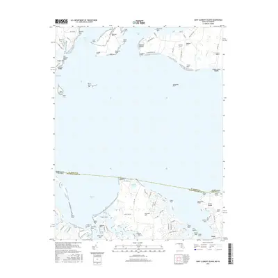
 2014 Saint Clements Island2014 Print · USGSCovers Breton Beach, including Coles Point, Meter, and other nearby areas
 - 2016 Map of Saint Clements Island, 2016 Print
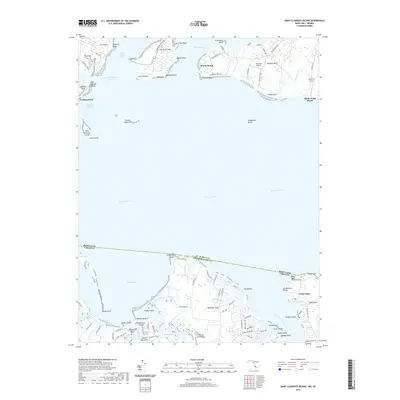
 2016 Saint Clements Island2016 Print · USGSCovers Breton Beach, including Coles Point, Meter, and other nearby areas
 - 2019 Map of Saint Clements Island, 2019 Print
 2019 Saint Clements Island2019 Print · USGSCovers Breton Beach, including Coles Point, Meter, and other nearby areas
 - 2023 Map of Saint Clements Island, 2023 Print
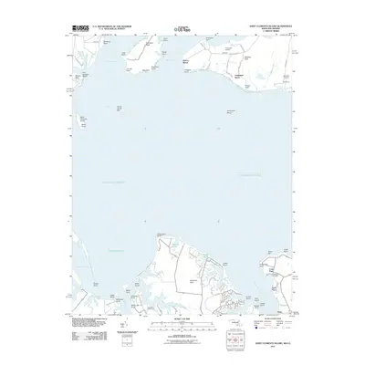
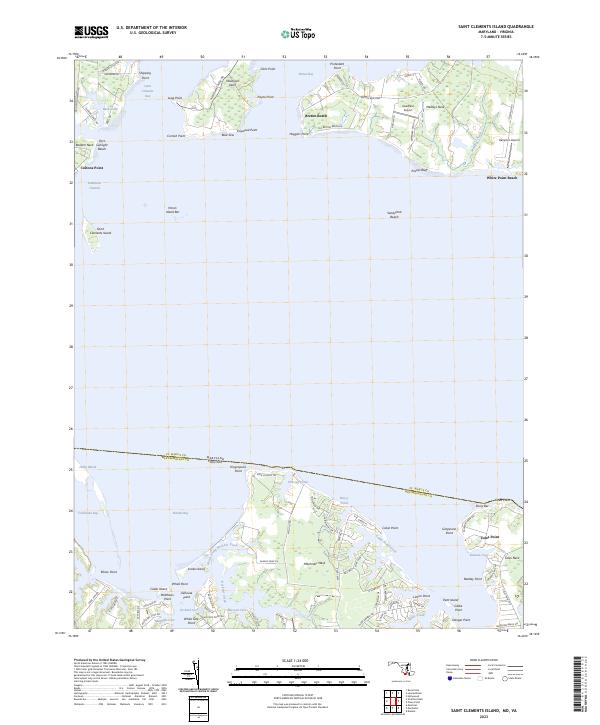 2023 Saint Clements Island2023 Print · USGSThe Potomac River crossings and colonial-era tidewater peninsulas of Maryland and Virginia are detailed in this recent coastal survey. Researchers can trace landforms and local hubs like Coltons Point, Saint Clements Island, and the waterfront at Coles Point.
End of results
Showing maps 1-19 of 19
Top cities near Breton Beach
- Lexington Park historical maps
- California historical maps
- Wildewood historical maps
- Leonardtown historical maps
- Callaway historical maps
- Mechanicsville historical maps
See more
Frequently asked questions
- What are the different types of historical maps available for Breton Beach?
- What is the oldest map of Breton Beach?
- Where can I purchase historical maps of Breton Beach for my home or office?
- Where can I download high-res historical maps of Breton Beach?
- Are there historical topographic maps available for Breton Beach?
- Is there historical aerial imagery available for Breton Beach?
- Where are historical maps of Breton Beach sourced from?