Old Maps of Hotton Acres, Salisbury for Metal Detecting
Plan your next treasure hunt with 16 historic maps of Hotton Acres. Find old homesites, ghost towns, trails, and gathering spots that may be lost to time — perfect for identifying promising metal detecting locations.
- Locate forgotten sites: Uncover places like long-lost settlements, abandoned rail lines, or gathering spots.
- Plan better hunts: Use map overlays combined with LiDAR or satellite views to narrow in on historically rich areas.
- Made for detectorists: Thousands of hobbyists use these maps to discover relics, coins, and hidden history.
Use these historic maps to boost your research and find new opportunities beneath the surface of Hotton Acres.
Hotton Acres, Salisbury maps
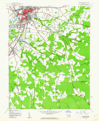
(16)- 1901 Map of Salisbury
 1901 Salisbury1901 Print · USGSWicomico County at the turn of the century centered on the steamboat and rail traffic through Salisbury. Trace historic family-named locations and rural infrastructure like Fooks School, Minksville, and the steam route at Shad Pt.4 unique versions available
 - 1942 Map of Salisbury, 1962 Print
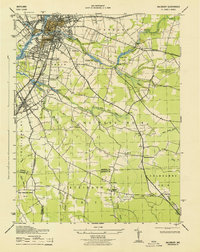
 1942 Salisbury1962 Print · USGSMaryland's Eastern Shore hub of Salisbury and the nearby settlement of Fruitland are seen here in the early 1940s. Genealogists and historians can trace rail routes like the Pennsylvania RR and find rural landmarks like St Lukes Ch and the Wicomico Orphanage.2 unique versions available
 - 1943 Map of Salisbury
 1943 Salisbury1943 Print · USGSWicomico County at the height of the war years reveals a bustling Salisbury and the surrounding agricultural tidewater districts. Researchers can trace historic family properties near Nassawango Church, Mt Hermon, and along the Pennsylvania Railroad corridor.
 - 1946 Map of Salisbury, 1948 Print
 1946 Salisbury1948 Print · USGSThe Delmarva Peninsula in the late nineteen-forties shows a landscape defined by its deep river arteries and emerging coastal defenses. Genealogists and historians can trace rail-connected towns like Federalsburg or locate maritime landmarks such as the Ocean City Seaplane Base and Fort Miles Military Reservation.4 unique versions available
 - 1947 Map of Salisbury, 1948 Print
 1947 Salisbury1948 Print · USGSThe Delmarva Peninsula in the late forties reveals a coastal landscape of maritime defense and growing seaside towns. Trace the post-war footprint of Salisbury, the strategic Fort Miles Military Reservation, and the Ocean City Seaplane Base.
 - 1948 Map of Salisbury, 1951 Print
 1948 Salisbury1951 Print · USGSThe Delmarva Peninsula in the late 1940s is shown here as a busy network of rail-towns and coastal outposts. Researchers can trace the legacy of the Pennsylvania Railroad through inland hubs like Georgetown or the maritime reaches of Crisfield and Cape May.
 - 1957 Map of Salisbury
 1957 Salisbury1957 Print · USGSThe Delmarva Peninsula in the mid-1950s reveals a landscape of coastal defenses and rail-driven commerce. Researchers can trace the Pennsylvania railroad lines or locate historic landmarks like the Fenwick Island Lighthouse and St Martin church.
 - 1961 Map of Salisbury
 1961 Salisbury1961 Print · USGSThe Delmarva Peninsula comes into focus in the early sixties, showing the vital road and rail networks connecting the Chesapeake to the Atlantic. Genealogists and historians can trace family-named landings and coastal landmarks from Crisfield to the Brandywine Shoal Lighthouse.
 - 1965 Map of Salisbury
 1965 Salisbury1965 Print · USGSThe Delmarva Peninsula in the mid-1960s is depicted here as a landscape of coastal defenses and maritime hubs. Genealogists and local historians can trace the foundations of bayside towns like Crisfield and the tactical positioning of the Fort Miles Military Reservation and Cape May Naval Air Station.
 - 1982 Map of Salisbury, 1983 Print
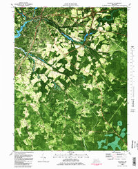 1982 Salisbury1983 Print · USGSThe Lower Eastern Shore enters the early eighties with Salisbury at its heart, showing a mix of college-town growth and rural timberlands. Trace the local landscape from Salisbury State College to the quiet reaches of the Pocomoke State Forest.2 unique versions available
 - 1983 Map of Salisbury, 1984 Print
 1983 Salisbury1984 Print · USGSThe Lower Eastern Shore was a landscape of tide and timber in the early eighties, from the bustling streets of Salisbury to the wild coast of Assateague Island. Researchers can trace the rail-and-road network of the Conrail and U S Highway 50 while locating historic centers like Princess Anne and Crisfield.
 - 2011 Map of Salisbury, 2011 Print
 2011 Salisbury2011 Print · USGSCovers Hotton Acres, including Salisbury, Fruitland, and other nearby areas
 - 2014 Map of Salisbury, 2014 Print
 2014 Salisbury2014 Print · USGSCovers Hotton Acres, including Salisbury, Fruitland, and other nearby areas
 - 2016 Map of Salisbury, 2016 Print
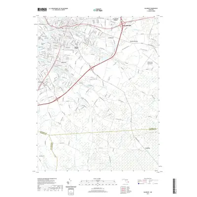
 2016 Salisbury2016 Print · USGSCovers Hotton Acres, including Salisbury, Fruitland, and other nearby areas
 - 2019 Map of Salisbury, 2019 Print
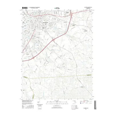
 2019 Salisbury2019 Print · USGSCovers Hotton Acres, including Salisbury, Fruitland, and other nearby areas
 - 2023 Map of Salisbury, 2023 Print
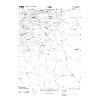
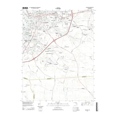
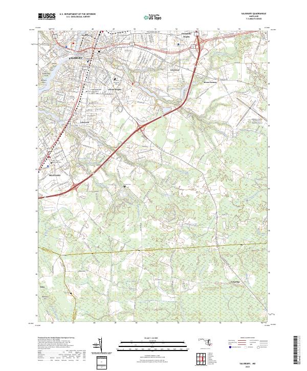 2023 Salisbury2023 Print · USGSThe Delmarva landscape around Salisbury comes into focus in this recent survey, capturing the city’s growth alongside its riverine heritage. Researchers can trace local history through sites like the Wicomico County Courthouse, Salisbury University, and the waters of Coulbourn Millpond.
End of results
Showing maps 1-16 of 16
Top cities near Hotton Acres
- Salisbury historical maps
- Fruitland historical maps
- Delmar historical maps
- Laurel historical maps
- Princess Anne historical maps
- Millsboro historical maps
See more
Frequently asked questions
- What are the different types of historical maps available for Hotton Acres?
- What is the oldest map of Hotton Acres?
- Where can I purchase historical maps of Hotton Acres for my home or office?
- Where can I download high-res historical maps of Hotton Acres?
- Are there historical topographic maps available for Hotton Acres?
- Is there historical aerial imagery available for Hotton Acres?
- Where are historical maps of Hotton Acres sourced from?