Old Maps of Indiantown, Maryland
Explore 16 old maps of Indiantown, spanning from 1901 to today. These high-resolution historic maps reveal how streets, neighborhoods, landmarks, and natural features evolved over time — perfect for genealogy, metal detecting, research, and local history exploration.
What you can do with these maps:
- See how Indiantown changed over time: Compare historical maps to modern-day views to trace roads, homesites, rail lines & more.
- View detailed metadata: Each map includes creators, publishers, year, scale, and archive source.
- Overlay maps with satellite & LiDAR: Visualize the past alongside modern tools to explore terrain & human change.
- Trusted historical sources: Maps sourced from the USGS, Library of Congress, and other archives.
- Access maps your way: View online, download high-res files, or order prints for personal or research use.
Start exploring old maps of Indiantown to uncover forgotten places, hidden landmarks, and the deep history beneath your feet.
Indiantown, MD maps
(16)- 1901 Map of Snow Hill
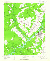
 1901 Snow Hill1901 Print · USGSSnow Hill and the surrounding Worcester County wetlands are captured at the opening of the twentieth century, when the Pocomoke River was a vital Steamboat Route. Researchers can trace the Waterman culture through historic sites like Public Landing and the railway hubs at Girdletree and Stockton.4 unique versions available
 - 1942 Map of Snow Hill, 1962 Print
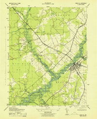
 1942 Snow Hill1962 Print · USGSSnow Hill and the winding Pocomoke River are captured in the early 1940s, showing a landscape of state forests and riparian landings. Genealogists and historians can trace the Pennsylvania rail line or locate rural landmarks like the Nassawango Ch and the historic Furnace site.
 - 1943 Map of Snow Hill
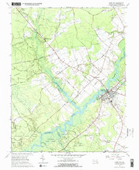
 1943 Snow Hill1943 Print · USGSSnow Hill and the surrounding Worcester County wetlands are captured here during the early years of the war. Genealogists and historians can trace the Pennsylvania RR line to sites like Scarboro, Nassawango Church, and the river landings at Mattaponi Landing.
 - 1946 Map of Salisbury, 1948 Print
 1946 Salisbury1948 Print · USGSThe Delmarva Peninsula in the late nineteen-forties shows a landscape defined by its deep river arteries and emerging coastal defenses. Genealogists and historians can trace rail-connected towns like Federalsburg or locate maritime landmarks such as the Ocean City Seaplane Base and Fort Miles Military Reservation.4 unique versions available
 - 1947 Map of Salisbury, 1948 Print
 1947 Salisbury1948 Print · USGSThe Delmarva Peninsula in the late forties reveals a coastal landscape of maritime defense and growing seaside towns. Trace the post-war footprint of Salisbury, the strategic Fort Miles Military Reservation, and the Ocean City Seaplane Base.
 - 1948 Map of Salisbury, 1951 Print
 1948 Salisbury1951 Print · USGSThe Delmarva Peninsula in the late 1940s is shown here as a busy network of rail-towns and coastal outposts. Researchers can trace the legacy of the Pennsylvania Railroad through inland hubs like Georgetown or the maritime reaches of Crisfield and Cape May.
 - 1957 Map of Salisbury
 1957 Salisbury1957 Print · USGSThe Delmarva Peninsula in the mid-1950s reveals a landscape of coastal defenses and rail-driven commerce. Researchers can trace the Pennsylvania railroad lines or locate historic landmarks like the Fenwick Island Lighthouse and St Martin church.
 - 1961 Map of Salisbury
 1961 Salisbury1961 Print · USGSThe Delmarva Peninsula comes into focus in the early sixties, showing the vital road and rail networks connecting the Chesapeake to the Atlantic. Genealogists and historians can trace family-named landings and coastal landmarks from Crisfield to the Brandywine Shoal Lighthouse.
 - 1965 Map of Salisbury
 1965 Salisbury1965 Print · USGSThe Delmarva Peninsula in the mid-1960s is depicted here as a landscape of coastal defenses and maritime hubs. Genealogists and local historians can trace the foundations of bayside towns like Crisfield and the tactical positioning of the Fort Miles Military Reservation and Cape May Naval Air Station.
 - 1966 Map of Snow Hill, 1968 Print
 1966 Snow Hill1968 Print · USGSSnow Hill and the Pocomoke River region are captured here in the mid-1960s, showing a landscape defined by timber, river landings, and rural crossroads. Researchers can trace family history through sites like Nassawango Cem, Taylor Gate Ch, and the small settlement at Scarboro.2 unique versions available
 - 1983 Map of Salisbury, 1984 Print
 1983 Salisbury1984 Print · USGSThe Lower Eastern Shore was a landscape of tide and timber in the early eighties, from the bustling streets of Salisbury to the wild coast of Assateague Island. Researchers can trace the rail-and-road network of the Conrail and U S Highway 50 while locating historic centers like Princess Anne and Crisfield.
 - 2011 Map of Snow Hill, 2011 Print
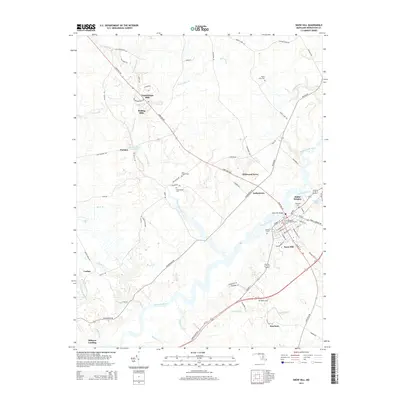
 2011 Snow Hill2011 Print · USGSCovers Indiantown, including Snow Hill, Nassawango Hills, and other nearby areas
 - 2014 Map of Snow Hill, 2014 Print
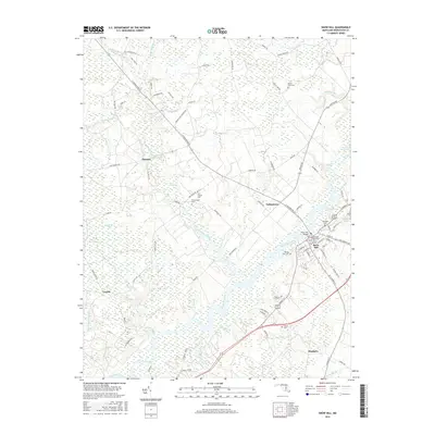
 2014 Snow Hill2014 Print · USGSCovers Indiantown, including Snow Hill, Nassawango Hills, and other nearby areas
 - 2016 Map of Snow Hill, 2016 Print
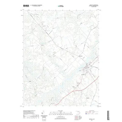
 2016 Snow Hill2016 Print · USGSCovers Indiantown, including Snow Hill, Nassawango Hills, and other nearby areas
 - 2019 Map of Snow Hill, 2019 Print
 2019 Snow Hill2019 Print · USGSCovers Indiantown, including Snow Hill, Nassawango Hills, and other nearby areas
 - 2023 Map of Snow Hill, 2023 Print
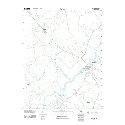
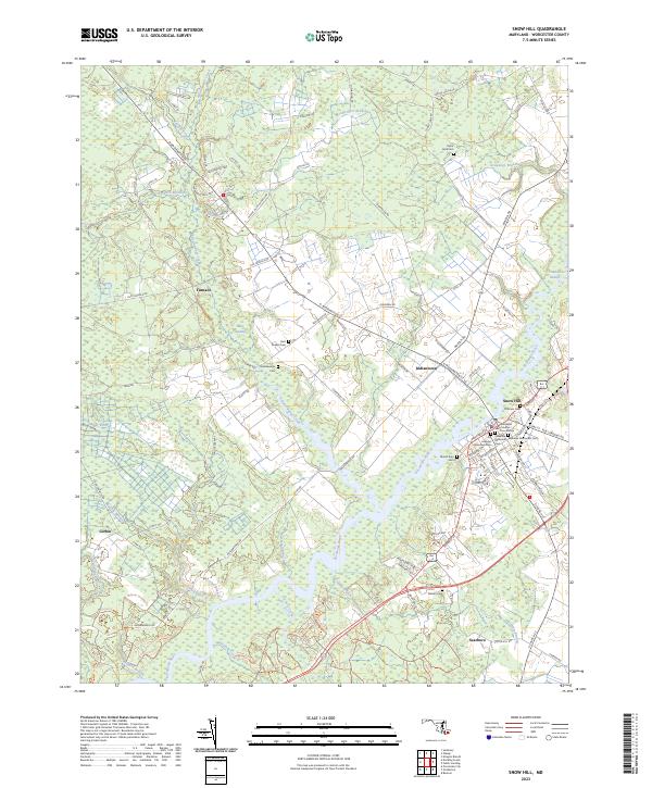 2023 Snow Hill2023 Print · USGSSnow Hill and the Pocomoke River valley are captured in this contemporary look at one of Maryland's oldest colonial-era seats. Researchers can locate historic burial grounds like Ebenezer Methodist Cem and trace old routes through Indiantown and Bear Swamp.
End of results
Showing maps 1-16 of 16
Top cities near Indiantown
- Salisbury historical maps
- Fruitland historical maps
- Pocomoke City historical maps
- Berlin historical maps
- Chincoteague historical maps
- Snow Hill historical maps
See more
Frequently asked questions
- What are the different types of historical maps available for Indiantown?
- What is the oldest map of Indiantown?
- Where can I purchase historical maps of Indiantown for my home or office?
- Where can I download high-res historical maps of Indiantown?
- Are there historical topographic maps available for Indiantown?
- Is there historical aerial imagery available for Indiantown?
- Where are historical maps of Indiantown sourced from?