Old Maps of Ocean City, Maryland
Explore 30 old maps of Ocean City, spanning from 1901 to today. These high-resolution historic maps reveal how streets, neighborhoods, landmarks, and natural features evolved over time — perfect for genealogy, metal detecting, research, and local history exploration.
What you can do with these maps:
- See how Ocean City changed over time: Compare historical maps to modern-day views to trace roads, homesites, rail lines & more.
- View detailed metadata: Each map includes creators, publishers, year, scale, and archive source.
- Overlay maps with satellite & LiDAR: Visualize the past alongside modern tools to explore terrain & human change.
- Trusted historical sources: Maps sourced from the USGS, Library of Congress, and other archives.
- Access maps your way: View online, download high-res files, or order prints for personal or research use.
Start exploring old maps of Ocean City to uncover forgotten places, hidden landmarks, and the deep history beneath your feet.
Ocean City, MD maps
(30)- 1901 Map of Ocean City
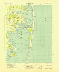
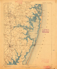 1901 Ocean City1901 Print · USGSThe Maryland and Delaware coastlines were still largely defined by maritime labor and new rail lines at the turn of the century. You can trace the early streets of Ocean City and Berlin or locate landmarks like the Fenwick Island Lighthouse and Muskrattown.5 unique versions available
 - 1942 Map of Ocean City
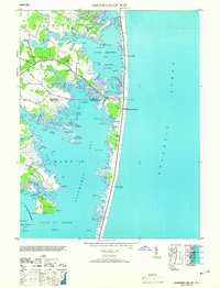
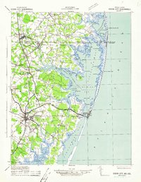 1942 Ocean City1942 Print · USGSThe Maryland and Delaware coastline at the onset of the 1940s reveals a region of tidal bays and rail-dependent coastal towns. Genealogists and historians can trace family roots in early settlements like Berlin, Sinepuxent, and Bishopville or locate maritime landmarks including Fenwick Island Lighthouse.2 unique versions available
 - 1942 Map of Ocean City, 1962 Print
 1942 Ocean City1962 Print · USGSMaryland's Atlantic coast is seen here during the early years of the Second World War as the resort town began its modern expansion. Genealogists and historians can trace the early layout of Ocean City and landmarks like the Coast Guard Sta and Ocean City Inlet.
 - 1943 Map of Ocean City
 1943 Ocean City1943 Print · USGSOcean City and the barrier islands of Maryland's coast are documented here during the early 1940s as strategic maritime hubs. Researchers can trace the Baltimore and Eastern rail line and locate coastal defenses like the Observation Post and various range lights.
 - 1943 Map of Assawoman Bay
 1943 Assawoman Bay1943 Print · USGSThe Maryland and Delaware coastlines appear here during the early 1940s, showing a landscape of maritime navigation and scattered bayside settlements. Trace the early footprints of Bayville or locate historic coastal landmarks like the Fenwick Island Lighthouse and the Isle of Wight.
 - 1946 Map of Salisbury, 1948 Print
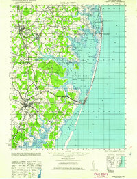
 1946 Salisbury1948 Print · USGSThe Delmarva Peninsula in the late nineteen-forties shows a landscape defined by its deep river arteries and emerging coastal defenses. Genealogists and historians can trace rail-connected towns like Federalsburg or locate maritime landmarks such as the Ocean City Seaplane Base and Fort Miles Military Reservation.4 unique versions available
 - 1947 Map of Salisbury, 1948 Print
 1947 Salisbury1948 Print · USGSThe Delmarva Peninsula in the late forties reveals a coastal landscape of maritime defense and growing seaside towns. Trace the post-war footprint of Salisbury, the strategic Fort Miles Military Reservation, and the Ocean City Seaplane Base.
 - 1948 Map of Salisbury, 1951 Print
 1948 Salisbury1951 Print · USGSThe Delmarva Peninsula in the late 1940s is shown here as a busy network of rail-towns and coastal outposts. Researchers can trace the legacy of the Pennsylvania Railroad through inland hubs like Georgetown or the maritime reaches of Crisfield and Cape May.
 - 1953 Map of Assawoman Bay
 1953 Assawoman Bay1953 Print · USGSThe Atlantic coast and back bays along the Maryland-Delaware border are captured here just after the war. You can trace early coastal landmarks including the Fenwick Island Lighthouse, the settlement of Bayville, and the marshy expanses of Isle of Wight.
 - 1957 Map of Salisbury
 1957 Salisbury1957 Print · USGSThe Delmarva Peninsula in the mid-1950s reveals a landscape of coastal defenses and rail-driven commerce. Researchers can trace the Pennsylvania railroad lines or locate historic landmarks like the Fenwick Island Lighthouse and St Martin church.
 - 1961 Map of Ocean City
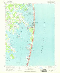
 1961 Ocean City1961 Print · USGSThe Maryland and Delaware coastlines come alive in this mid-century survey of the barrier islands and quiet inland towns. Genealogists and historians can trace the early layout of Ocean City and Berlin, or locate vanished rail stops along the Philadelphia Wilmington and Baltimore RR.
 - 1961 Map of Salisbury
 1961 Salisbury1961 Print · USGSThe Delmarva Peninsula comes into focus in the early sixties, showing the vital road and rail networks connecting the Chesapeake to the Atlantic. Genealogists and historians can trace family-named landings and coastal landmarks from Crisfield to the Brandywine Shoal Lighthouse.
 - 1964 Map of Ocean City, 1966 Print
 1964 Ocean City1966 Print · USGSOcean City and the surrounding barrier islands are captured in the mid-1960s as the coastal resort town expanded northward along the Atlantic. Local researchers can trace early residential developments like Bay Shore Acres or locate landmarks such as the Coast Guard Sta and Ocean City Sch.3 unique versions available
 - 1965 Map of Salisbury
 1965 Salisbury1965 Print · USGSThe Delmarva Peninsula in the mid-1960s is depicted here as a landscape of coastal defenses and maritime hubs. Genealogists and local historians can trace the foundations of bayside towns like Crisfield and the tactical positioning of the Fort Miles Military Reservation and Cape May Naval Air Station.
 - 1967 Map of Assawoman Bay, 1969 Print
 1967 Assawoman Bay1969 Print · USGSThe coastal border of Delaware and Maryland is captured here in the late sixties as vacation communities began to expand. Genealogists and historians can trace old landings like Sassafras Landing, the historic Fenwick Island Lighthouse, and the Sound Ch.4 unique versions available
 - 1980 Map of Assawoman Bay, 1982 Print
 1980 Assawoman Bay1982 Print · USGSCoastal Maryland and Delaware are seen here in the early eighties as beachfront development reshaped the barrier islands. Trace the growth of Ocean City and Fenwick Island between the Atlantic Ocean and Assawoman Bay.
 - 1983 Map of Salisbury, 1984 Print
 1983 Salisbury1984 Print · USGSThe Lower Eastern Shore was a landscape of tide and timber in the early eighties, from the bustling streets of Salisbury to the wild coast of Assateague Island. Researchers can trace the rail-and-road network of the Conrail and U S Highway 50 while locating historic centers like Princess Anne and Crisfield.
 - 1992 Map of Assawoman Bay
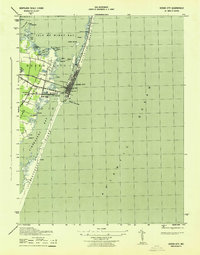
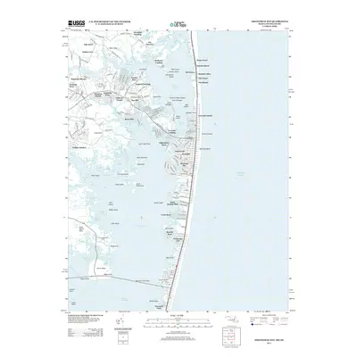
 1992 Assawoman Bay1992 Print · USGSCoastal Delaware and Maryland meet in the early nineties along a landscape of shifting barrier islands and growing waterfront communities. Trace the shoreline development of Fenwick Island and Maryland Beach, or locate historic landmarks like the Fenwick Island Lighthouse and Peppers Landing.
 - 1997 Map of Assawoman Bay, 2000 Print
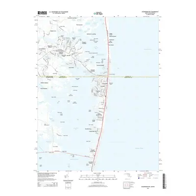
 1997 Assawoman Bay2000 Print · USGSThe coastal borderlands of Delaware and Maryland are captured here just before the millennium, showing the dense development of the barrier islands. Genealogists and local historians can trace family landmarks like Drum Cem, the Fenwick Island Lighthouse, and the St George Ch.
 - 1998 Map of Ocean City, 2000 Print
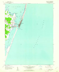
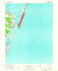
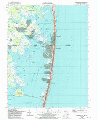
 1998 Ocean City2000 Print · USGSOcean City and the Maryland coast are captured here in the late 1990s, showing the dense development of the barrier island alongside protected shorelines. Trace the urban grid from the Boardwalk to the Ocean City Inlet, or locate mainland landmarks like Captains Hill and the Ocean City Airport.
 - 2011 Map of Ocean City, 2011 Print
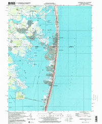
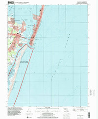
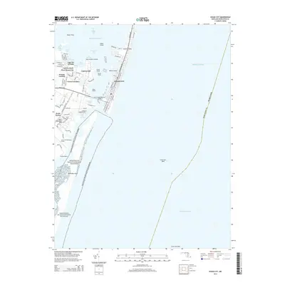
 2011 Ocean City2011 Print · USGSCovers Ocean City, including West Ocean City, Worcester County, and other nearby areas
 - 2013 Map of Assawoman Bay, 2013 Print
 2013 Assawoman Bay2013 Print · USGSCovers Ocean City, including Fenwick Island, Bayville, and other nearby areas
 - 2014 Map of Assawoman Bay, 2014 Print
 2014 Assawoman Bay2014 Print · USGSCovers Ocean City, including Fenwick Island, Bayville, and other nearby areas
 - 2014 Map of Ocean City, 2014 Print
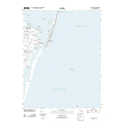
 2014 Ocean City2014 Print · USGSCovers Ocean City, including West Ocean City, Worcester County, and other nearby areas
 - 2016 Map of Ocean City, 2016 Print
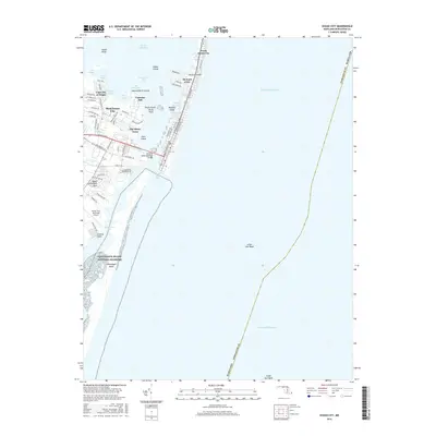 2016 Ocean City2016 Print · USGSCovers Ocean City, including West Ocean City, Worcester County, and other nearby areas
Showing maps 1-25 of 30
Top cities near Ocean City
- Ocean Pines historical maps
- West Ocean City historical maps
- Berlin historical maps
- Millsboro historical maps
- Selbyville historical maps
- Ocean View historical maps
See more
Top neighborhoods of Ocean City
- Bayside Keys historical maps
- Caine Harbor Mile historical maps
- Caine Woods historical maps
- Little Salisbury historical maps
- Montego Bay historical maps
- Montego Bay Mobile Home Park historical maps
See more
Frequently asked questions
- What are the different types of historical maps available for Ocean City?
- What is the oldest map of Ocean City?
- Where can I purchase historical maps of Ocean City for my home or office?
- Where can I download high-res historical maps of Ocean City?
- Are there historical topographic maps available for Ocean City?
- Is there historical aerial imagery available for Ocean City?
- Where are historical maps of Ocean City sourced from?