Old Maps of Lee, Massachusetts for Hiking & Exploration
Hike through history with 42 historic maps of Lee. Explore old trails, ghost towns, and forgotten backroads — perfect for outdoor adventurers and local explorers.
- Rediscover forgotten places: Map out old mining camps, roads, and footpaths that no longer exist on modern maps.
- Layer with modern tools: Combine with LiDAR or satellite views to plan hikes through historical terrain.
- Made for exploration: Popular among hikers, overlanders, and local history lovers.
Use these maps to find adventure and explore the hidden past of Lee.
Lee, MA maps
(42)- 1886 Map of Becket
 1886 Becket1886 Print · USGSThe Berkshire Highlands come into focus in the late nineteenth century, revealing a landscape of hill-town settlements and early industrial rail lines. Genealogists and historians can trace family locations in Becket Center, Middlefield, and Washington, or follow the Boston and Albany railroad as it passes Lenox Furnace.
 - 1888 Map of Becket
 1888 Becket1888 Print · USGSThe Berkshire highlands come alive in the late 1880s, showcasing a network of mountain settlements and vital rail corridors. Trace the path of the Boston and Albany Railroad through high-elevation stops like Washington Station and industrial sites at Lenox Furnace.
 - 1888 Map of Pittsfield
 1888 Pittsfield1888 Print · USGSThe Berkshires and eastern New York meet in this late 19th-century record of a landscape defined by communal settlements and early industry. Genealogists and historians can trace the footprint of the Canaan Shakers, industrial sites at Richmond Furnace, and the early rail stops at Edwards Station.
 - 1890 Map of Pittsfield
 1890 Pittsfield1890 Print · USGSThe Berkshires and New York borderlands are captured here in the late nineteenth century, showing a landscape defined by communal Shaker life and iron works. Researchers can trace the Lebanon Springs Railroad through Lebanon Springs or locate early industrial hubs like Richmond Furnace and Lower Barkerville.
 - 1893 Map of Becket
 1893 Becket1893 Print · USGSThe Berkshire highlands in the 1890s reveal a landscape of mountain railroading and early industrial water power. Genealogists and historians can trace family locations near Washington Station, Lenox Furnace, and the early settlements of Becket Center.
 - 1893 Map of Pittsfield
 1893 Pittsfield1893 Print · USGSThe Berkshires and the New York border are captured here in the late nineteenth century, showing a landscape of Shaker communities and early industrial sites. Genealogists can trace family roots in Barkerville, Curtisville, and near the historic Richmond Furnace.
 - 1894 Map of Pittsfield
 1894 Pittsfield1894 Print · USGSThe Massachusetts and New York borderlands meet in the 1890s, where industrial villages and Shaker settlements thrive along the rail corridors. Genealogists and historians can trace family roots through communities like Canaan Shakers, Richmond Furnace, and Lower Barkerville.
 - 1897 Map of Becket
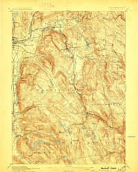 1897 Becket1897 Print · USGSThe Berkshires at the end of the nineteenth century reveal a landscape of mountain rail lines and industrial waterpower. Genealogists and historians can trace family locations in Becket Center, Washington Station (P.O.), and Lenox Furnace.8 unique versions available
 - 1897 Map of Pittsfield
 1897 Pittsfield1897 Print · USGSThe Berkshires and Columbia County come to life in the late nineteenth century as a hub of rail travel and communal living. Trace the historic Canaan Shakers settlement, find long-gone stops like Edwards Station, or study the industrial layout of Richmond Furnace.11 unique versions available
 - 1899 Map of Housatonic
 1899 Housatonic1899 Print · USGSThe Berkshire hills at the close of the nineteenth century reveal a landscape of industrial hamlets and Shaker settlements. Trace the rail-and-river economy through Lenox Furnace, locate the historic Shaker Village, and find landmarks like Laura Tower.
 - 1900 Map of Housatonic
 1900 Housatonic1900 Print · USGSThe Berkshires and the Housatonic Valley are captured here at a moment of industrial and social transition during the late Victorian era. Genealogists and historians can trace the early rail networks of the Boston and Albany R.R. through old settlements like Shaker Village and Lenox Furnace.5 unique versions available
 - 1943 Map of Housatonic
 1943 Housatonic1943 Print · USGSThe Berkshires and the Housatonic Valley are captured during the war years, showing a landscape of traditional Shaker settlements and growing industrial centers. Trace the routes of the NY NH & H RR and explore sites like Shaker Village, Richmond Furnace, and Rockdale Mills.
 - 1945 Map of East Lee, 1956 Print
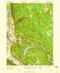 1945 East Lee1956 Print · USGSThe Berkshires at the end of the Second World War reveal a landscape of industrial river towns and high mountain reservoirs. Genealogists and hikers can trace the legacy of the New York New Haven and Hartford railroad and the early footprint of the Massachusetts Turnpike near East Lee and Goose Pond.2 unique versions available
 - 1948 Map of Stockbridge
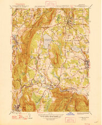 1948 Stockbridge1948 Print · USGSThe Berkshire valley comes to life in this mid-century survey of the river and rail lines that defined its growth. Trace the historic corridor from Stockbridge to Lenox, finding old mill sites, the grounds of Tanglewood, and the winding Housatonic River.3 unique versions available
 - 1948 Map of East Lee
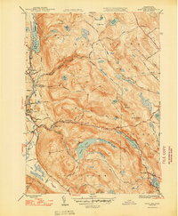 1948 East Lee1948 Print · USGSThe industrial Housatonic valley and the forested heights of October Mountain are captured here during the late 1940s. Genealogists and hikers can trace the original route of the Appalachian Trail or locate family properties near Lenoxdale, East Lee, and West Becket.2 unique versions available
 - 1948 Map of Albany, 1951 Print
 1948 Albany1951 Print · USGSThe Hudson and Connecticut River valleys are captured here in the late 1940s, showing the vital rail and water corridors of the Northeast. You can trace the Boston and Maine tracks past Mt Greylock or locate early settlements like Great Barrington and Bennington.
 - 1950 Map of East Lee
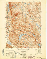 1950 East Lee1950 Print · USGSThe industrial corridor of the Housatonic Valley meets the high peaks of the Berkshires in the mid-century. Genealogists and historians can trace the rail-side growth of Lenoxdale or locate vanished upland homesteads near October Mountain and Upper Goose Pond.
 - 1956 Map of Albany, 1968 Print
 1956 Albany1968 Print · USGSThe industrial heart of the Northeast is revealed in the mid-1950s, from the Hudson Valley to the Connecticut River. Researchers can trace the legacy of the Quabbin Reservoir, locate Westover Air Force Base, or follow the Rutland RR through the Green Mountains.2 unique versions available
 - 1957 Map of Albany
 1957 Albany1957 Print · USGSThe Tri-State region and Connecticut River Valley are captured here during a period of significant postwar growth and infrastructure expansion. Genealogists and historians can trace the rail-and-river economy through landmarks like the Boston and Maine railroad, Quabbin Reservoir, and Westover Air Force Base.
 - 1958 Map of East Lee, 1960 Print
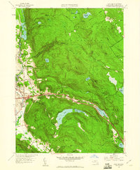 1958 East Lee1960 Print · USGSThe Berkshire highlands and the Housatonic valley meet in this mid-century survey as the modern turnpike era begins. Researchers can trace the New York New Haven & Hartford Railroad through Lenox Dale or locate the St Marys Sch in Lee.
 - 1959 Map of Albany
 1959 Albany1959 Print · USGSThe Hudson and Connecticut River valleys are captured here during the late fifties, showing the region's dense rail networks and massive water projects. Researchers can trace the New York State Thruway or locate local landmarks like Mt Greylock and the Quabbin Reservoir.
 - 1959 Map of Stockbridge, 1962 Print
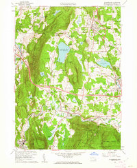 1959 Stockbridge1962 Print · USGSStockbridge and Lenox are shown at a peak of cultural and religious development in the late fifties. Researchers can trace the grounds of the Shadowbrook Novitiate, the Tanglewood Auditorium, and the old lines of the New York Central RR.2 unique versions available
 - 1962 Map of Albany
 1962 Albany1962 Print · USGSThe Hudson and Connecticut River valleys meet the Green Mountains and Berkshires in this mid-century overview of the Northeast. Genealogists and historians can trace the industrial hearts of Albany and Springfield or locate features like Quabbin Reservoir and Westover Air Force Base.
 - 1973 Map of East Lee, 1974 Print
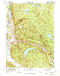 1973 East Lee1974 Print · USGSThe Berkshires in the early seventies reveal a rugged landscape of state forests and river-valley industry. Trace the historic route of the Penn Central railroad through Lenox Dale or locate the path of the Appalachian Trail near Goose Pond.3 unique versions available
 - 1973 Map of Stockbridge, 1974 Print
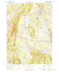 1973 Stockbridge1974 Print · USGSThe Berkshires come alive in this early 1970s survey of the Housatonic River valley and its storied cultural institutions. Researchers can trace the grounds of the Tanglewood Auditorium, locate the Chesterwood Museum, or find family names at Stockbridge Cem.3 unique versions available
Showing maps 1-25 of 42
Top cities near Lee
- Pittsfield historical maps
- Great Barrington historical maps
- Dalton historical maps
- Lenox historical maps
- Sheffield historical maps
- Cheshire historical maps
See more
Top neighborhoods of Lee
Frequently asked questions
- What are the different types of historical maps available for Lee?
- What is the oldest map of Lee?
- Where can I purchase historical maps of Lee for my home or office?
- Where can I download high-res historical maps of Lee?
- Are there historical topographic maps available for Lee?
- Is there historical aerial imagery available for Lee?
- Where are historical maps of Lee sourced from?