1990s Maps of New Ashford, Massachusetts
Explore 5 historic maps of New Ashford from the 1990s. These maps offer a rare glimpse into what life looked like during the 1990s — showing old roads, neighborhoods, homes, and landmarks that have changed or disappeared over time.
Whether you're researching your family's past, planning a metal detecting trip, or studying how New Ashford's landscape evolved across the 1990s, these high-resolution maps are a powerful tool for exploring the history of this region.
- Focus on a specific era: All maps on this page are from the 1990s, giving you a focused view of this time period.
- See what’s changed: Compare century-old streets, trails, and buildings to today's modern landscape using overlays and satellite layers.
- Research with precision: Use these maps for genealogy, historical research, land use analysis, or educational projects.
- View, download, or print: Maps are fully viewable online in high resolution, and can be downloaded or printed for your own records.
Start exploring New Ashford's history through authentic maps from the 1990s. This is your window into the past.
New Ashford, MA maps
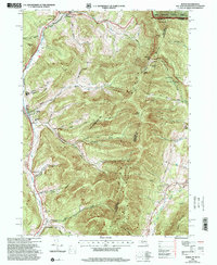
(5)- 1997 Map of Williamstown, 2000 Print
 1997 Williamstown2000 Print · USGSThe Berkshire highlands and the academic center of Williamstown are captured here in the late nineties. Researchers can trace the Appalachian Trail over Mt Greylock or locate Southwilliamstown Cem and Mt Hope Farm.
 - 1997 Map of Berlin, 2000 Print
 1997 Berlin2000 Print · USGSRensselaer County, New York, sits at the intersection of three states in the late nineties, where valley towns follow the Hoosic River. You can trace the Boston and Maine RR line past Meadow Lawn Cem, Cherryplain Sch, and the high ridges of the Petersburg Range.
 - 1998 Map of Stephentown Center, 2000 Print
 1998 Stephentown Center2000 Print · USGSThe borderlands of New York and Massachusetts are captured here in the late nineties, showcasing the remote valley settlements along Kinderhook Creek. Genealogists can locate family landmarks like Hillside Cem, St Josephs Cem, and the Hancock Central Sch.
 - 1998 Map of Cheshire, 2000 Print
 1998 Cheshire2000 Print · USGSThe Northern Berkshires come into focus in the late 1990s, where traditional valley settlements meet the rising peaks of the Hoosac Range. Genealogists and hikers can trace the Appalachian Trail past historic sites like Riverside Cem and St Stanislaus Kostka Cem.
 - 1998 Map of Berlin, 2001 Print
 1998 Berlin2001 Print · USGSThe Little Hoosic River valley and the high Taconic ridges define this portion of Rensselaer County in the late 1990s. Researchers can trace rural lineages through family-named landmarks like Satterlee Hollow and several burial grounds including Fifty-Six Cem and Moses Cem.
End of results
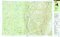
Showing maps 1-5 of 5
Top cities near New Ashford
- Pittsfield historical maps
- North Adams historical maps
- Adams historical maps
- Williamstown historical maps
- Hoosick historical maps
- Dalton historical maps
See more
Frequently asked questions
- What are the different types of historical maps available for New Ashford?
- What is the oldest map of New Ashford?
- Where can I purchase historical maps of New Ashford for my home or office?
- Where can I download high-res historical maps of New Ashford?
- Are there historical topographic maps available for New Ashford?
- Is there historical aerial imagery available for New Ashford?
- Where are historical maps of New Ashford sourced from?