Old Maps of Windsor, Massachusetts for Genealogy
Trace your family roots with 82 historic maps of Windsor. These high-res maps reveal old neighborhoods, homesites, landmarks, and streets — helping you uncover where your ancestors lived and how the area evolved over time.
- Explore historic neighborhoods: Identify where your relatives may have lived in the 1800s or 1900s.
- Compare maps over time: Trace the changes in streets, buildings, and landmarks for multi-generational research.
- Perfect for genealogy & ancestry research: Used by family historians and researchers to map out lineage and migration.
These maps are an incredible resource for exploring your personal connection to Windsor's past.
Windsor, MA maps
(82)- 1886 Map of Greylock
 1886 Greylock1886 Print · USGSThe northern Berkshires are captured here in the mid-1880s, dominated by the massif of Mt Greylock and the industrial valleys below. Genealogists and researchers can trace the vital rail links through the Hoosac Tunnel Line and find old neighborhood names like Blackington, Cheshire Harbor, and Savoy Hollow.
 - 1886 Map of Hawley
 1886 Hawley1886 Print · USGSThe northern Berkshires and Vermont border are captured in the late 1800s as railroads began to pierce the highlands. Trace the engineering of the Hoosac Tunnel or locate old settlements like Monroe Bridge and Buckland Four Corners.
 - 1886 Map of Chesterfield
 1886 Chesterfield1886 Print · USGSThe Hampshire Hills are captured here in the late nineteenth century, showing a network of upland hamlets and river-powered industry. Researchers can trace historic family locations along Ireland Street or locate the old Bisbee Mill and the Boston and Albany rail line.
 - 1886 Map of Becket
 1886 Becket1886 Print · USGSThe Berkshire Highlands come into focus in the late nineteenth century, revealing a landscape of hill-town settlements and early industrial rail lines. Genealogists and historians can trace family locations in Becket Center, Middlefield, and Washington, or follow the Boston and Albany railroad as it passes Lenox Furnace.
 - 1888 Map of Becket
 1888 Becket1888 Print · USGSThe Berkshire highlands come alive in the late 1880s, showcasing a network of mountain settlements and vital rail corridors. Trace the path of the Boston and Albany Railroad through high-elevation stops like Washington Station and industrial sites at Lenox Furnace.
 - 1888 Map of Chesterfield
 1888 Chesterfield1888 Print · USGSHampshire County in the late 1880s is shown here as a landscape of river-driven hamlets and upland farms. Genealogists can trace family holdings near rural crossroads like Ireland Street, Shack Street, and the riverside Bisbee Mill.
 - 1890 Map of Hawley
 1890 Hawley1890 Print · USGSFranklin County and the Vermont borderlands are shown here in the 1880s as the railroad era transformed the Deerfield Valley. Trace the path of the Fitchburg Railroad through the Hoosac Tunnel or find old roads in Hawley and Ashfield.
 - 1891 Map of Greylock
 1891 Greylock1891 Print · USGSThe northern Berkshires are captured here in the late nineteenth century as rail lines and textile centers transformed the rugged valley floor. Genealogists and hikers can trace old homesteads and landmarks like Mt Greylock, the Hoosac Tunnel Line, and the vanished site of Arnoldsville.
 - 1893 Map of Chesterfield
 1893 Chesterfield1893 Print · USGSThe Hampshire County highlands are captured here in the late nineteenth century as a network of river-powered mill towns and mountain farmsteads. Local historians can trace early neighborhood clusters like Ireland Street and Shack Street or locate industrial sites like Risbee Mill.
 - 1893 Map of Becket
 1893 Becket1893 Print · USGSThe Berkshire highlands in the 1890s reveal a landscape of mountain railroading and early industrial water power. Genealogists and historians can trace family locations near Washington Station, Lenox Furnace, and the early settlements of Becket Center.
 - 1893 Map of Greylock
 1893 Greylock1893 Print · USGSThe Northern Berkshires were at an industrial peak in the late 1800s, centered on the vital rail and water corridors of the Hoosic Valley. Researchers can trace the engineering of the Hoosac Tunnel Line and find historic mill settlements like Maple Grove and Cheshire Harbor.
 - 1894 Map of Hawley
 1894 Hawley1894 Print · USGSThe northern Berkshires in the late nineteenth century are defined by the Deerfield River and the legendary Hoosac Tunnel rail route. Researchers can trace old upland hamlets like Spruce Corner, locate riverside settlements such as Monroe Bridge, and study the early rail network through Zoar.8 unique versions available
 - 1895 Map of Chesterfield
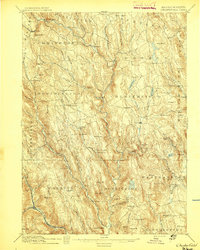 1895 Chesterfield1895 Print · USGSThe Hampshire County uplands in the late nineteenth century show a landscape of steep river valleys and small mill towns. Researchers can trace the early industrial footprint at Risbees Mill or locate family homesteads in hamlets like Ireland Street and Jordansville.8 unique versions available
 - 1896 Map of Holyoke
 1896 Holyoke1896 Print · USGSThe Pioneer Valley and the eastern Berkshire foothills thrive in the 1890s as a complex network of industrial towns and upland farming communities. Historians can trace early infrastructure through the Bisbee Mill, the Agricultural College, and the prominent Ox Bow on the Connecticut River.
 - 1897 Map of Holyoke
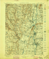 1897 Holyoke1897 Print · USGSThe Pioneer Valley and surrounding highlands thrive in the 1890s, caught here at the height of the region's industrial and agricultural development. Genealogists and historians can trace family roots through dozens of hill towns and river settlements, from Agricultural College in Amherst to the mills of Holyoke and the remote tracks of the Athol Br. R. R..
 - 1897 Map of Becket
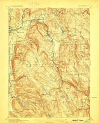 1897 Becket1897 Print · USGSThe Berkshires at the end of the nineteenth century reveal a landscape of mountain rail lines and industrial waterpower. Genealogists and historians can trace family locations in Becket Center, Washington Station (P.O.), and Lenox Furnace.8 unique versions available
 - 1898 Map of Greylock
 1898 Greylock1898 Print · USGSThe Berkshire highlands at the close of the nineteenth century reveal a landscape of deep valleys and engineering feats. Trace the path of the Hoosac Tunnel or locate historic mill sites and rail stops in North Adams, Zylonite, and Cheshire.10 unique versions available
 - 1899 Map of Housatonic
 1899 Housatonic1899 Print · USGSThe Berkshire hills at the close of the nineteenth century reveal a landscape of industrial hamlets and Shaker settlements. Trace the rail-and-river economy through Lenox Furnace, locate the historic Shaker Village, and find landmarks like Laura Tower.
 - 1900 Map of Taconic
 1900 Taconic1900 Print · USGSThe tri-state border region of the Taconic Mountains thrived at the turn of the century as a hub of rail travel and valley industry. Genealogists and historians can trace the early footprints of Hoosick Falls, Bennington, and the winding path of the Rutland R.R.4 unique versions available
 - 1900 Map of Housatonic
 1900 Housatonic1900 Print · USGSThe Berkshires and the Housatonic Valley are captured here at a moment of industrial and social transition during the late Victorian era. Genealogists and historians can trace the early rail networks of the Boston and Albany R.R. through old settlements like Shaker Village and Lenox Furnace.5 unique versions available
 - 1901 Map of Holyoke
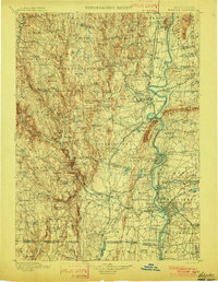 1901 Holyoke1901 Print · USGSThe Pioneer Valley and surrounding highlands thrive at the turn of the century, showing a landscape defined by mill towns and early rail networks. Genealogists and historians can trace old homesteads and local landmarks like Bisbee Mill, South Ferry, and the Agricultural College.4 unique versions available
 - 1943 Map of Holyoke
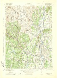 1943 Holyoke1943 Print · USGSThe Pioneer Valley and the eastern Berkshires are captured here in the early 1940s, showing a robust network of river-side industry and hill-country forests. Researchers can locate vanished landmarks and institutional grounds like Northampton State Hospital, Barnes Airport, and the Nat Gd Rifle Range.
 - 1943 Map of Brattleboro
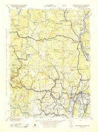 1943 Brattleboro1943 Print · USGSSouthern Vermont and the Massachusetts border area appear in this mid-century survey as a landscape of timbered peaks and river-connected villages. Genealogists can trace family roots through markers like Arms Cem or follow the rails at Dummerston Sta and Putney Sta.
 - 1943 Map of Housatonic
 1943 Housatonic1943 Print · USGSThe Berkshires and the Housatonic Valley are captured during the war years, showing a landscape of traditional Shaker settlements and growing industrial centers. Trace the routes of the NY NH & H RR and explore sites like Shaker Village, Richmond Furnace, and Rockdale Mills.
 - 1944 Map of Windsor, 1958 Print
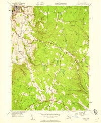 1944 Windsor1958 Print · USGSBerkshire County in the mid-1940s reveals a rugged upland landscape of mountain peaks and winding river valleys before modern development. Genealogists and hikers can trace the path of the Appalachian Trail near Stafford Hill and locate long-standing landmarks like Tannery Falls and Savoy Center.
Showing maps 1-25 of 82
Top cities near Windsor
- Pittsfield historical maps
- North Adams historical maps
- Adams historical maps
- Williamstown historical maps
- Dalton historical maps
- Lee historical maps
See more
Top neighborhoods of Windsor
Frequently asked questions
- What are the different types of historical maps available for Windsor?
- What is the oldest map of Windsor?
- Where can I purchase historical maps of Windsor for my home or office?
- Where can I download high-res historical maps of Windsor?
- Are there historical topographic maps available for Windsor?
- Is there historical aerial imagery available for Windsor?
- Where are historical maps of Windsor sourced from?