Old Maps of Marblehead Neck, Marblehead
Explore 34 old maps of Marblehead Neck, spanning from 1888 to today. These high-resolution historic maps reveal how streets, neighborhoods, landmarks, and natural features evolved over time — perfect for genealogy, metal detecting, research, and local history exploration.
What you can do with these maps:
- See how Marblehead Neck changed over time: Compare historical maps to modern-day views to trace roads, homesites, rail lines & more.
- View detailed metadata: Each map includes creators, publishers, year, scale, and archive source.
- Overlay maps with satellite & LiDAR: Visualize the past alongside modern tools to explore terrain & human change.
- Trusted historical sources: Maps sourced from the USGS, Library of Congress, and other archives.
- Access maps your way: View online, download high-res files, or order prints for personal or research use.
Start exploring old maps of Marblehead Neck to uncover forgotten places, hidden landmarks, and the deep history beneath your feet.
Marblehead Neck, Marblehead maps
(34)- 1888 Map of Salem
 1888 Salem1888 Print · USGSThe North Shore in the late nineteenth century is captured here in its era of peak rail development. Genealogists and historians can trace family-named sites like Doles Corner and institutions such as Dummer Academy or the Insane Asylum.
 - 1892 Map of Boston Bay
 1892 Boston Bay1892 Print · USGSThe outer harbor and North Shore coastline are captured in the late Victorian era, before modern development reshaped the beaches and islands. Genealogists and maritime historians can trace the early rail lines to Revere Beach or locate historic defenses like Fort Warren and the iconic Boston Light.4 unique versions available
 - 1893 Map of Salem
 1893 Salem1893 Print · USGSCoastal Massachusetts at the end of the nineteenth century reveals a landscape defined by industrial rail lines and ancient marshlands. Genealogists and historians can trace family-named hills and early institutional sites like Dummer Academy, the Insane Asylum, and the Ipswich Light.11 unique versions available
 - 1903 Map of Boston Bay
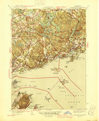
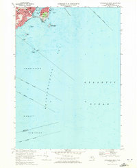
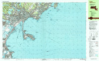
 1903 Boston Bay1903 Print · USGSThe Massachusetts North and South Shores are seen here at the turn of the century as a hub of rail-connected maritime life. You can trace the path of old rail divisions to historic coastal landings at Point of Pines, Marblehead, and the naval defenses at Ft. Warren.9 unique versions available
 - 1917 Map of Salem
 1917 Salem1917 Print · USGSCoastal Massachusetts at the end of the Great War reveals a landscape of maritime commerce and rail-connected villages. Trace the local economy from Salem Harbor to Ipswich Light, or locate historic sites like Dummer Academy and the Insane Asylum.
 - 1919 Map of Salem
 1919 Salem1919 Print · USGSThe North Shore and its rail-connected towns are captured here during the height of the steam era. Genealogists and historians can trace the local landscape through landmarks like Dummer Academy, the Insane Asylum, and the vanished Box Factory.2 unique versions available
 - 1943 Map of Cape Ann
 1943 Cape Ann1943 Print · USGSCoastal Massachusetts and New Hampshire appear here during the wartime era, showing the maritime and rail infrastructure that defined the North Shore. Genealogists can trace family names across Asbury Grove, Merrimacport, and the Boston & Maine RR rail corridor.
 - 1945 Map of Marblehead North
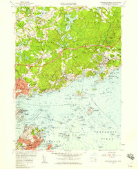
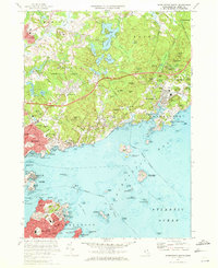
 1945 Marblehead North1945 Print · USGSThe North Shore of Massachusetts during the mid-1940s shows a complex landscape of maritime heritage and rail-connected settlements. Genealogists and local historians can trace the detailed streets of Marblehead and locate landmarks like Central Cemetery and Fort Pickering.3 unique versions available
 - 1945 Map of Marblehead South
 1945 Marblehead South1945 Print · USGSCoastal Essex County comes to life at the close of the war, showing the intricate shoreline and rail connections of the North Shore. Genealogists and historians can trace the Boston and Maine corridor and locate local landmarks like Castle Rock or the Devereux Beach coastline.3 unique versions available
 - 1948 Map of Boston
 1948 Boston1948 Print · USGSEastern Massachusetts and southern New Hampshire appear at an industrial peak in the late 1940s, just as suburban growth began to accelerate. Genealogists and historians can trace rail lines like the Boston and Albany RR or locate coastal landmarks like Graves Lighthouse and Fort Devens.2 unique versions available
 - 1956 Map of Marblehead South, 1959 Print
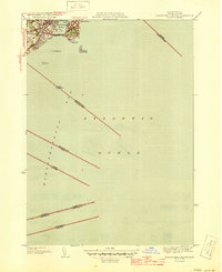
 1956 Marblehead South1959 Print · USGSThe North Shore coastline in the mid-fifties reveals a landscape of maritime tradition and suburban growth. Researchers can trace the development of Marblehead Neck and identify coastal landmarks like Tinkers Island and Star of the Sea Ch.2 unique versions available
 - 1956 Map of Marblehead North, 1959 Print
 1956 Marblehead North1959 Print · USGSThe Massachusetts North Shore flourished in the mid-1950s as classic maritime villages like Manchester and Marblehead met the expansion of the State Route 128 corridor. Genealogists and historians can trace the foundations of local institutions like Endicott Jr College, the U.S. Coast Guard Air Station, and the historic Fort Sewell.2 unique versions available
 - 1956 Map of Boston, 1967 Print
 1956 Boston1967 Print · USGSThe Massachusetts coastline and industrial interior are seen here during the mid-century peak of suburban and highway expansion. Researchers can trace historic harbor defenses like Fort Revere, local landmarks such as Faneuil Hall, and the vast Parker River National Wildlife Refuge.6 unique versions available
 - 1958 Map of Boston
 1958 Boston1958 Print · USGSEastern Massachusetts and southern New Hampshire are shown at the height of the industrial era, before the full expansion of the interstate system. Trace coastal defenses at Fort Warren, historic rail lines like the Boston and Maine, and the development of the Mass. 128 corridor.2 unique versions available
 - 1961 Map of Boston
 1961 Boston1961 Print · USGSThe Massachusetts coastline and its industrial interior are detailed here in the mid-twentieth century, from the Monadnock highlands to Cape Cod. Researchers can trace the rail routes of the Boston and Maine or locate landmarks like Fort Devens and the Wachusett Reservoir.2 unique versions available
 - 1970 Map of Marblehead South, 1972 Print
 1970 Marblehead South1972 Print · USGSThe North Shore coastline comes into focus in the 1970s, showcasing the maritime heritage and residential growth of Marblehead and Devereux. Researchers can trace the town's layout through sites like Alley Hospital, Seaside Park, and the Bell Sch.2 unique versions available
 - 1970 Map of Marblehead North, 1972 Print
 1970 Marblehead North1972 Print · USGSThe North Shore coast and the towns of Marblehead and Beverly are captured here during the early 1970s. Researchers can locate family landmarks such as Central Cemetery, historic sites like Abbot Hall, and the layout of the Boston and Maine railroad.2 unique versions available
 - 1977 Map of Marblehead North, 1980 Print
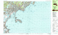
 1977 Marblehead North1980 Print · USGSThe North Shore coastline in the late seventies is captured here through detailed aerial photography. Genealogists and historians can trace the exact 1977 footprints of coastal settlements from Marblehead and Salem up to Manchester.
 - 1977 Map of Marblehead South, 1980 Print
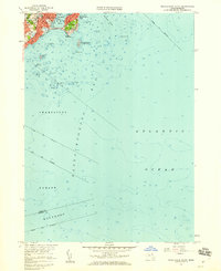
 1977 Marblehead South1980 Print · USGSThe coastline around Marblehead is captured in detail during the late seventies, showing the transition from settlement to sea. Researchers can trace the town's coastal perimeter and rocky harbor shoreline where it meets Massachusetts Bay.
 - 1984 Map of Gloucester
 1984 Gloucester1984 Print · USGSCoastal Massachusetts and the New Hampshire borderlands are shown here in the mid-eighties, from the granite shores of Cape Ann to the Merrimack River. Researchers can trace the legacy of maritime trade and higher education at Salem State College or follow the Boston and Maine rail lines through Ipswich and Beverly.
 - 1984 Map of Provincetown, 1986 Print
 1984 Provincetown1986 Print · USGSThe Massachusetts coastline and the tip of Cape Cod appear here during the mid-eighties, highlighting the region's dense coastal settlements and maritime defenses. You can locate family landmarks in Marshfield, trace the grounds of the North Truro Air Force Station, and explore the islands of Boston Harbor like Peddocks Island.2 unique versions available
 - 1985 Map of Lynn
 1985 Lynn1985 Print · USGSThe Massachusetts North Shore comes into focus during the mid-eighties, detailing the dense urban fabric and rocky coastlines from Lynn to Marblehead. Researchers can trace neighborhood development near Pine Grove Cem, locate the old Coast Guard Station at Nahant, and follow the B & M rail corridor.2 unique versions available
 - 1985 Map of Salem, 1986 Print
 1985 Salem1986 Print · USGSThe North Shore coastline in the mid-eighties shows the established urban centers of Salem and Beverly alongside the expanding suburbs of Danvers. Genealogists can locate family sites near Harmony Grove Cemetery or trace landmarks like the Danvers State Hospital and Fort Sewall.3 unique versions available
 - 1997 Map of Lynn, 1999 Print
 1997 Lynn1999 Print · USGSThe North Shore coastline comes into sharp focus during the late twentieth century, showing the dense urban grid of Lynn and the jagged peninsula of Nahant. Genealogists and local historians can trace family locations near Pine Grove Cem, English High Sch, or the many parish schools and temples throughout Swampscott.
 - 2012 Map of Marblehead South, 2012 Print
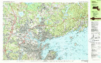
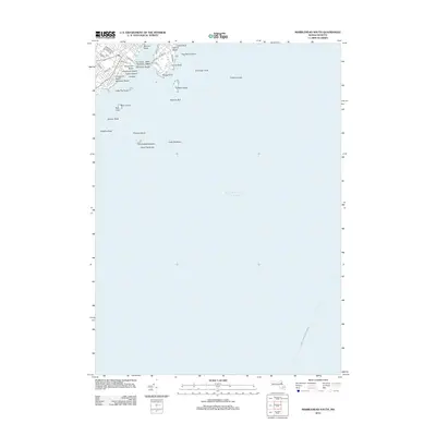 2012 Marblehead South2012 Print · USGSCovers Marblehead Neck, including Boston, Lynn, and other nearby areas
Showing maps 1-25 of 34
Frequently asked questions
- What are the different types of historical maps available for Marblehead Neck?
- What is the oldest map of Marblehead Neck?
- Where can I purchase historical maps of Marblehead Neck for my home or office?
- Where can I download high-res historical maps of Marblehead Neck?
- Are there historical topographic maps available for Marblehead Neck?
- Is there historical aerial imagery available for Marblehead Neck?
- Where are historical maps of Marblehead Neck sourced from?