Old Maps of Cummington Farm Village, Cummington for Academic Research
Study the evolution of Cummington Farm Village with 21 high-resolution historic maps. Whether you're teaching, researching, or modeling changes in land use, these maps provide essential visual documentation of urban, environmental, and geographic change.
- Analyze long-term change: Track patterns in development, transportation, and natural features.
- Ideal for environmental or urban studies: Support academic projects with primary historical map data.
- Use in the classroom or lab: Educators and researchers rely on these maps to bring historical context to life.
These maps are a powerful tool for teaching, research, and visualizing how Cummington Farm Village has changed over the decades.
Cummington Farm Village, Cummington maps
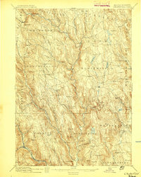
(21)- 1886 Map of Chesterfield
 1886 Chesterfield1886 Print · USGSCovers Cummington Farm Village, including Southampton, Williamsburg, and other nearby areas
 - 1888 Map of Chesterfield
 1888 Chesterfield1888 Print · USGSCovers Cummington Farm Village, including Southampton, Williamsburg, and other nearby areas
 - 1893 Map of Chesterfield
 1893 Chesterfield1893 Print · USGSCovers Cummington Farm Village, including Southampton, Williamsburg, and other nearby areas
 - 1895 Map of Chesterfield
 1895 Chesterfield1895 Print · USGSCovers Cummington Farm Village, including Southampton, Williamsburg, and other nearby areas8 unique versions available
 - 1896 Map of Holyoke
 1896 Holyoke1896 Print · USGSCovers Cummington Farm Village, including Springfield, Chicopee, and other nearby areas
 - 1897 Map of Holyoke
 1897 Holyoke1897 Print · USGSCovers Cummington Farm Village, including Springfield, Chicopee, and other nearby areas
 - 1901 Map of Holyoke
 1901 Holyoke1901 Print · USGSCovers Cummington Farm Village, including Springfield, Chicopee, and other nearby areas4 unique versions available
 - 1943 Map of Holyoke
 1943 Holyoke1943 Print · USGSCovers Cummington Farm Village, including Springfield, Chicopee, and other nearby areas
 - 1946 Map of Worthington
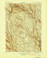 1946 Worthington1946 Print · USGSCovers Cummington Farm Village, including Chesterfield, Worthington, and other nearby areas2 unique versions available
 - 1948 Map of Albany, 1951 Print
 1948 Albany1951 Print · USGSCovers Cummington Farm Village, including Springfield, Albany, and other nearby areas
 - 1956 Map of Worthington, 1957 Print
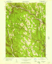 1956 Worthington1957 Print · USGSCovers Cummington Farm Village, including Chesterfield, Worthington, and other nearby areas2 unique versions available
 - 1956 Map of Albany, 1968 Print
 1956 Albany1968 Print · USGSCovers Cummington Farm Village, including Springfield, Albany, and other nearby areas2 unique versions available
 - 1957 Map of Albany
 1957 Albany1957 Print · USGSCovers Cummington Farm Village, including Springfield, Albany, and other nearby areas
 - 1959 Map of Albany
 1959 Albany1959 Print · USGSCovers Cummington Farm Village, including Springfield, Albany, and other nearby areas
 - 1962 Map of Albany
 1962 Albany1962 Print · USGSCovers Cummington Farm Village, including Springfield, Albany, and other nearby areas
 - 1972 Map of Worthington, 1973 Print
 1972 Worthington1973 Print · USGSCovers Cummington Farm Village, including Chesterfield, Worthington, and other nearby areas2 unique versions available
 - 1975 Map of Worthington, 1981 Print
 1975 Worthington1981 Print · USGSCovers Cummington Farm Village, including Chesterfield, Worthington, and other nearby areas
 - 1985 Map of Holyoke, 1986 Print
 1985 Holyoke1986 Print · USGSCovers Cummington Farm Village, including Springfield, Chicopee, and other nearby areas2 unique versions available
 - 1990 Map of Goshen
 1990 Goshen1990 Print · USGSCovers Cummington Farm Village, including Williamsburg, Conway, and other nearby areas
 - 1997 Map of Goshen, 1999 Print
 1997 Goshen1999 Print · USGSCovers Cummington Farm Village, including Williamsburg, Conway, and other nearby areas
 - 2024 Map of Worthington, 2024 Print
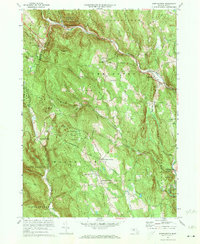
 2024 Worthington2024 Print · USGSCovers Cummington Farm Village, including Chesterfield, Worthington, and other nearby areas
End of results
Showing maps 1-21 of 21
Frequently asked questions
- What are the different types of historical maps available for Cummington Farm Village?
- What is the oldest map of Cummington Farm Village?
- Where can I purchase historical maps of Cummington Farm Village for my home or office?
- Where can I download high-res historical maps of Cummington Farm Village?
- Are there historical topographic maps available for Cummington Farm Village?
- Is there historical aerial imagery available for Cummington Farm Village?
- Where are historical maps of Cummington Farm Village sourced from?