1970s Maps of Hatfield, Massachusetts
Explore 4 historic maps of Hatfield from the 1970s. These maps offer a rare glimpse into what life looked like during the 1970s — showing old roads, neighborhoods, homes, and landmarks that have changed or disappeared over time.
Whether you're researching your family's past, planning a metal detecting trip, or studying how Hatfield's landscape evolved across the 1970s, these high-resolution maps are a powerful tool for exploring the history of this region.
- Focus on a specific era: All maps on this page are from the 1970s, giving you a focused view of this time period.
- See what’s changed: Compare century-old streets, trails, and buildings to today's modern landscape using overlays and satellite layers.
- Research with precision: Use these maps for genealogy, historical research, land use analysis, or educational projects.
- View, download, or print: Maps are fully viewable online in high resolution, and can be downloaded or printed for your own records.
Start exploring Hatfield's history through authentic maps from the 1970s. This is your window into the past.
Hatfield, MA maps
(4)- 1971 Map of Mt Toby, 1973 Print
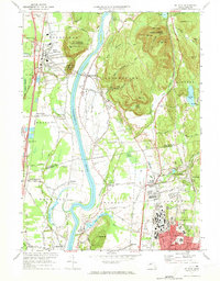 1971 Mt Toby1973 Print · USGSMassachusetts' Pioneer Valley is shown here in the early seventies, centered on the Connecticut River corridor. Genealogists and historians can trace family sites near Wildwood Cemetery, the evolving University of Massachusetts campus, and the industrial relics at Factory Hollow.2 unique versions available
 - 1975 Map of Mt Toby, 1981 Print
 1975 Mt Toby1981 Print · USGSThe Pioneer Valley mid-century agricultural landscape is frozen in time in this 1970s aerial survey. Genealogists and local historians can trace the field patterns and original footprints of Sunderland, South Deerfield, and Russellville.
 - 1975 Map of Easthampton, 1981 Print
 1975 Easthampton1981 Print · USGSNorthampton and the central Pioneer Valley are documented here in the mid-seventies through detailed aerial photography. Genealogists and local historians can trace the exact 1975 footprints of settlements like Loudville, West Farms, and Easthampton.
 - 1975 Map of Williamsburg, 1981 Print
 1975 Williamsburg1981 Print · USGSWilliamsburg and the surrounding hill towns appear in high-altitude detail during the mid-seventies. Local historians can trace the building footprints in Williamsburg, find the residential clusters of Searsville, and follow the course of the Mill River.
End of results
Showing maps 1-4 of 4
Top cities near Hatfield
- Springfield historical maps
- Chicopee historical maps
- Westfield historical maps
- Holyoke historical maps
- Amherst historical maps
- Northampton historical maps
See more
Top neighborhoods of Hatfield
- Bradstreet historical maps
- North Hatfield historical maps
- West Hatfield historical maps
- Westbrook historical maps
- Old Mill Site Historic District historical maps
Frequently asked questions
- What are the different types of historical maps available for Hatfield?
- What is the oldest map of Hatfield?
- Where can I purchase historical maps of Hatfield for my home or office?
- Where can I download high-res historical maps of Hatfield?
- Are there historical topographic maps available for Hatfield?
- Is there historical aerial imagery available for Hatfield?
- Where are historical maps of Hatfield sourced from?