1900s (20th Century) Maps of Bedford, Massachusetts
Explore 38 historic maps of Bedford from the 1900s (20th Century). These maps offer a rare glimpse into what life looked like during the 1900s — showing old roads, neighborhoods, homes, and landmarks that have changed or disappeared over time.
Whether you're researching your family's past, planning a metal detecting trip, or studying how Bedford's landscape evolved across the 1900s, these high-resolution maps are a powerful tool for exploring the history of this region.
- Focus on a specific era: All maps on this page are from the 1900s, giving you a focused view of this time period.
- See what’s changed: Compare century-old streets, trails, and buildings to today's modern landscape using overlays and satellite layers.
- Research with precision: Use these maps for genealogy, historical research, land use analysis, or educational projects.
- View, download, or print: Maps are fully viewable online in high resolution, and can be downloaded or printed for your own records.
Start exploring Bedford's history through authentic maps from the 1900s. This is your window into the past.
Bedford, MA maps
(38)- 1903 Map of Boston
 1903 Boston1903 Print · USGSThe Greater Boston area and its sprawling rail-and-river network are captured here at the turn of the century. Genealogists and historians can trace neighborhood blocks, the grounds of Tufts College, and military landmarks like Ft. Winthrop and Ft. Independence.13 unique versions available
 - 1918 Map of Lowell
 1918 Lowell1918 Print · USGSGreater Lowell and the Merrimack Valley are shown at their industrial peak during the First World War. Genealogists can trace family connections to mill-town life in Middlesex Village or locate rural landmarks like Flat Rock Quarry and the Old Middlesex Canal.
 - 1918 Map of Lawrence
 1918 Lawrence1918 Print · USGSGreater Lawrence and the Merrimac Valley are captured here during the late First World War era, showing a landscape defined by industrial rail and historic village centers. Researchers can trace the sprawling Boston and Maine Railroad network to specific sites like the State Almshouse or the Andover Theological Seminary.2 unique versions available
 - 1918 Map of Framingham
 1918 Framingham1918 Print · USGSEastern Massachusetts is seen here as a bustling rail-and-river corridor during the early twentieth century. Genealogists and historians can trace old property lines and landmarks like the Wayside Inn, the State Prison, and Nine Acre Corner.2 unique versions available
 - 1921 Map of Lowell
 1921 Lowell1921 Print · USGSThe industrial corridor of the Merrimack Valley is captured here during the early twentieth century, showing the dense urban grid of Lowell alongside rural Middlesex County. Researchers can trace the extensive reach of the Boston and Maine Railroad and locate local landmarks like the Poor Farm or Flat Rock Quarry.
 - 1935 Map of Lowell
 1935 Lowell1935 Print · USGSGreater Lowell and the Merrimack Valley are captured in the mid-1930s, showing a region defined by its industrial riverfront and extensive rail networks. Researchers can trace historic neighborhoods like Wamesit, local landmarks like St Marie Convent, and early industry at Flat Rock Quarry.3 unique versions available
 - 1941 Map of Billerica
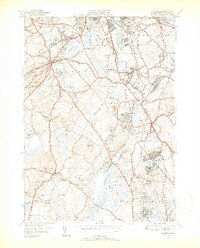
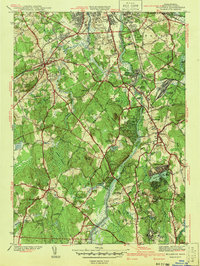 1941 Billerica1941 Print · USGSMiddlesex County communities like Billerica and Chelmsford Center appear here as they were just before the post-war suburban boom. Genealogists can trace family names through numerous burial grounds like Edson Cem and North Cem or locate historic schoolhouses such as Weed St Sch.2 unique versions available
 - 1942 Map of Billerica
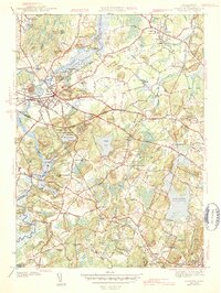
 1942 Billerica1942 Print · USGSMiddlesex County emerges at the start of the 1940s as a landscape of river-driven industry and significant institutional grounds. Researchers can trace the Boston and Maine rail corridors and find local landmarks like Nutting Lake, Bennett Hall, and St Patrick Cem.
 - 1943 Map of Concord
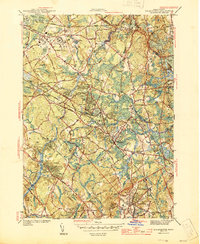
 1943 Concord1943 Print · USGSMiddlesex County's revolutionary and literary landscapes are meticulously detailed during the early years of the war. Researchers can trace ancestral sites like Sleepy Hollow Cem or locate historic schools and landmarks such as Middlesex Sch and Old North Bridge.4 unique versions available
 - 1943 Map of Boston
 1943 Boston1943 Print · USGSGreater Boston and its southern suburbs appear here during the mobilization of the early 1940s. Genealogists and historians can trace the early footprints of Commonwealth Airport, military sites like Fort Winthrop, and local institutions such as Pondville State Hospital.
 - 1943 Map of Lowell
 1943 Lowell1943 Print · USGSCentral New England industrial hubs and rural borderlands are mapped here during the early 1940s. Genealogists can trace family names across Mt Misery, Barrett Hill, and small settlements like Collinsville or North Pelham.
 - 1944 Map of Lexington
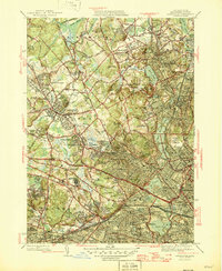
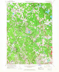
 1944 Lexington1944 Print · USGSMiddlesex County is shown in the early 1940s, capturing a landscape of historic town centers and massive institutional estates. Researchers can trace ancestral sites at Ye Old Burying Ground or locate vanished rail stops like Munroe Sta and Beaver Bk Sta.
 - 1944 Map of Wilmington
 1944 Wilmington1944 Print · USGSWilmington and its surrounding Middlesex County hamlets are shown during the mid-1940s, a period when the Boston and Maine Railroad still anchored the local economy. Genealogists and researchers can trace family landmarks like the State Infirmary, Wildwood Cem, and rural schoolhouses such as the Shawsheen Sch.2 unique versions available
 - 1946 Map of Lexington
 1946 Lexington1946 Print · USGSSuburban Middlesex County comes alive in the mid-forties, showing the postwar density of these classic Boston-area towns. Researchers can locate significant institutional grounds like the Metropolitan State Hospital or trace family roots at Wildwood Cem and Oak Grove Cemetery.3 unique versions available
 - 1948 Map of Boston
 1948 Boston1948 Print · USGSEastern Massachusetts and southern New Hampshire appear at an industrial peak in the late 1940s, just as suburban growth began to accelerate. Genealogists and historians can trace rail lines like the Boston and Albany RR or locate coastal landmarks like Graves Lighthouse and Fort Devens.2 unique versions available
 - 1950 Map of Concord, 1952 Print
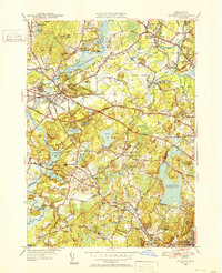 1950 Concord1952 Print · USGSGreater Concord and Lincoln are seen here just after the war, balancing their deep colonial heritage with new aviation and transit infrastructure. Researchers can trace historic cemeteries and rail stops like the Old Burying Ground, Hastings Sta, and Walden Pond State Reservation.4 unique versions available
 - 1950 Map of Billerica, 1952 Print
 1950 Billerica1952 Print · USGSMid-century Middlesex County reveals a landscape of growing towns and established institutions along the Concord River. Genealogists and local historians can trace legacy sites like St Patrick Cem, Howe High Sch, and the Marist College and Convent.4 unique versions available
 - 1950 Map of Wilmington, 1952 Print
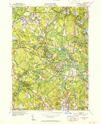 1950 Wilmington1952 Print · USGSWilmington and Tewksbury are shown during a period of significant mid-century growth along the Boston and Maine rail lines. Researchers can trace the sprawling grounds of the State Infirmary and locate vanished local landmarks like the Whitefield Sch and Silver Lake.4 unique versions available
 - 1956 Map of Lexington
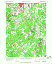
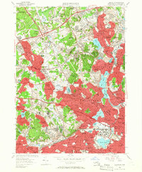 1956 Lexington1956 Print · USGSMiddlesex County was rapidly evolving in the mid-1950s as suburban residential belts thickened between established town centers. Genealogists and historians can trace institutional history at Metropolitan State Hospital or locate ancestral sites like the Old Burying Ground and St Patricks Cem.3 unique versions available
 - 1956 Map of Boston, 1967 Print
 1956 Boston1967 Print · USGSThe Massachusetts coastline and industrial interior are seen here during the mid-century peak of suburban and highway expansion. Researchers can trace historic harbor defenses like Fort Revere, local landmarks such as Faneuil Hall, and the vast Parker River National Wildlife Refuge.6 unique versions available
 - 1958 Map of Boston
 1958 Boston1958 Print · USGSEastern Massachusetts and southern New Hampshire are shown at the height of the industrial era, before the full expansion of the interstate system. Trace coastal defenses at Fort Warren, historic rail lines like the Boston and Maine, and the development of the Mass. 128 corridor.2 unique versions available
 - 1958 Map of Concord, 1959 Print
 1958 Concord1959 Print · USGSConcord and Lincoln are captured here in the late fifties, balancing their deep Revolutionary roots with a growing mid-century military and academic footprint. Genealogists and historians can locate Sleepy Hollow Cemetery, the original Old Burying Ground, and historic waypoints like Merriams Corner.3 unique versions available
 - 1961 Map of Boston
 1961 Boston1961 Print · USGSThe Massachusetts coastline and its industrial interior are detailed here in the mid-twentieth century, from the Monadnock highlands to Cape Cod. Researchers can trace the rail routes of the Boston and Maine or locate landmarks like Fort Devens and the Wachusett Reservoir.2 unique versions available
 - 1965 Map of Wilmington, 1968 Print
 1965 Wilmington1968 Print · USGSWilmington and Tewksbury are captured in the mid-sixties as post-war suburban growth begins to surround established institutions and rail lines. Researchers can trace family history through the Tewksbury State Hospital, Wildwood Cemetery, and local schools like North Street Sch.2 unique versions available
 - 1965 Map of Billerica, 1968 Print
 1965 Billerica1968 Print · USGSMiddlesex County in the mid-1960s shows a landscape of traditional New England town centers being rapidly reshaped by the new interstate highway system. Researchers can trace family roots through numerous burial grounds like Edson Cem or locate community hubs such as Talbot Sch and Nutting Lake.2 unique versions available
Showing maps 1-25 of 38
Top cities near Bedford
- Boston historical maps
- Lowell historical maps
- Cambridge historical maps
- Quincy historical maps
- Nashua historical maps
- Newton historical maps
See more
Top neighborhoods of Bedford
Frequently asked questions
- What are the different types of historical maps available for Bedford?
- What is the oldest map of Bedford?
- Where can I purchase historical maps of Bedford for my home or office?
- Where can I download high-res historical maps of Bedford?
- Are there historical topographic maps available for Bedford?
- Is there historical aerial imagery available for Bedford?
- Where are historical maps of Bedford sourced from?