Old Maps of Shirley Center, Shirley for Metal Detecting
Plan your next treasure hunt with 19 historic maps of Shirley Center. Find old homesites, ghost towns, trails, and gathering spots that may be lost to time — perfect for identifying promising metal detecting locations.
- Locate forgotten sites: Uncover places like long-lost settlements, abandoned rail lines, or gathering spots.
- Plan better hunts: Use map overlays combined with LiDAR or satellite views to narrow in on historically rich areas.
- Made for detectorists: Thousands of hobbyists use these maps to discover relics, coins, and hidden history.
Use these historic maps to boost your research and find new opportunities beneath the surface of Shirley Center.
Shirley Center, Shirley maps
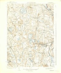
(19)- 1893 Map of Groton, 1905 Print
 1893 Groton1905 Print · USGSCovers Shirley Center, including Nashua, Leominster, and other nearby areas8 unique versions available
 - 1935 Map of Groton
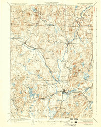
 1935 Groton1935 Print · USGSCovers Shirley Center, including Nashua, Leominster, and other nearby areas
 - 1935 Map of Shirley
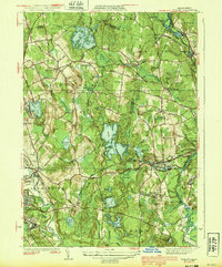
 1935 Shirley1935 Print · USGSCovers Shirley Center, including Leominster, Fitchburg, and other nearby areas3 unique versions available
 - 1936 Map of Groton
 1936 Groton1936 Print · USGSCovers Shirley Center, including Nashua, Leominster, and other nearby areas3 unique versions available
 - 1939 Map of Shirley
 1939 Shirley1939 Print · USGSCovers Shirley Center, including Leominster, Fitchburg, and other nearby areas3 unique versions available
 - 1943 Map of Fitchburg
 1943 Fitchburg1943 Print · USGSCovers Shirley Center, including Manchester, Nashua, and other nearby areas
 - 1948 Map of Boston
 1948 Boston1948 Print · USGSCovers Shirley Center, including Boston, Worcester, and other nearby areas2 unique versions available
 - 1949 Map of Shirley
 1949 Shirley1949 Print · USGSCovers Shirley Center, including Leominster, Fitchburg, and other nearby areas
 - 1950 Map of Shirley, 1958 Print
 1950 Shirley1958 Print · USGSCovers Shirley Center, including Leominster, Fitchburg, and other nearby areas
 - 1955 Map of Shirley
 1955 Shirley1955 Print · USGSCovers Shirley Center, including Leominster, Fitchburg, and other nearby areas2 unique versions available
 - 1956 Map of Boston, 1967 Print
 1956 Boston1967 Print · USGSCovers Shirley Center, including Boston, Worcester, and other nearby areas6 unique versions available
 - 1958 Map of Boston
 1958 Boston1958 Print · USGSCovers Shirley Center, including Boston, Worcester, and other nearby areas2 unique versions available
 - 1961 Map of Boston
 1961 Boston1961 Print · USGSCovers Shirley Center, including Boston, Worcester, and other nearby areas2 unique versions available
 - 1965 Map of Shirley, 1968 Print
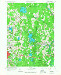 1965 Shirley1968 Print · USGSCovers Shirley Center, including Leominster, Fitchburg, and other nearby areas3 unique versions available
 - 1975 Map of Shirley, 1981 Print
 1975 Shirley1981 Print · USGSCovers Shirley Center, including Leominster, Fitchburg, and other nearby areas
 - 1984 Map of Lowell
 1984 Lowell1984 Print · USGSCovers Shirley Center, including Manchester, Lowell, and other nearby areas
 - 1988 Map of Ayer
 1988 Ayer1988 Print · USGSCovers Shirley Center, including Leominster, Fitchburg, and other nearby areas2 unique versions available
 - 1988 Map of Lowell
 1988 Lowell1988 Print · USGSCovers Shirley Center, including Manchester, Lowell, and other nearby areas2 unique versions available
 - 2024 Map of Shirley, 2024 Print
 2024 Shirley2024 Print · USGSCovers Shirley Center, including Leominster, Fitchburg, and other nearby areas
End of results
Showing maps 1-19 of 19
Frequently asked questions
- What are the different types of historical maps available for Shirley Center?
- What is the oldest map of Shirley Center?
- Where can I purchase historical maps of Shirley Center for my home or office?
- Where can I download high-res historical maps of Shirley Center?
- Are there historical topographic maps available for Shirley Center?
- Is there historical aerial imagery available for Shirley Center?
- Where are historical maps of Shirley Center sourced from?