1970s Maps of Middleborough, Massachusetts
Explore 5 historic maps of Middleborough from the 1970s. These maps offer a rare glimpse into what life looked like during the 1970s — showing old roads, neighborhoods, homes, and landmarks that have changed or disappeared over time.
Whether you're researching your family's past, planning a metal detecting trip, or studying how Middleborough's landscape evolved across the 1970s, these high-resolution maps are a powerful tool for exploring the history of this region.
- Focus on a specific era: All maps on this page are from the 1970s, giving you a focused view of this time period.
- See what’s changed: Compare century-old streets, trails, and buildings to today's modern landscape using overlays and satellite layers.
- Research with precision: Use these maps for genealogy, historical research, land use analysis, or educational projects.
- View, download, or print: Maps are fully viewable online in high resolution, and can be downloaded or printed for your own records.
Start exploring Middleborough's history through authentic maps from the 1970s. This is your window into the past.
Middleborough, MA maps
(5)- 1977 Map of Plympton
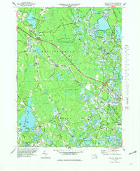
 1977 Plympton1977 Print · USGSCranberry bogs and sprawling wetlands dominate the Plymouth County landscape in the mid-seventies. Genealogists and local historians can trace family roots near Lakenham Cem, locate the Cole Mill, and explore old crossroads like Harrubs Corner and Eddyville.4 unique versions available
 - 1977 Map of Bridgewater, 1978 Print
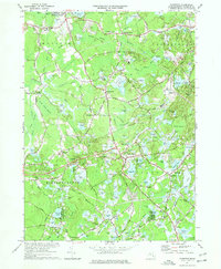
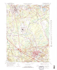 1977 Bridgewater1978 Print · USGSBridgewater and Middleboro appear in the late seventies as significant rail and river hubs south of Brockton. Genealogists and local historians can trace family plots at St Marys Cem or locate the Pratt Free Sch and Paper Mill Village.3 unique versions available
 - 1977 Map of Snipatuit Pond, 1979 Print
 1977 Snipatuit Pond1979 Print · USGSPlymouth County's cranberry country and wetland heritage are preserved in this mid-seventies survey of the Middleborough and Wareham borderlands. Genealogists and local historians can trace family-named crossroads like Douglas Corner, find old burial sites at Union Cem, and locate the Seaplane Base on the shore of Snipatuit Pond.2 unique versions available
 - 1977 Map of Assawompset Pond, 1981 Print
 1977 Assawompset Pond1981 Print · USGSSoutheastern Massachusetts in the late seventies is captured here through detailed orthophotography of its vast lake system. Genealogists and researchers can trace local landmarks like Masons Corner, Lakeville, and the waters of Assawompset Pond.
 - 1978 Map of Assawompset Pond, 1979 Print
 1978 Assawompset Pond1979 Print · USGSSoutheastern Massachusetts in the late seventies reveals a landscape defined by the great ponds and the cranberry industry. Researchers can trace family sites near Lakeville or locate historic burying grounds like Strowbridge Cem and Wapanucket Cem.
End of results
Showing maps 1-5 of 5
Top cities near Middleborough
- Brockton historical maps
- New Bedford historical maps
- Fall River historical maps
- Plymouth historical maps
- Taunton historical maps
- Dartmouth historical maps
See more
Top neighborhoods of Middleborough
- Namasket Village historical maps
- Nemasket historical maps
- North Middleboro historical maps
- Warrentown historical maps
- Eddyville historical maps
- Maxim Corner historical maps
See more
Frequently asked questions
- What are the different types of historical maps available for Middleborough?
- What is the oldest map of Middleborough?
- Where can I purchase historical maps of Middleborough for my home or office?
- Where can I download high-res historical maps of Middleborough?
- Are there historical topographic maps available for Middleborough?
- Is there historical aerial imagery available for Middleborough?
- Where are historical maps of Middleborough sourced from?