Old Maps of Old North Ashburnham Station, Ashburnham
Explore 24 old maps of Old North Ashburnham Station, spanning from 1887 to today. These high-resolution historic maps reveal how streets, neighborhoods, landmarks, and natural features evolved over time — perfect for genealogy, metal detecting, research, and local history exploration.
What you can do with these maps:
- See how Old North Ashburnham Station changed over time: Compare historical maps to modern-day views to trace roads, homesites, rail lines & more.
- View detailed metadata: Each map includes creators, publishers, year, scale, and archive source.
- Overlay maps with satellite & LiDAR: Visualize the past alongside modern tools to explore terrain & human change.
- Trusted historical sources: Maps sourced from the USGS, Library of Congress, and other archives.
- Access maps your way: View online, download high-res files, or order prints for personal or research use.
Start exploring old maps of Old North Ashburnham Station to uncover forgotten places, hidden landmarks, and the deep history beneath your feet.
Old North Ashburnham Station, Ashburnham maps
(24)- 1887 Map of Fitchburg
 1887 Fitchburg1887 Print · USGSThe hills of Worcester County were a beehive of rail and industry when this survey was conducted. Trace the original routes of the Fitchburg Railroad and find long-established local centers like Wachusett Village, Converse Ville, and Rollstone Hill.
 - 1889 Map of Fitchburg
 1889 Fitchburg1889 Print · USGSNorth-central Massachusetts and southern New Hampshire are captured here in the late Victorian era as industry and rail expanded. Genealogists can trace family homesteads near Whitmanville or locate specific rail depots like Ashburnham Junction and Westminster Station.
 - 1893 Map of Fitchburg
 1893 Fitchburg1893 Print · USGSNorth-central Massachusetts at the close of the nineteenth century was a complex network of industrial valley towns and highland rail junctions. You can trace the path of the Cheshire Railroad as it winds past Lake Monomonac or explore the early street layouts of Fitchburg and Leominster.7 unique versions available
 - 1931 Map of Fitchburg
 1931 Fitchburg1931 Print · USGSThe Massachusetts and New Hampshire border region was a network of mill villages and mountain ridges in the early thirties. Genealogists and historians can locate rural landmarks like School No 8, the High Bridge, and the Boston and Maine rail line.
 - 1935 Map of Fitchburg
 1935 Fitchburg1935 Print · USGSThe industrial corridor and border hills of north-central Massachusetts and southern New Hampshire are captured here in the mid-1930s. Trace the intricate rail networks of the Old Colony Railroad and find local landmarks like School No 8 or Rollstone Hill.3 unique versions available
 - 1936 Map of Fitchburg
 1936 Fitchburg1936 Print · USGSNorthwestern Massachusetts and southern New Hampshire are shown here during the mid-1930s, featuring a mature network of rail lines and industrial river towns. Genealogists can locate family landmarks like School No 9 or trace the early paths of the Fitchburg Railroad and Old Colony Railroad Fitchburg Branch.2 unique versions available
 - 1943 Map of Fitchburg
 1943 Fitchburg1943 Print · USGSSouthern New Hampshire and northern Massachusetts are captured during the war years, showing a landscape of river-powered mill towns and mountain trails. You can trace family roots in Peterboro, locate the historic Groton School, or study the rail lines of the Boston & Maine RR.
 - 1946 Map of Ashburnham
 1946 Ashburnham1946 Print · USGSMid-century Worcester County and the New Hampshire border region are captured here in the years just after the war. Genealogists and hikers can trace the original Boston and Maine RR line, locate the Meeting House, or explore the slopes of Mount Watatic.2 unique versions available
 - 1948 Map of Boston
 1948 Boston1948 Print · USGSEastern Massachusetts and southern New Hampshire appear at an industrial peak in the late 1940s, just as suburban growth began to accelerate. Genealogists and historians can trace rail lines like the Boston and Albany RR or locate coastal landmarks like Graves Lighthouse and Fort Devens.2 unique versions available
 - 1950 Map of Ashburnham, 1952 Print
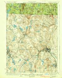
 1950 Ashburnham1952 Print · USGSMid-century Worcester County comes to life as a landscape of interconnected glacial lakes and upland ridges during the postwar years. Genealogists and local historians can trace the foundations of Ashburnham, Lane Village, and the remote Old North Ashburnham Sta.4 unique versions available
 - 1953 Map of Fitchburg
 1953 Fitchburg1953 Print · USGSMid-century Worcester County comes to life during a period of steady growth and established rail commerce. Local historians can trace family roots at Prospect Hill Cemetery or explore the development of Blackburne Village and the Fitchburg Leominster Airport.
 - 1956 Map of Boston, 1967 Print
 1956 Boston1967 Print · USGSThe Massachusetts coastline and industrial interior are seen here during the mid-century peak of suburban and highway expansion. Researchers can trace historic harbor defenses like Fort Revere, local landmarks such as Faneuil Hall, and the vast Parker River National Wildlife Refuge.6 unique versions available
 - 1958 Map of Boston
 1958 Boston1958 Print · USGSEastern Massachusetts and southern New Hampshire are shown at the height of the industrial era, before the full expansion of the interstate system. Trace coastal defenses at Fort Warren, historic rail lines like the Boston and Maine, and the development of the Mass. 128 corridor.2 unique versions available
 - 1961 Map of Boston
 1961 Boston1961 Print · USGSThe Massachusetts coastline and its industrial interior are detailed here in the mid-twentieth century, from the Monadnock highlands to Cape Cod. Researchers can trace the rail routes of the Boston and Maine or locate landmarks like Fort Devens and the Wachusett Reservoir.2 unique versions available
 - 1965 Map of Ashburnham, 1968 Print
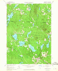 1965 Ashburnham1968 Print · USGSThe Worcester County highlands during the mid-sixties show a landscape of glacial lakes and quiet hill towns. Genealogists can locate family sites near St Dennis Cem or trace the early industrial footprint of Factory Village and Cushing Academy.5 unique versions available
 - 1975 Map of Ashburnham, 1981 Print
 1975 Ashburnham1981 Print · USGSNorthern Worcester County and the New Hampshire borderlands are visible in this mid-seventies aerial study. Local historians can trace the early residential footprints of Lane Village and Wellville or examine the shoreline of Lake Monomonac.
 - 1984 Map of Lowell
 1984 Lowell1984 Print · USGSThe Merrimack Valley industrial corridor is captured here in the mid-eighties, showing the interconnected growth of Lowell, Nashua, and Lawrence. Genealogists and historians can trace the paths of the Boston and Maine railroad or locate institutional landmarks like Merrimack College and the Fort Devens Military Reservation.
 - 1988 Map of Ashburnham
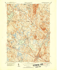
 1988 Ashburnham1988 Print · USGSThe Massachusetts-New Hampshire borderlands near Ashburnham appear here in the late eighties as a network of wooded hills and glacial lakes. Genealogists and local historians can trace family locations near St Dennis Cem, North Ashburnham, and Converseville.2 unique versions available
 - 1988 Map of Lowell
 1988 Lowell1988 Print · USGSThe industrial corridor of the Merrimack Valley is captured in the late eighties as it transitioned into a modern technological and residential hub. Genealogists and researchers can trace the urban layouts of Lowell and Nashua alongside landmarks like Massabesic Lake and Miller State Park.2 unique versions available
 - 2012 Map of Ashburnham, 2012 Print
 2012 Ashburnham2012 Print · USGSCovers Old North Ashburnham Station, including Gardner, Winchendon, and other nearby areas
 - 2015 Map of Ashburnham, 2015 Print
 2015 Ashburnham2015 Print · USGSCovers Old North Ashburnham Station, including Gardner, Winchendon, and other nearby areas
 - 2018 Map of Ashburnham, 2018 Print
 2018 Ashburnham2018 Print · USGSCovers Old North Ashburnham Station, including Gardner, Winchendon, and other nearby areas
 - 2021 Map of Ashburnham, 2021 Print
 2021 Ashburnham2021 Print · USGSCovers Old North Ashburnham Station, including Gardner, Winchendon, and other nearby areas
 - 2024 Map of Ashburnham, 2024 Print
 2024 Ashburnham2024 Print · USGSThe northern reaches of Worcester County meet the New Hampshire border in this recent survey of a landscape defined by glacial lakes and the Wapack Range. Researchers can trace old family burial grounds like Wilder Cem or locate historic rail connections at Old North Ashburnham Station.
End of results
Showing maps 1-24 of 24
Top cities near Old North Ashburnham Station
- Leominster historical maps
- Fitchburg historical maps
- Gardner historical maps
- Holden historical maps
- Athol historical maps
- Winchendon historical maps
See more
Frequently asked questions
- What are the different types of historical maps available for Old North Ashburnham Station?
- What is the oldest map of Old North Ashburnham Station?
- Where can I purchase historical maps of Old North Ashburnham Station for my home or office?
- Where can I download high-res historical maps of Old North Ashburnham Station?
- Are there historical topographic maps available for Old North Ashburnham Station?
- Is there historical aerial imagery available for Old North Ashburnham Station?
- Where are historical maps of Old North Ashburnham Station sourced from?