1940s Maps of Hardwick, Massachusetts
Explore 7 historic maps of Hardwick from the 1940s. These maps offer a rare glimpse into what life looked like during the 1940s — showing old roads, neighborhoods, homes, and landmarks that have changed or disappeared over time.
Whether you're researching your family's past, planning a metal detecting trip, or studying how Hardwick's landscape evolved across the 1940s, these high-resolution maps are a powerful tool for exploring the history of this region.
- Focus on a specific era: All maps on this page are from the 1940s, giving you a focused view of this time period.
- See what’s changed: Compare century-old streets, trails, and buildings to today's modern landscape using overlays and satellite layers.
- Research with precision: Use these maps for genealogy, historical research, land use analysis, or educational projects.
- View, download, or print: Maps are fully viewable online in high resolution, and can be downloaded or printed for your own records.
Start exploring Hardwick's history through authentic maps from the 1940s. This is your window into the past.
Hardwick, MA maps
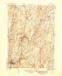
(7)- 1942 Map of Ware
 1942 Ware1942 Print · USGSCentral Massachusetts and the Connecticut border are captured here during the early years of the war, just as the landscape was being reshaped by the Quabbin Reservoir. Researchers can trace rail-era industry and local landmarks like the Lead Mine and the Bald Peak Hospital.
 - 1944 Map of Winsor Dam
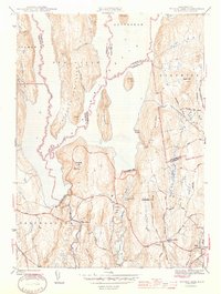 1944 Winsor Dam1944 Print · USGSIn the early 1940s, the Swift River Valley was recently transformed into a critical water resource for Massachusetts. Local historians can trace the new shoreline and legacy sites like the Quabbin Park Cem, Winsor Dam, and the hilltop Lookout on Quabbin Hill.3 unique versions available
 - 1944 Map of Quabbin Reservoir
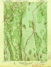 1944 Quabbin Reservoir1944 Print · USGSCentral Massachusetts undergoes a total transformation in the early forties as the valley fills to create a massive water system. Trace former upland settlements like North Prescott and prominent landmarks like Soapstone Hill and the Baffle Dam.3 unique versions available
 - 1946 Map of Petersham
 1946 Petersham1946 Print · USGSPetersham and the surrounding Worcester County uplands are documented here just after the war as the region's watershed began its modern era. Genealogists and local historians can trace family-named sites and rural crossroads like Bassets Corner, Nichewaug, and the eastern shores of the Quabbin Reservoir.2 unique versions available
 - 1946 Map of Ware
 1946 Ware1946 Print · USGSCentral Massachusetts was a landscape of river-powered industry and upland farms in the years following the war. Genealogists and historians can trace rail-to-river connections through Gilbertville, locate rural landmarks like School No 2, and explore the terrain around Wickaboag Pond.2 unique versions available
 - 1946 Map of North Brookfield
 1946 North Brookfield1946 Print · USGSWorcester County townships like North Brookfield and Hillsville are captured here just after the war, showing a landscape defined by industry and agriculture. Researchers can locate family landmarks including Pine Grove Cem, Port Hill Sch, and the Boston and Albany RR line.2 unique versions available
 - 1948 Map of Albany, 1951 Print
 1948 Albany1951 Print · USGSThe Hudson and Connecticut River valleys are captured here in the late 1940s, showing the vital rail and water corridors of the Northeast. You can trace the Boston and Maine tracks past Mt Greylock or locate early settlements like Great Barrington and Bennington.
End of results
Showing maps 1-7 of 7
Top cities near Hardwick
- Gardner historical maps
- Ludlow historical maps
- Wilbraham historical maps
- Belchertown historical maps
- Charlton historical maps
- Palmer historical maps
See more
Top neighborhoods of Hardwick
Frequently asked questions
- What are the different types of historical maps available for Hardwick?
- What is the oldest map of Hardwick?
- Where can I purchase historical maps of Hardwick for my home or office?
- Where can I download high-res historical maps of Hardwick?
- Are there historical topographic maps available for Hardwick?
- Is there historical aerial imagery available for Hardwick?
- Where are historical maps of Hardwick sourced from?