1940s Maps of Lunenburg, Massachusetts
Explore 6 historic maps of Lunenburg from the 1940s. These maps offer a rare glimpse into what life looked like during the 1940s — showing old roads, neighborhoods, homes, and landmarks that have changed or disappeared over time.
Whether you're researching your family's past, planning a metal detecting trip, or studying how Lunenburg's landscape evolved across the 1940s, these high-resolution maps are a powerful tool for exploring the history of this region.
- Focus on a specific era: All maps on this page are from the 1940s, giving you a focused view of this time period.
- See what’s changed: Compare century-old streets, trails, and buildings to today's modern landscape using overlays and satellite layers.
- Research with precision: Use these maps for genealogy, historical research, land use analysis, or educational projects.
- View, download, or print: Maps are fully viewable online in high resolution, and can be downloaded or printed for your own records.
Start exploring Lunenburg's history through authentic maps from the 1940s. This is your window into the past.
Lunenburg, MA maps
(6)- 1943 Map of Fitchburg
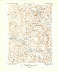
 1943 Fitchburg1943 Print · USGSSouthern New Hampshire and northern Massachusetts are captured during the war years, showing a landscape of river-powered mill towns and mountain trails. You can trace family roots in Peterboro, locate the historic Groton School, or study the rail lines of the Boston & Maine RR.
 - 1944 Map of Townsend
 1944 Townsend1944 Print · USGSTownsend and Brookline sit at the heart of this mid-century New England landscape as the rail era transitioned toward the modern highway. Researchers can trace the Boston and Maine RR line through Townsend Harbor and find family names at Pine Grove Cem or Center Cem.4 unique versions available
 - 1946 Map of Fitchburg
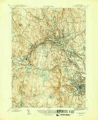 1946 Fitchburg1946 Print · USGSThe industrial corridor of the Nashua River valley is captured here in the mid-1940s. Genealogists and historians can trace family locations near Waites Corner, Wachusett Sta, or the historic St Bernard Cem.4 unique versions available
 - 1946 Map of Ashby
 1946 Ashby1946 Print · USGSThe borderlands of New Hampshire and Massachusetts are captured in the mid-1940s, showing a network of upland farms and timbered hills. You can trace family roots through landmarks like Gibson Four Corners, find old burials at Glenwood Cem, or locate the rail stop at Mason Sta.2 unique versions available
 - 1948 Map of Boston
 1948 Boston1948 Print · USGSEastern Massachusetts and southern New Hampshire appear at an industrial peak in the late 1940s, just as suburban growth began to accelerate. Genealogists and historians can trace rail lines like the Boston and Albany RR or locate coastal landmarks like Graves Lighthouse and Fort Devens.2 unique versions available
 - 1949 Map of Shirley
 1949 Shirley1949 Print · USGSPost-war central Massachusetts reveals its military and rural character as Fort Devens expands near the Nashua River. Genealogists and historians can trace the Shaker Cemetery, the Industrial School, and the legacy of the Boston and Maine Railroad.
End of results
Showing maps 1-6 of 6
Top cities near Lunenburg
- Nashua historical maps
- Leominster historical maps
- Fitchburg historical maps
- Marlborough historical maps
- Merrimack historical maps
- Westford historical maps
See more
Top neighborhoods of Lunenburg
Frequently asked questions
- What are the different types of historical maps available for Lunenburg?
- What is the oldest map of Lunenburg?
- Where can I purchase historical maps of Lunenburg for my home or office?
- Where can I download high-res historical maps of Lunenburg?
- Are there historical topographic maps available for Lunenburg?
- Is there historical aerial imagery available for Lunenburg?
- Where are historical maps of Lunenburg sourced from?