Old Maps of Central Woolen Mills District, Uxbridge for Hiking & Exploration
Hike through history with 20 historic maps of Central Woolen Mills District. Explore old trails, ghost towns, and forgotten backroads — perfect for outdoor adventurers and local explorers.
- Rediscover forgotten places: Map out old mining camps, roads, and footpaths that no longer exist on modern maps.
- Layer with modern tools: Combine with LiDAR or satellite views to plan hikes through historical terrain.
- Made for exploration: Popular among hikers, overlanders, and local history lovers.
Use these maps to find adventure and explore the hidden past of Central Woolen Mills District.
Central Woolen Mills District, Uxbridge maps
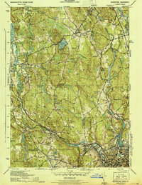
(20)- 1886 Map of Blackstone
 1886 Blackstone1886 Print · USGSCovers Central Woolen Mills District, including Worcester, Woonsocket, and other nearby areas
 - 1889 Map of Blackstone
 1889 Blackstone1889 Print · USGSCovers Central Woolen Mills District, including Worcester, Woonsocket, and other nearby areas
 - 1893 Map of Blackstone
 1893 Blackstone1893 Print · USGSCovers Central Woolen Mills District, including Worcester, Woonsocket, and other nearby areas2 unique versions available
 - 1900 Map of Blackstone
 1900 Blackstone1900 Print · USGSCovers Central Woolen Mills District, including Worcester, Woonsocket, and other nearby areas7 unique versions available
 - 1908 Map of Quinsigamond
 1908 Quinsigamond1908 Print · USGSCovers Central Woolen Mills District, including Worcester, Leominster, and other nearby areas3 unique versions available
 - 1919 Map of Blackstone
 1919 Blackstone1919 Print · USGSCovers Central Woolen Mills District, including Worcester, Woonsocket, and other nearby areas2 unique versions available
 - 1943 Map of Quinsigamond
 1943 Quinsigamond1943 Print · USGSCovers Central Woolen Mills District, including Worcester, Leominster, and other nearby areas
 - 1944 Map of Blackstone
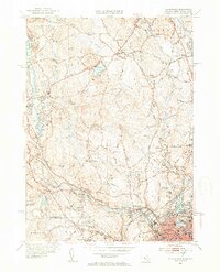
 1944 Blackstone1944 Print · USGSCovers Central Woolen Mills District, including Woonsocket, Milford, and other nearby areas5 unique versions available
 - 1948 Map of Boston
 1948 Boston1948 Print · USGSCovers Central Woolen Mills District, including Boston, Worcester, and other nearby areas2 unique versions available
 - 1948 Map of Blackstone
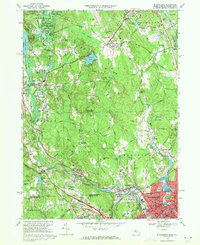
 1948 Blackstone1948 Print · USGSCovers Central Woolen Mills District, including Woonsocket, Milford, and other nearby areas
 - 1953 Map of Blackstone, 1954 Print
 1953 Blackstone1954 Print · USGSCovers Central Woolen Mills District, including Woonsocket, Milford, and other nearby areas4 unique versions available
 - 1956 Map of Boston, 1967 Print
 1956 Boston1967 Print · USGSCovers Central Woolen Mills District, including Boston, Worcester, and other nearby areas6 unique versions available
 - 1958 Map of Boston
 1958 Boston1958 Print · USGSCovers Central Woolen Mills District, including Boston, Worcester, and other nearby areas2 unique versions available
 - 1961 Map of Boston
 1961 Boston1961 Print · USGSCovers Central Woolen Mills District, including Boston, Worcester, and other nearby areas2 unique versions available
 - 1969 Map of Blackstone, 1971 Print
 1969 Blackstone1971 Print · USGSCovers Central Woolen Mills District, including Woonsocket, Milford, and other nearby areas6 unique versions available
 - 1977 Map of Blackstone, 1981 Print
 1977 Blackstone1981 Print · USGSCovers Central Woolen Mills District, including Woonsocket, Milford, and other nearby areas
 - 1982 Map of Uxbridge, 1984 Print
 1982 Uxbridge1984 Print · USGSCovers Central Woolen Mills District, including Woonsocket, Milford, and other nearby areas
 - 1985 Map of Boston, 1986 Print
 1985 Boston1986 Print · USGSCovers Central Woolen Mills District, including Boston, Worcester, and other nearby areas
 - 1989 Map of Boston
 1989 Boston1989 Print · USGSCovers Central Woolen Mills District, including Boston, Worcester, and other nearby areas2 unique versions available
 - 2024 Map of Blackstone, 2024 Print
 2024 Blackstone2024 Print · USGSCovers Central Woolen Mills District, including Woonsocket, Milford, and other nearby areas
End of results
Showing maps 1-20 of 20
Frequently asked questions
- What are the different types of historical maps available for Central Woolen Mills District?
- What is the oldest map of Central Woolen Mills District?
- Where can I purchase historical maps of Central Woolen Mills District for my home or office?
- Where can I download high-res historical maps of Central Woolen Mills District?
- Are there historical topographic maps available for Central Woolen Mills District?
- Is there historical aerial imagery available for Central Woolen Mills District?
- Where are historical maps of Central Woolen Mills District sourced from?