2020s Maps of Torch Lake Township, Michigan
Explore 4 historic maps of Torch Lake Township from the 2020s. These maps offer a rare glimpse into what life looked like during the 2020s — showing old roads, neighborhoods, homes, and landmarks that have changed or disappeared over time.
Whether you're researching your family's past, planning a metal detecting trip, or studying how Torch Lake Township's landscape evolved across the 2020s, these high-resolution maps are a powerful tool for exploring the history of this region.
- Focus on a specific era: All maps on this page are from the 2020s, giving you a focused view of this time period.
- See what’s changed: Compare century-old streets, trails, and buildings to today's modern landscape using overlays and satellite layers.
- Research with precision: Use these maps for genealogy, historical research, land use analysis, or educational projects.
- View, download, or print: Maps are fully viewable online in high resolution, and can be downloaded or printed for your own records.
Start exploring Torch Lake Township's history through authentic maps from the 2020s. This is your window into the past.
Torch Lake Township, MI maps
(4)- 2023 Map of Central Lake, 2023 Print
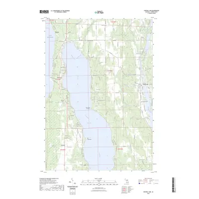 2023 Central Lake2023 Print · USGSAntrim County’s inland waterways and lakefront settlements are documented here during the early twenty-first century. Genealogists and researchers can trace property locations near Central Lake, Eastport, and historic burial sites like Bay View Cemetery and Lake View Cemetery.
 - 2023 Map of Alden, 2023 Print
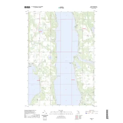 2023 Alden2023 Print · USGSAntrim County’s shoreline and village life are captured here in the early twenty-first century, centered on the deep waters of Torch Lake. Researchers can locate family heritage sites like the Kewadin Indian Mission Cem and the lakeside streets of Alden and Kewadin.
 - 2023 Map of Elk Rapids, 2023 Print
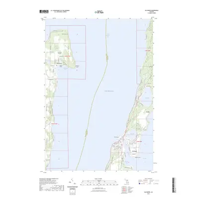 2023 Elk Rapids2023 Print · USGSGrand Traverse Bay and the northern tip of the Old Mission Peninsula are captured here in the early twenty-first century. Researchers can trace local lineage at Lakeside Cem and Maple Grove Cem or locate homes near Elk Rapids and Kewadin.
 - 2023 Map of Central Lake OE W, 2023 Print
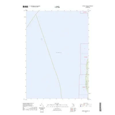 2023 Central Lake OE W2023 Print · USGSThe western Antrim County shoreline is captured here in the early twenty-first century, showing the interface of Lake Michigan and Grand Traverse Bay. Researchers can trace the layout of coastal roads and property access points like Bay View Dr, Patees Pond Rd, and Creswell Rd.
End of results
Showing maps 1-4 of 4
Top cities near Torch Lake Township
- Peninsula Township historical maps
- Acme Township historical maps
- Whitewater Township historical maps
- East Jordan historical maps
- Elk Rapids historical maps
- Torch Lake historical maps
See more
Top neighborhoods of Torch Lake Township
Frequently asked questions
- What are the different types of historical maps available for Torch Lake Township?
- What is the oldest map of Torch Lake Township?
- Where can I purchase historical maps of Torch Lake Township for my home or office?
- Where can I download high-res historical maps of Torch Lake Township?
- Are there historical topographic maps available for Torch Lake Township?
- Is there historical aerial imagery available for Torch Lake Township?
- Where are historical maps of Torch Lake Township sourced from?